What will increase the 'landing field length limited landing mass' when ? [ Course landing ]
Question 85-1 : A headwind a downslope a contaminated runway an increase in pressure altitude
 A headwind.
 When calculating approach speeds the minimum approach speed in the initial ?
Question 85-2 : 1 4 to 1 5 times vs1 2 times vs1 1 15 times vs0 1 05 times vat
You are approaching a wet runway in gusty conditions you should ?
Question 85-3 : Increase approach speed adopt a steeper approach path decrease approach speed increase landing speed
 Increase approach speed.
 Compared with a level runway the use of a runway with a 2% downslope will ?
Question 85-4 : Reduce vmbe increase vmbe and v1 not affect the value of v1 increase vmbe and decreased v1
 Reduce vmbe.
 If the anti skid system is inoperative may auto brake system can be used ?
Question 85-5 : No never without any limitation if selected to minimum only if full reverse thrust is used
 No, never.
 You climb with a climb speed schedule 300/ 78 what do you expect in the ?
Question 85-6 : The rate of climb increases since the constant ias climb is replaced by the constant mach climb during the acceleration to the mach number 0 78 the rate of climb is approximately zero the rate of climb decreases since climb performance at a constant mach number is grossly reduced as compared to constant ias no noticeable effect since the true airspeed at 300 kts ias and 0 78 mach are the same at isa temperature tas = 460 kt
 The rate of climb increases since the constant ias-climb is replaced by the constant mach-climb.
 The effect of an aft cg on take off performance are ?
Question 85-7 : Take off distance decreases climb gradient increases take off distance decreases climb gradient remains constant take off distance and climb gradient increase take off distance and climb gradient decrease
 Take-off distance decreases, climb gradient increases.
 At maximum landing mass the structure of the aircraft is designed for a rate of ?
Question 85-8 : 600 ft/min 200 ft/min 250 ft/min 220 ft/min
 600 ft/min.
 The approach climb requirement is normally met by ?
Question 85-9 : Reducing flap setting for approach with one engine inoperative selecting a runway with no obstacles in the go around area a threshold speed of 2 times stall speed reducing final approach speed
 Reducing flap setting for approach with one engine inoperative.
 A change of runway in use from a runway slope of 1% downhill to a runway slope ?
Question 85-10 : Increase take off run increase take off distance increase take off run decrease take off distance decrease take off run decrease take off distance decrease take off run increase take off distance
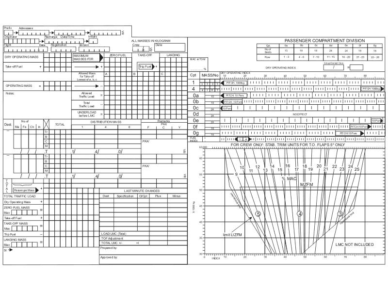 Increase take-off run, increase take-off distance.
 An uphill slope runway will ?
Question 85-11 : Increase asdr decrease asdr increase asdr only if the tom increases decrease asdr only if the tom decreases
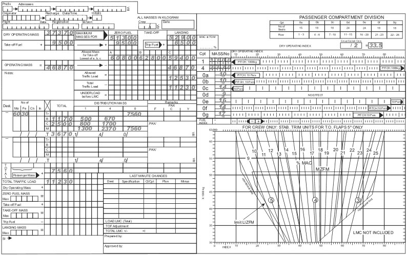 Increase asdr.
 Runway 30 is in use and the threshold elevation is 2139 feet threshold ?
Question 85-12 : 2 65% uphill 1 49% uphill 2 53% per minute 1 86% downhill
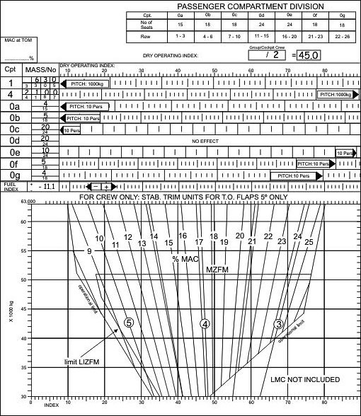 2.65% uphill.
 In the event of an engine failure during cruise it is necessary to reduce speed ?
Question 85-13 : For maximum lift/drag ratio and if necessary start fuel jettisoning close to stall speed and if necessary starting fuel jettisoning for best rate of climb with full flaps for minimum drag speed vmd with full flaps
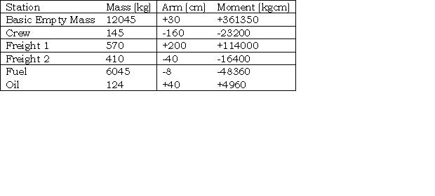 For maximum lift/drag ratio and, if necessary, start fuel jettisoning.
 On a long distance flight the optimum cruise altitude is continuously increased ?
Question 85-14 : As a consequence of the fuel consumption to take in account the passenger movements all along the flight due do the decreasing outside air temperature because of the movements of the centre of gravity
 As a consequence of the fuel consumption.
 The take off and landing distances on a grass runway are in relation to that ?
Question 85-15 : Take off distance and landing distance increase take off distance and landing distance decrease take off distance decreases and landing distance increases take off distance increases and landing distance decreases
Which take off condition is most likely resulting in the poorest climb ?
Question 85-16 : 5000 ft field elevation isa +20° take off flaps 30° sea level field elevation isa 20° take off flaps 10° sea level field elevation isa +5° take off flaps 10° 5000 ft field elevation isa 5° take off flaps 10°
 5000 ft field elevation, isa +20°, take-off flaps 30°.
 During take off the time between critical engine failure and v1 recognition ?
Question 85-17 : 2 seconds 5 seconds 6 seconds 0 seconds
The lift off speed vlof and take off safety speed v2 when flap position is ?
Question 85-18 : Increase / increase decrease / increase increase / decrease decrease / decrease
 Increase / increase.
 An aircraft has this following flap position up 5° 10° 20° if the flap ?
Question 85-19 : Increase take off distance decrease landing distance decrease ground roll distance decrease take off distance
 Increase take-off distance.
 Changing flaps selection from 10° to flaps 0° while establish in climb after ?
Question 85-20 : Climb gradient and vy increase climb gradient and vy decrease climb gradient remains unchanged and vy decreases climb gradient increases and vy decreases
 Climb gradient and vy increase.
 During a descent a headwind will have the following effects ?
Question 85-21 : Descent angle remains constant flight path angle increases descent angle decreases flight path angle increases descent angle and flight path angle increases descent angle remains constant flight path angle decreases
 Descent angle remains constant, flight path angle increases.
 During a descent a tailwind will have the following effects ?
Question 85-22 : Descent angle remains constant flight path angle decreases descent angle remains constant flight path angle increases descent angle and flight path angle increases descent angle increases flight path angle decreases
 Descent angle remains constant, flight path angle decreases.
 The 'flight path angle' is the angle ?
Question 85-23 : Between the horizontal plane and the flight path between the relative airflow and the horizontal plane between the longitudinal axis and the horizontal plane displayed on the attitude indicator artificial horizon
 Between the horizontal plane and the flight path.
 The vertical 'flight path angle' is assumed to be ?
Question 85-24 : Ground related the same as pitch angle relative to the longitudinal axis the angle of attack
 Ground related.
 Specific fuel consumption sfc is ?
Question 85-25 : Mass of fuel required to produce unit power for unit time designed fuel consumption for a given rpm quantity of fuel required to run the engine for one minute at maximum operating conditions maximum fuel consumption of the aircraft
 Mass of fuel required to produce unit power for unit time.
 The specific range sr is ?
Question 85-26 : The air distance that the aircraft would fly per kilogram of fuel the ground distance that the aircraft would fly per kilogram of fuel the ground distance divided by air distance the air distance that the aircraft would fly per unit of thrust
 The air distance that the aircraft would fly per kilogram of fuel.
 How does the asdr accelerate stop distance required will be affected by the ?
Question 85-27 : Remains the same increases decreases decreases only for a downhill stopway
 Remains the same.
 What is the effect of using engine bleed air on the take off distance ?
Question 85-28 : Reduces available thrust and increases the take off distance reduces available thrust and take off distance bleed air has no effect on take off distance increases available thrust and take off distance
 Reduces available thrust and increases the take-off distance.
 Which of the following will decrease landing distance ?
Question 85-29 : The spoilers a wet runway a tailwind a high altitude airfield
 The spoilers.
 If cabin altitude cannot be controlled eg rapid decompression while in cruise ?
Question 85-30 : Target speed mmo speedbrake deployed no flaps target speed vmo speedbrake deployed no flaps target speed mmo speedbrake up flaps 10° target speed mmo speedbrake deployed full flaps
 Target speed mmo, speedbrake deployed, no flaps.
 The climb gradient is ?
Question 85-31 : Always larger than the angle of climb always smaller than the angle of climb the same as the angle of climb represents the angle of variation
 Always larger than the angle of climb.
 Induced drag is caused by ?
Question 85-32 : Movement of the aerofoil through the air boundary layer effects the shape of aerofoil increased zero lift drag
 Movement of the aerofoil through the air.
 How does an increase in aircraft mass affect the gliding range ?
Question 85-33 : Has no effect on gliding range increases gliding range decreases gliding range none of the above
 Has no effect on gliding range.
 Under what condition does pressure altitude has the same value as density ?
Question 85-34 : At standard temperature at sea level when temperature is 0°c when altimeter setting is 1013 25 hpa when altimeter has no position error
 At standard temperature.
 What is true about a clearway ?
Question 85-35 : A clearway can be water or land and must be under the control of the aerodrome authority a clearway has a virtual gradient of 1 5% a clearway can be used to bring the aircraft to a full stop after an engine failure a clearway has a minimum width of 90m
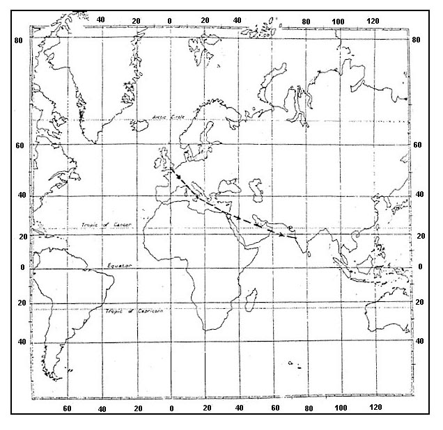 A clearway can be water or land and must be under the control of the aerodrome authority.
 The effect an increase of weight has on the value of stalling speed las is that ?
Question 85-36 : Increases decreases remains constant increases or decreases depending on the amount of weight increase
 Increases.
 An aircraft has a stall speed of 83 kt on short final its speed will be ?
Question 85-37 : 108 kt 90 kt 120 kt 100 kt
 108 kt.
 The parameters taken into account for take off performance calculations are ?
Question 85-38 : Outside temperature pressure altitude wind mass standard temperature pressure altitude wind mass standard temperature standard pressure wind mass outside temperature standard pressure wind mass
 Outside temperature, pressure altitude, wind, mass.
 For a piston engine aeroplane the speed for maximum range is ?
Question 85-39 : That which gives the maximum lift to drag ratio that which gives the minimum value of induced drag that which gives the maximum value of lift 1 4 times the stall speed in clean configuration
 That which gives the maximum lift to drag ratio.
 Maximum endurance for a piston engine aeroplane is achieved at ?
Question 85-40 : The speed that approximately corresponds to the maximum rate of climb speed the speed for maximum lift coefficient the speed for minimum drag the speed that corresponds to the speed for maximum climb angle
 The speed that approximately corresponds to the maximum rate of climb speed.
 ~
Exclusive rights reserved. Reproduction prohibited under penalty of prosecution.
3359 Free Training Exam
