Un compte Premium offert sur le site FCL.055 ! Rendez-vous sur www.fcl055-exam.fr puis créez un compte avec le même email que celui...   [Lire la suite]


Amongst others sbas allows for the implementation of ? [ Answer reports ]

Question 199-1 : Three dimensional type a and type b approaches two dimensional precision and non precision approaches one dimensional baro vnav approaches four dimensional fms approaches
Satellite based augmentation system sbas with all the augmentation capabilities is able to offer approach and landing guidance operations with sufficient accuracy for cat i precision approaches the approach is aided by a vertical guidance service to aid the vertical profile of the approach .sbas allows the implementation of three dimensional type a and type b approaches and it can provide approach procedure with vertical guidance apv .according to the new icao classification .. . type a has a minima of 250 ft or above. . . type b has a minima below 250 ft exemple 299 Three dimensional type-a and type-b approaches.Three dimensional type-a and type-b approaches.

An aircraft flying out of sight of land using gnss and abas without sbas ?

Question 199-2 : Reducing abas to raim and barometric altitude only loss of raim leaving only barometric altitude for abas loss of all integrity monitoring of the gnss reduced accuracy of the gnss position
Airborne based augmentation system abas is a type of augmentation system that is installed on board aircraft abas has two sub categories receiver autonomous integrity monitoring raim and aircraft autonomous integrity monitoring aaim therefore abas = raim + aaim .. . raim improves redundancy based only on multiple satellite signals and no external systems it applies the technique of using more satellites in view than the minimum 4 that are needed for a 3d position fix this method is using to verify the fixing information . . . aaim uses additional on board sensors such as barometric altimeter and inertial reference system to cross check the gnss position it compares the 3d position with the navigation information from on board systems and not with signals from other satellites . ..=> if the inertial reference system irs is lost barometric altitude from aaim and the raim function are still available exemple 303 Reducing abas to raim and barometric altitude only.Reducing abas to raim and barometric altitude only.

The accuracy of the navstar gps position depends on the geometry of the ?

Question 199-3 : If the satellites as viewed by the gps receiver are close together there will be a poor angle of intersection resulting in a loss of accuracy there will be a good angle of intersection if the satellites as viewed by the gps receiver are close together resulting in an increase in accuracy the position accuracy will increase if the satellites as viewed by the gps receiver are paced 60° apart and close to the horizon the worst configuration to give an accurate fix would be three satellites spaced 120°apart and a fourth satellite overhead
Refer to figure .position dilution of precision pdop is an error resulting from adverse positioning of satellites and the number of satellites in view for gps it is important that satellite defined spherical surface positions are such that they do not degrade the potential accuracy of the resultant fix if the satellites lie too close to each other it results in a poor intersection of the spherical surfaces for a good intersection the ideal arrangement to ensure adequate spacing is one satellite directly above and the other three close to the horizon space at 120º from each other exemple 307 If the satellites, as viewed by the gps receiver, are close together, there will be a poor angle of intersection, resulting in a loss of accuracy.If the satellites, as viewed by the gps receiver, are close together, there will be a poor angle of intersection, resulting in a loss of accuracy.

If a gps malfunction occurs egnos provides an alert time within ?

Question 199-4 : 6 seconds 3 hours 3 seconds 6 minutes
Los reference 062 06 02 02 09 explain that integrity and safety are improved by alerting sbas users within 6 seconds if a gps malfunction occurs ..the european sbas is called egnos and was developed by the european space agency its primary purpose is to check the accuracy and reliability of gnss positioning and to send out corrections whenever necessary egnos supports integrity and safety by alerting users within 6 seconds if a satellite malfunctions occurs gps alone is only capable of alerting within 3 hours exemple 311 6 seconds.6 seconds.

A navstar gps satellite broadcasts on two frequencies what is broadcast on both ?

Question 199-5 : Ranging signals sbas signals raim code c/a code
Satellites transmit navigation data and ranging signals on two main l band frequencies l1 at 1 575 mhz and l2 at 1 227 mhz .originally l1 frequency provided the standard positioning service sps accuracy for civilian users and l2 frequency was used by authorised users such as the military in addition to l1 to achieve precision positioning service pps the ranging signal is composed of a navigation data message and a coarse acquisition c/a code exemple 315 Ranging signalsRanging signals

User equivalent range error uere or user range accuracy ura is a signal in ?

Question 199-6 : Lonospheric propagation delay ipd dilution of precision dop satellite clock errors dilution of position
Learning objectives reference 062 06 01 03 04 state that ionospheric delay is the most significant error ..the ionospheric propagation delay ipd is the most significant error affecting gps accuracy the ionosphere is a layer in the earth’s upper atmosphere full of ionised magnetic particles that cause the distortion in the gps signal speed by reducing the signal energy .the maximum position error that has to be expected by the user is known as the user equivalent range error uere the actual position error however to be expected is not only affected by uere another factor is the geometric dilution of position gdop which occurs when the satellites in view are in less than optimum geometrical arrangement .the total position error can be computed by multiplying uere by the gdop exemple 319 Lonospheric propagation delay (ipd)Lonospheric propagation delay (ipd)

What is correct concerning the l1 and l2 navstar gps transmission frequencies ?

Question 199-7 : The c/a code is the only code available for civilian use it is transmitted only on l1 the c/a code is for authorised military use only it is transmitted on both l1 and l2 the p code is the only code available for civilian use it is transmitted only on l1 the p code is for authorised military use only it is transmitted only on l2
Satellites transmit navigation data and ranging signals on two main l band frequencies l1 at 1 575 mhz and l2 at 1 227 mhz .l1 frequency provided the standard positioning service sps for civilian users and l2 frequency was used by authorised users such as the military in addition to l1 to achieve precision positioning service pps .. l1 at 1575 mhz provides sps and is used by civilian and military users transmits both c/a and p codes . l2 at 1227 mhz provides pps and is used by authorized users military transmits p codes exemple 323 The c/a code is the only code available for civilian use. it is transmitted only on l1.The c/a code is the only code available for civilian use. it is transmitted only on l1.

Assume that one of the satellites used by a gps receiver is faulty and that the ?

Question 199-8 : Able to detect that one of the satellites is faulty and is able to identify and isolate the faulty one able to detect that one of the satellites is faulty but is unable to identify the faulty one not active as the software needs at least eight satellites to function correctly unable to detect and identify the faulty satellite
A minimum of three satellite measurements is required to determine a two dimensional position and time if altitude is known measurements from a minimum of four satellites are required to establish three dimensional position and time .however raim algorithms require a minimum of five visible satellites in order to perform fault detection and detect the presence of an unacceptably large position error for a given mode of flight raim can maintain an accurate 3d fix by monitoring 5 satellites even if satellite signals become temporarily erroneous when one satellite is excluded the raim function is lost but accurate gnss position is maintained .fde uses a minimum of six satellites not only to detect a faulty satellite but also to exclude it from the navigation solution so that the navigation function can continue without interruption exemple 327 Able to detect that one of the satellites is faulty and is able to identify and isolate the faulty one.Able to detect that one of the satellites is faulty and is able to identify and isolate the faulty one.

How does the gbas system provide improved position accuracy to an aircraft by ?

Question 199-9 : Vhf data broadcast uhf data broadcast uhf reference signal vhf reference signal
If the communication is on vhf data broadcast vdb and not on the vhf frequencies in addition to increased accuracy corrections gbas is also capable of providing approach data and satellite integrity information to increase system redundancy and approach safety exemple 331 Vhf data broadcast.Vhf data broadcast.

The satellite navigation system navstar gps uses two navigation frequencies l1 ?

Question 199-10 : Both l1 and l2 frequencies are used for pps the l1 frequency is used for pps and the l2 frequency is used for sps only the l2 frequency is used for pps only the l1 frequency is used for pps
062 06 01 02 06 state that pps uses both frequencies l1 and l2 there are two modes of operation of navstar gps each with a different accuracy the standard positioning service sps is available for civilian users sps is a positioning and timing service provided on frequency l1 the precise position service pps is only available for authorised users such as the military pps provides a higher accuracy than sps and uses both frequencies l1 and l2 exemple 335 Both l1 and l2 frequencies are used for pps.Both l1 and l2 frequencies are used for pps.

What does raim determine ?

Question 199-11 : Integrity of the gnss navigation signals using only gps signals or gps signals augmented with altitude predicted positions of gnss satellites to ensure that the required geometric dilution of precision gdop will be available at all times aircraft's position in three dimensions from at least 4 available satellites and one on board inertial system accuracy of the computed aircraft position based on input from at least one ground based radio transmitter
Receiver autonomous integrity monitoring raim means a technique whereby a gnss receiver/processor determines the integrity of the gnss navigation signals using only gnss signals or gnss signals augmented with altitude this determination is achieved by a consistency check among redundant pseudo range measurements at least one satellite in addition to those required for navigation has to be in view for the receiver to perform the raim function exemple 339 Integrity of the gnss navigation signals using only gps signals or gps signals augmented with altitude.Integrity of the gnss navigation signals using only gps signals or gps signals augmented with altitude.

A gbas system communicates with an aircraft using gps to provide aircraft with ?

Question 199-12 : 1 and 3 1 and 4 2 and 3 2 and 4
One ground station can support all the aircraft subsystems within its coverage providing the aircraft with approach data corrections and integrity information for gnss satellites in view via a vhf data broadcast vdb exemple 343 1 and 31 and 3

Complete the following sentence .receiver autonomous integrity monitoring raim ?

Question 199-13 : 1 five 2 six 1 six 2 seven 1 three 2 four 1 four 2 five
A minimum of three satellite measurements is required to determine a two dimensional position and time if altitude is known measurements from a minimum of four satellites are required to establish three dimensional position and time .however raim algorithms require a minimum of five visible satellites in order to perform fault detection and detect the presence of an unacceptably large position error for a given mode of flight raim can maintain an accurate 3d fix by monitoring 5 satellites even if satellite signals become temporarily erroneous when one satellite is excluded the raim function is lost but accurate gnss position is maintained .fault detection and exclusion fde uses a minimum of six satellites not only to detect a faulty satellite but also to exclude it from the navigation solution so that the navigation function can continue without interruption exemple 347 (1) five; (2) six(1) five; (2) six

You are approaching an airport in sweden at 73ºn due to this high latitude the ?

Question 199-14 : Aaim with baro barometric altimeter and clock only on board clock to aid time reference and sbas ins and clock
Aaim uses additional on board sensors to cross check the gnss position the aaim compares the 3d position with navigation information from on board systems and not with signals from other satellites the navigation systems on board may be self contained inertial reference system irs or radio signals from navigation aids furthermore redundancy to satellite signals may be offered by the barometric altimeter as a back up for positioning in the vertical dimension .note this question has been created based on incomplete feedback the available options may be different from what you may find in your official exam if you do get this question in your exam we kindly ask that you contact us if you have info you'd like to add exemple 351 Aaim with baro.Aaim with baro.

Gps uses two frequencies l1 and l2 choose the correct statement from these ?

Question 199-15 : L1 is required for the standard positioning and timing service sps l1 and l2 are both required for the standard positioning service sps l2 is required for civilian users in order to achieve basic accuracy the l2c part of l2 is required to achieve the required accuracy
There are two modes of operation of navstar gps each with a different accuracy the standard positioning service sps is available for civilian users sps is a positioning and timing service provided on frequency l1 the precise position service pps is only available for authorised users such as the military pps provides a higher accuracy than sps and uses both frequencies l1 and l2 the satellite frequencies known as l1 1 575 mhz and l2 1 227 mhz transmit different information l1 at 1575 mhz provides sps and is used by civilian and military users transmits both c/a and p codes l2 at 1227 mhz provides pps and is used by authorized users military transmits p precision codes 062 06 01 02 05 state that sps is a positioning and timing service provided on frequency l1 exemple 355 L1 is required for the standard positioning and timing service, sps.L1 is required for the standard positioning and timing service, sps.

One of the more significant errors that reduces the accuracy of the gnss signal ?

Question 199-16 : Dilution of precision caused by the relative positions of the navigation satellites interference from other space vehicles operating in the same frequency band tropospheric propagation delay caused by pollution in lower atmospheric layers receiver clock error caused by variations in the satellites' orbits
Refer to figure .global navigation satellite system gnss positioning is based on the pseudorange between satellites and receivers the ‘time of flight’ of radio signals from several satellites to a receiver is used to calculate pseudorange or pseudo distances the term ‘pseudorange’ is used to distinguish it from true range as it may be affected by various sources of error in time of flight measurement even the smallest timing errors can result in large position errors for example a millionth of a second timing error can create a distance error 0 16 nm various types of error may degrade precision including the following ionospheric and tropospheric errorssatellite clock errorsephemeris data errorsreceiver qualitymultipath errordilution of precision dop sources of errorionospheric errors the ionosphere is the layer of the atmosphere between approximately 50 km to 1000 km above the earth’s surface this layer contains ions which are electrically charged when the gnss signal passes through this layer its interaction with theses ions reduces its speed and therefore introduces an error ionospheric delay may vary depending on solar activity the time of year time of day or location making it very difficult to predict the induced delay on the other hand the troposphere is the layer closest to the earth surface it is approximately 8 and 14 km deep depending on the location on the earth’s surface tropospheric errors can also exist but are far smaller and due to temperature and density factors mostly and are not mentioned in the learning objectives satellite clock errors although gnss satellites use the most precise atomic clocks featuring nanosecond accuracy the clock drift phenomena may cause minute inaccuracies which can produce errors that affect positioning ephemeris data error these are errors induced by the satellite’s location an ‘ephemeris error’ describes the difference between the expected and actual orbital position of a gnss satellite because gnss receivers use the satellite's location in pseudorange calculations orbital error reduces gnss accuracy the navigation messages include ephemeris data together with information about the time and status of the entire satellite constellation called the almanac ephemeris are used to calculate the position and the clock deviation of the receiver the almanac is used to check the visible satellites from a receiver according to the moment of time and its position receiver quality the hardware used within the receiver may limit precision by introducing inaccuracies in receiver timing multipath errors multipath errors appear when a gnss signal arrives at the receiver gnss antenna after having been reflected from an object such as the surface of a building the reflected signal clearly has to travel further to reach the antenna and so it arrives with a slight delay this delay can cause positional error dilution of precision dop dop error may be caused by the relative positions in three dimensional space of the satellites used to calculate a position to get a better understanding the concept of geometrical dop gdop is often used poor gdop values mean ‘bad’ positioning of satellites on the contrary ‘well’ distributed satellites produce good values satellites that are closer together will greate a less accurate position measurement whereas satellites which are well spread around the sky will give a more accurate position of the receiver as the spheres of pseudorange cut each other at better angles error characterization small timing errors may produce large positioning errors the accumulative effect of gnss pseudorange error is described by a factor known as uere user equivalent range error sometimes referred to as ‘ura’ in some gnss documentation this value expresses the individual error contribution to the global error in this question the dilution of precision is the largest factor in accuracy reduction as tropospheric propagation is usually a small effect and not mentioned in the los also receiver clock error is usually removed by the iterative process of resetting the receiver clock during satellite acquisition exemple 359 Dilution of precision caused by the relative positions of the navigation satellites.Dilution of precision caused by the relative positions of the navigation satellites.

A gnss approach may achieve lower minima by using correction signals from a ?

Question 199-17 : Gls approach gbas landing system to cat i ii or iii standard ils approach instrument landing system to cat i ii or iii standard apv approach procedure with vertical guidance to cati ii or iii standard lnav/vnav approach procedure to cat i ii or iii standard
Refer to figure . gbas ground based augmentation system . gbas is a system that attempts to reduce the natural errors within the gnss system by providing very localised augmentation to the satellite signals via a vhf data broadcast vdb that a suitably equipped aircraft can receive and use to fix any position errors it is also called 'differential gps' and can correct for errors induced by satellite clocks ephemeris and ionospheric propagation to make the augmented gnss signal very accurate these are measurable errors which are measured by multiple receiver antennas and interpreted by a ground station usually located at an airport which can make use of this highly accurate gnss errors in the receiver multipath signals and some small atmospheric propagation errors can still occur but the intention is to get the accuracy below 1m for aircraft on final approach the gbas can also like its satellite based cousin sbas give integrity warnings about faulty satellites as it should be able to detect this at the nearby antennas . . gbas is limited in the fact that it is very short range spanning approximately 30km away from the relevant ground station although there is the capability for a network of such stations in the future the operation of gbas allows it to work in the same way as an ils approach down to ils minimums depending on the category and this is called the gbas landing system or gls and is a precision approach it is tuned using a 5 digit channel number that picks up the correct vhf datalink signals for that approach the gbas positioning service is a terminal version of gbas and is useful for high accuracy navigation and fast integrity monitoring in the terminal areas around airports gbas used to be known as laas the local area augmentation system exemple 363 Gls approach (gbas landing system) to cat i, ii or iii standard.Gls approach (gbas landing system) to cat i, ii or iii standard.

What does a satellite based augmentation system sbas use to improve integrity ?

Question 199-18 : Up to 4 geostationary satellites are used to improve accuracy to within 1 m to 2 m horizontally and to advise of any gnss malfunction at least 1 geostationary satellite is required to relay integrity and safety messages to the user error signals are sent to the gnss satellite to correct any position error 2 geostationary satellites are used to broadcast gnss malfunctions using the l2 frequency which includes an additional ranging signal to augment the signals from the gps satellites
Refer to figure .satellite based augmentation systems sbas .sbas uses the idea of differential gps dgps and spreads it over very wide area the satellites involved have geosynchronous orbits meaning that they stay over the same place on the earth all the time and can reduce gnss errors and increase integrity over a very large area this means that there are multiple around the world waas for the usa egnos for europe gagan for india msas for japan etc .accuracy is enhanced through the transmission of wide area corrections for gnss range errors such as ephemeris satellite clock errors and ionospheric propagation .integrity is enhanced by the sbas network quickly detecting satellite signal errors through the many ground stations and sending alerts to receivers that they should not track the failed satellite .signal availability can be improved as the sbas transmits ranging signals from its satellites on top of their other roles each acts as an extra gnss satellite .sbas systems include reference stations which are geographically distributed throughout the sbas service area receive gnss signals and forward them to the master station since the locations of the reference stations are accurately known the master station can accurately calculate wide area corrections and detect any errors with the gnss signals as soon as they occur ..whilst the answers do contain multiple correct statements the one that we believe most applies to the question integrity alerting within 6 seconds is the answer mentioning just the one required geostationary satellite as only one sbas satellite is required to relay the loss of integrity alert message from the master station to the aircraft although egnos does indeed have up to 4 geostationary satellites .it does appear that some feedback particularly from the polish ulc states that the answer mentioning 4 satellites is the correct answer under that authority .note this question has multiple answers that are correct and we have had to use the most recent feedback to choose the correct answer in our database any further feedback on this question would be very useful exemple 367 Up to 4 geostationary satellites are used to improve accuracy to within 1 m to 2 m horizontally and to advise of any gnss malfunction.Up to 4 geostationary satellites are used to improve accuracy to within 1 m to 2 m horizontally and to advise of any gnss malfunction.

A flight is planned to longyear airport in svalbard lat 78°15'n due to the ?

Question 199-19 : Aaim aircraft autonomous integrity monitoring using the irs and barometric altimeter aaim aircraft autonomous integrity monitoring using the vor and dme gbas using the dme only gbas using the ins and barometric altimeter
Both aaim aircraft autonomous integrity monitoring and raim receiver autonomous integrity monitoring are covered under the term airborne based augmentation system abas .aaim is a method of monitoring the integrity of the gnss position data using information from on board sensors such as barometric altitude data and irs position data vor and dme nav aid autotuning is theoretically possible but much less common and the learning objectives specify that the typical sensors used are barometric altimeter and irss lo 062 06 02 04 04 this can allow our aircraft to notice any suspicious gnss position data and notify the pilots that it may not be correct .raim is a system which uses extra gnss satellites to effectively verify the working order of the usual 4 required for a 3d position fix 1 extra satellite 5 in total can give the ability to notice when a fault occurs fault detection 2 extra satellites 6 in total gives the ability to detect and identify which satellite is faulty fault detection and exclusion this can have the issue as in this question of not enough satellite coverage hence requiring another system to provide the integrity monitoring .gbas ground based augmentation system can provide integrity monitoring but the airport has to be fully equipped with a gbas system which is still quite rare the aircraft must be correctly equipped and it only reaches out to approximately 30 km which would not be suitable for the arrival phase of flight furthermore it does not use the dme ins or barometric altimeter systems at all to aid accuracy or integrity so neither gbas answers are correct exemple 371 Aaim (aircraft autonomous integrity monitoring) using the irs and barometric altimeter.Aaim (aircraft autonomous integrity monitoring) using the irs and barometric altimeter.

What is one of the primary tasks of the space segment of navstar/gps ?

Question 199-20 : Transmitting signals which can be used by suitable receivers to determine time position and velocity transmitting signals to suitable receivers and monitoring the orbital planes autonomously monitoring the satellites' orbits and status computing the user position from the receiver user messages and transmitting the computed position back to the user segment

Refer to figure . .gnss global navigation satellite systems are navigational systems that employ the use of many satellites orbiting the earth 24 is a technical minimum each satellite transmits a constant coded electromagnetic message called the prn pseudo random noise as well as a navigation message which contains extra data useful to our receiver .the prn code contains immensely precise timing data from when it was transmitted by the satellite this timing data allows us to measure the time between when a message was sent and when it arrives at the receiver as we know that these electromagnetic messages travel at the speed of light we can calculate how far they have travelled between the transmitter and the receiver this distance means that we can draw a 3d sphere around the satellite called a range sphere in the knowledge that the receiver is somewhere on that sphere edge .with multiple satellites in the sky above our receiver this process can happen multiple times every time giving us anther range sphere that narrows down a receiver's location further for a 3 dimensional position fix to be made we need 4 range spheres and therefore 4 usable satellites in view .any gnss system gps/navstar in this question has three segments a control segment a space segment and a user segment this question asks about one of the main functions of the space segment which is primarily there to transmit the signals that the receivers use to calculate their positions with not only positions but also the exact time is sent in every transmission and the velocity of the receiver can be calculated by measuring the doppler shift of the frequencies the satellites do not perform position calculations for us and our receivers do not make any replies to the satellites nor do the satellites do their own orbital tracking and corrections that is controlled by the control segment and the master station on the ground exemple 375 Transmitting signals which can be used, by suitable receivers, to determine time, position and velocity.Transmitting signals which can be used, by suitable receivers, to determine time, position and velocity.

What is the meaning of the term receiver autonomous integrity monitoring raim ?

Question 199-21 : It is a technique by which a receiver checks the reliability of the signals it is receiving and can detect if one of the signals is incorrect it is a method whereby a receiver ensures the integrity of the pseudo random noise prn code transmitted by the satellites it is a technique whereby the receivers of the world wide distributed monitor stations ground segment automatically determine the integrity of the navigation message it is the ability of the gps satellites to check the integrity of the data transmitted by the monitoring stations of the ground segment
Refer to figure . receiver autonomous integrity monitoring raim . raim is a technique which uses extra gnss satellites to improve the integrity of gnss location data instead of the 4 satellite ranges required for a 3d gnss fix using 5 satellites can mean that the onboard raim system can continuously measure different combinations of 4 signals making sure that every fix is consistent with the others each fix excludes 1 satellite so the receiver knows if they are all correct or not as they will all be correct if all the positions are the same thereby noticing if any one satellite becomes faulty as all the separate fixes will then be different from each other this can tell us within 6 seconds if one of the satellites that we are using becomes faulty rather than waiting a potential 3 hours for it to be noticed by the master station and taken offline this raim feature is called fault detection fd if we use a second extra satellite a total of 6 for a 3d fix then we can also reliably calculate which one is the faulty satellite and remove it from usage called fault detection and exclusion fde raim does not require anything more than a raim capable reciever and enough standard gnss satellites to perform its integrity monitoring it is a type of air based augmentation system abas the other of which is called aircraft autonomous integrity monitoring aaim which uses onboard location data such as irs and barometric altimeter information to verify the integrity of the gnss position aaim can actually assist raim if the two systems are suitably paired and can allow for one less satellite to be required in some cases 2d fix exemple 379 It is a technique by which a receiver checks the reliability of the signals it is receiving and can detect if one of the signals is incorrect.It is a technique by which a receiver checks the reliability of the signals it is receiving and can detect if one of the signals is incorrect.

User equivalent range error uere or user range error ure is a signal in space ?

Question 199-22 : Solar winds and gravitational forces of the sun and the moon high solar activity causing variations to the depth of the ionosphere stronger than forecast ionospheric winds and electromagnetic forces jet streams and areas of significant weather along the orbit
Refer to figure . .learning objective 062 06 01 03 07 state that errors in the satellite orbits are due to solar winds gravitation of the sun and the moon ..the sum of errors that the slightly incorrect pseudo ranges bring to the position error is called the user range error ure and then when the receiver errors are added onto the ure the user equivalent range error eure is given the only main gnss error that is not included in the eure is geometric dilution of precision error .see the details highlighted in the full explanation below ..full explanation.global navigation satellite system gnss positioning is based on the pseudorange between satellites and receivers the ‘time of flight’ of radio signals from several satellites to a receiver is used to calculate pseudorange or pseudo distances multiple pseudoranges allow a process called trilateration to give a receiver its location the term ‘pseudorange’ is used to distinguish it from true range as it may be affected by various sources of error in time of flight measurement even the smallest timing errors can result in large position errors for example a millionth of a second timing error can create a distance error 0 16 nm .various types of error may degrade precision including the following .. ionospheric and tropospheric errors. satellite clock errors. ephemeris data errors. multipath error. receiver quality. dilution of precision dop ..*errors in bold above are part of the ure user range error .sources of error.ionospheric errors the ionosphere is the layer of the atmosphere between approximately 50 km to 1000 km above the earth’s surface this layer contains ions which are electrically charged when the gnss signal passes through this layer its interaction with theses ions reduces its speed and therefore introduces an error ionospheric delay may vary depending on solar activity the time of year time of day or location making it very difficult to predict the induced delay on the other hand the troposphere is the layer closest to the earth surface it is approximately 8 and 14 km deep depending on the location on the earth’s surface tropospheric errors can also exist but are far smaller and due to temperature and density factors mostly and are not mentioned in the learning objectives .satellite clock errors although gnss satellites use the most precise atomic clocks featuring nanosecond accuracy the clock drift phenomena may cause minute inaccuracies which can produce errors that affect positioning .ephemeris data error these are errors induced by the satellite’s location an ‘ephemeris error’ describes the difference between the expected and actual orbital position of a gnss satellite because gnss receivers use the satellite's location in pseudorange calculations orbital error reduces gnss accuracy the orbital errors arise through solar winds and varying gravitational forces such as those of the sun and the moon the navigation message includes ephemeris data together with information about the time and status of the entire satellite constellation called the almanac the almanac also gives the rough expected positions of the satellites in the future .multipath errors multipath errors appear when a gnss signal arrives at the receiver gnss antenna after having been reflected from an object such as the surface of a building the reflected signal clearly has to travel further to reach the antenna and so it arrives with a slight delay this delay can cause positional error .receiver quality the hardware used within the receiver may limit precision by introducing inaccuracies in receiver timing .dilution of precision dop dop error may be caused by the relative positions in three dimensional space of the satellites used to calculate a position to get a better understanding the concept of geometrical dop gdop is often used poor gdop values mean ‘bad’ positioning of satellites on the contrary ‘well’ distributed satellites produce good values satellites that are closer together will create a less accurate position measurement whereas satellites which are well spread around the sky will give a more accurate position of the receiver as the spheres of pseudorange cut each other at better angles exemple 383 Solar winds and gravitational forces of the sun and the moon.Solar winds and gravitational forces of the sun and the moon.

Some of the inherent errors in navstar/gps signals can be corrected by using a ?

Question 199-23 : Is located in an accurately surveyed position and analyses the received signals to provide an error correction checks the position calculated by the received signals against its own position then sends error signals back to the satellites which correct the errors transmits error information to each satellite where there is a conflict as regards position will only calculate errors in the signals that are being viewed by the users receiver
Refer to figure .gbas ground based augmentation system.gbas is a system that attempts to reduce the natural errors within the gnss system by providing very localised augmentation to the satellite signals via a vhf data broadcast vdb that a suitably equipped aircraft can receive and use to fix any position errors it is also called 'differential gps' and can correct for errors induced by satellite clocks ephemeris and ionospheric propagation to make the augmented gnss signal very accurate these are measurable errors which are measured by multiple receiver antennas and interpreted by a ground station usually located at an airport which can make use of this highly accurate gnss errors in the receiver multipath signals and some small atmospheric propagation errors can still occur but the intention is to get the accuracy below 1 m for aircraft on final approach the gbas can also like its satellite based cousin sbas give integrity warnings about faulty satellites as it should be able to detect this at the nearby antennas .the system works because the locations of the antennas are extremely precisely known an accurately surveyed position according to this question and therefore any errors in the gnss signals can be measured and each satellite prn signal can be individually corrected for given enough ground antennas ..gbas is limited in the fact that it is very short range spanning approximately 30 km away from the relevant ground station although there is the capability for a network of such stations in the future the operation of gbas allows it to work in the same way as an ils approach down to 200 ft minimums currently and this is called the gbas landing system or gls and is a precision approach it is tuned using a 5 digit channel number that picks up the correct vhf datalink signals for that approach the gbas positioning service is a terminal version of gbas and is useful for high accuracy navigation and fast integrity monitoring in the terminal areas around airports exemple 387 Is located in an accurately surveyed position and analyses the received signals to provide an error correction.Is located in an accurately surveyed position and analyses the received signals to provide an error correction.

How many satellites are required for gbas to function correctly ?

Question 199-24 : 4 satellites are required for gbas operations gbas uses the signals from at least 3 geostationary satellites gbas requires at least 5 satellites to detect and exclude the possible faulty satellite gbas uses the exact same satellites as the receiver in the aircraft
Refer to figures . .gbas ground based augmentation system . .gbas is a system that attempts to reduce the natural errors within the gnss system by providing very localised augmentation to the usual gnss satellite signals via a vhf data broadcast vdb that a suitably equipped aircraft can receive and use to fix any position errors it is also called 'differential gps' and can correct for errors induced by satellite clocks ephemeris and ionospheric propagation to make the augmented gnss signal very accurate these are measurable errors which are measured by multiple receiver antennas and interpreted by a ground station usually located at an airport which can make use of this highly accurate gnss errors in the receiver multipath signals and some small atmospheric propagation errors can still occur but the intention is to get the accuracy below 1m for aircraft on final approach the gbas can also like its satellite based cousin sbas give integrity warnings about faulty satellites as it should be able to detect this at the nearby antennas .this question however is much simpler than upon initial inspection as it is just asking about how many satellites we require for a 3d position which is 4 satellites standard gnss relies on satellites transmitting a timing signal called the prn signal with exact timing data included so that the receiver can measure this against the known time and calculate a distance from all the satellites within view then a process called trilateration is used to determine the exact position of the receiver from multiple ranges from satellites of known locations which creates multiple range spheres around the satellites and the receiver is where the faces of all spheres meet annex 2 above .the gbas signal does not require any more or less satellite ranges than this as 4 is sufficient to perform its job raim and geostationary satellites are not required for gbas more satellites are usually more accurate but with gbas the accuracy is extremely high anyway so it does not make much difference exemple 391 4 satellites are required for gbas operations.4 satellites are required for gbas operations.

What is receiver autonomous integrity monitoring raim ?

Question 199-25 : An aircraft based augmentation system a ground based augmentation system a space based augmentation system an atc based augmentation system
The term airborne aircraft based augmentation system abas covers both aaim aircraft autonomous integrity monitoring and raim receiver autonomous integrity monitoring . . aaim is a method of monitoring the integrity of the gnss position data using information from on board sensors such as barometric altitude data irs position data and potentially even conventional nav aid autotuning vor dme position data this can allow our aircraft to notice any suspicious gnss position data and notify the pilots that it may not be correct . . raim is a similar integrity monitoring system which uses extra gnss satellites to effectively verify the working order of the usual 4 required for a 3d position fix 1 extra satellite 5 in total can give the ability to notice when a fault occurs fault detection 2 extra satellites 6 in total gives the ability to detect and identify which satellite is faulty fault detection and exclusion exemple 395 An aircraft-based augmentation system.An aircraft-based augmentation system.

How is gbas information sent from the ground station to the aircraft ?

Question 199-26 : Vhf datalink vhf voice transmission uhf datalink uhf voice transmission
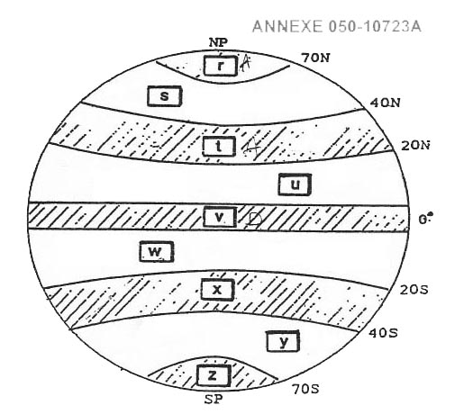
Refer to figure . gbas ground based augmentation system . gbas is a system that attempts to reduce the natural errors within the gnss system by providing very localised augmentation to the satellite signals via a vhf data broadcast vdb datalink that a suitably equipped aircraft can receive and use to fix some position errors it is also called 'differential gps' and can correct for errors induced by satellite clocks ephemeris and ionospheric propagation to make the augmented gnss signal very accurate these are measurable errors which are measured by multiple receiver antennas and interpreted by a ground station usually located at an airport which can make use of this highly accurate gnss errors in the receiver multipath signals and some small atmospheric propagation errors can still occur but the intention is to get the accuracy below 1m for aircraft on final approach the gbas can also like its satellite based cousin sbas give integrity warnings about faulty satellites as it should be able to detect this at the nearby antennas gbas is limited in the fact that it is very short range spanning approximately 30km away from the relevant ground station although there is the capability for a network of such stations in the future the operation of gbas allows it to work in the same way as an ils approach down to 200ft minimums currently and this is called the gbas landing system or gls and is a precision approach it is tuned using a 5 digit channel number that picks up the correct vhf datalink signals for that approach the gbas positioning service is a terminal version of gbas and is useful for high accuracy navigation and fast integrity monitoring in the terminal areas around airports exemple 399 Vhf datalink.Vhf datalink.

Select the correct statement about the european satellite based augmentation ?

Question 199-27 : Egnos uses up to 4 geostationary satellites to transmit integrity data and ranging signals to aircraft egnos uses at least 1 geostationary satellite to transmit integrity and safety related messages to aircraft egnos uses at least 3 geostationary satellites to transmit receiver clock error and integrity data egnos uses up to 2 geostationary satellites to transmit ranging signals in the l2 frequency
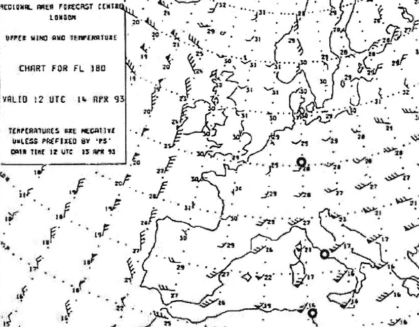
Refer to figure . note be careful here as there is a second option that is very close to being correct we do still believe that the answer stating 'up to 4 satellites' is more correct though and that also aligns with the feedback we have received satellite based augmentation systems sbas . sbas uses the idea of differential gps dgps and spreads it over very wide area the satellites involved have geosynchronous orbits meaning that they stay over the same place on the earth all the time and can reduce gnss errors and increase integrity over a very large area this means that there are multiple around the world waas for the usa egnos for europe gagan for india msas for japan etc accuracy is enhanced through the transmission of wide area corrections for gnss range errors such as ephemeris satellite clock errors and ionospheric propagation integrity is enhanced by the sbas network quickly detecting satellite signal errors through the many ground stations and sending alerts to receivers that they should not track the failed satellite signal availability can be improved as the sbas transmits ranging signals from its satellites on top of their other roles each acts as an extra gnss satellite egnos is europe's sbas and it contains up to 4 geo stationary satellites but deactivated one in 2019 so are running with 3 at the moment 2 active 1 in testing mode these provide sbas to europe and have the capability to provide it to africa and the middle east as well only 1 satellite is required to provide full coverage hence the 2 active satellites in case of failure due to the other options here it is best to go through the answers one by one 'egnos uses at least 1 geostationary satellite to transmit to aircraft integrity and safety related messages ' only 1 satellite is required that section is correct however they don't transmit safety related messages other than integrity messages therefore we would argue this is not completely correct 'egnos uses up to 2 geostationary satellites to transmit ranging signals in the l2 frequency ' no it uses between 1 and 4 satellites and transmits on l1 and l5 'egnos uses at least 3 geostationary satellites to transmit receiver clock error and integrity data ' no same as above 'egnos uses up to 4 geostationary satellites to transmit to aircraft integrity data and ranging signals ' this is completely correct egnos uses up to 4 satellites and does transmit integrity data and ranging signals to aircraft as this is completely correct we consider it the right answer over option a exemple 403 Egnos uses up to 4 geostationary satellites to transmit integrity data and ranging signals to aircraft.Egnos uses up to 4 geostationary satellites to transmit integrity data and ranging signals to aircraft.

What is true about the visibility of navstar gps satellites ?

Question 199-28 : Visibility varies depending on time and position of the observer visibility is greatest at the poles visibility is greatest at the equator visibility is the same across the entire globe
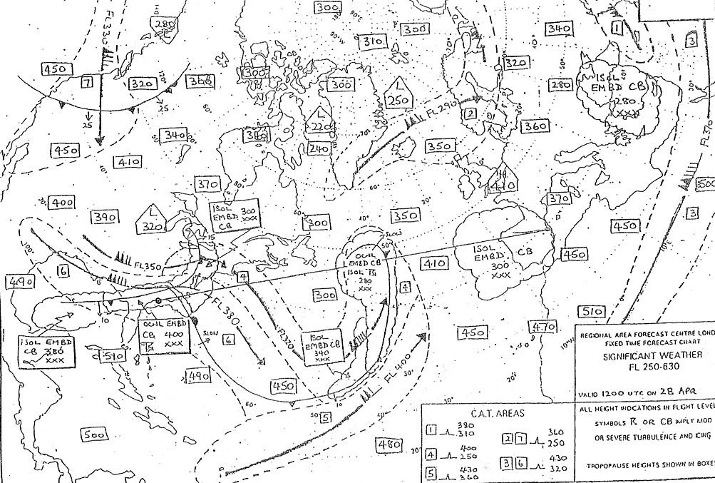
Refer to figure .navstar gps is the original gnss global navigation satellite system it uses a constellation of 24 satellites in 6 different orbital planes orbiting at 20 200 km .for a receiver to work correctly it must be able to 'see' 4 satellites in that the signals from the satellites are line of sight only and therefore cannot go over the horizon or through mountains thick obstructions etc 4 satellites give enough 'pseudorange' rings to get a suitable fix in 3d space of a receiver's position within low and mid latitudes there are usually more than 4 satellites in view of any receiver however as you get closer to the poles the satellites in view become fewer and quickly drop below the 4 required extra range can be gained when at high altitude as the horizon is much less restrictive there .this reinforces the nicely vague answer of this question that the 'visibility varies dependent on the time and position of the receiver' it is not always best at the equator nor is it the same everywhere around the globe exemple 407 Visibility varies depending on time and position of the observer.Visibility varies depending on time and position of the observer.

With regards to icao annex 10 volume 1 gps and glonass ?

Question 199-29 : Can both be used in a suitably equipped aircraft as the systems are compatible and their functions are interoperable are two completely separate systems but only gps is capable of providing approved position data can both be used but because their information is not compatible an aircraft cannot use both systems are two separate systems and only gps is covered by eu regulations so only that service can be used by european operators
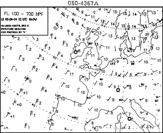
Note we believe that this is outside of the learning objectives and should be appealed in the exam please inform us of any further feedback from the exams and let us know of the outcome of any appeals thank you .learning objective 062 06 01 02 24 state that agreements have been concluded between the appropriate agencies for the compatibility and interoperability by any approved user of navstar and glonass systems .learning objective 062 06 01 02 25 state that the different gnsss use different data with respect to reference systems orbital data and navigation services ..this is a bit of a strange question as it is obviously created based solely off the first learning objective above but even that is quite vague stating that 'agreements have been concluded' .from our own knowledge on this the two systems can be used together but there is some 'translation' that has to occur to make them interoperable for instance if you've used a non aviation garmin device before you might have seen that you can choose to use gps only or gps + glonass one of the problems is that they use different reference systems gps uses wgs 84 and glonass uses pz 90 theoretically using them both side by side and mathematically converting the final product between the reference systems seems like the best way to use them at the moment .so we think that they are somewhat interoperable currently but we do not know if they are actually truly interoperable yet such as one system that uses both signals in the same way we know that something similar to that is the goal from the learning objectives and various easa documentation so we think that perhaps an examiner may have jumped the gun a little and written a question that is ahead of its time .note we would also like some further information on why option b 'are two separate systems and only gps is covered by eu regulations so only that service can be used by european operators ' is wrong currently we know that only gps is used in european airspace and they are separate systems so we do not see what the problem is with this answer other than the 'correct' answer from feedback being more in line with the learning objectives perhaps the examiner is not talking about flying in europe but that seems also misleading exemple 411 Can both be used in a suitably equipped aircraft as the systems are compatible and their functions are interoperable.Can both be used in a suitably equipped aircraft as the systems are compatible and their functions are interoperable.

Which of the following is an aircraft based augmentation system ?

Question 199-30 : Raim gbas sbas waas
The gps system alone does not meet icao requirements for navigation to improve accuracy provide necessary integrity and timely alerts the gps system needs to be augmented by ground based and space based systems in addition to these systems the airborne based augmentation system abas is used at the aircraft level and is comprised of two types that work together . the first type is the receiver autonomous integrity monitoring raim which is a stand alone integrity control that uses redundancy and geometry of gps satellites to ensure integrity however raim does not improve gps accuracy on its own . the second type is the aircraft autonomous integrity monitoring aaim which is also a stand alone integrity control but uses a combination of gps signals and other sensors such as radio navigation facilities and/or inertial navigation systems irs to ensure integrity exemple 415 RaimRaim

How many satellites are required for signal reception to perform an independent ?

Question 199-31 : Six four five three
Receiver autonomous integrity monitoring raim . raim is a technique which uses extra gnss satellites to improve the integrity of gnss location data instead of the 4 satellite ranges required for a 3d gnss fix using 5 satellites can mean that the onboard raim system can continuously measure different sets of 4 signals making sure that every fix is consistent with the others each fix excludes 1 satellite so the receiver knows if they are all correct or not thereby noticing if any one satellite becomes faulty as all the seperate fixes will then be different from each other this can tell us within a few seconds if a satellite that we are using becomes faulty rather than waiting a potential 3 hours for it to be noticed and taken offline this raim feature is called fault detection fd it does not tell us which is the faulty satellite as this is mathematically impossible to work out with so little data . . if we use a second extra satellite a total of 6 for a 3d fix then we can also reliably calculate which is the faulty satellite and remove it from usage called fault detection and exclusion fde . . the amount of required satellites can be reduced by 1 for 2d fixes but these are not used unless barometric altitude is fed to the gnss system which can allow an extra 'range sphere' and effectively acts like another satellite this is an air based augmentation system and occurs in a different place in the learning objectives exemple 419 SixSix

Which pair of factors when brought together can establish the estimate of the ?

Question 199-32 : The user equivalent range error uere and the geometric dilution of precision gdop the time dilution of precision tdop and the geometric dilution of precision gdop the horizontal dilution of precision hdop and vertical dilution of precision vdop the user equivalent range error uere and position dilution of precision pdop
The user equivalent range error uere emerges from a combination of factors including inaccuracies within the satellite navigation message the potential disruption of satellite orbits due to perturbations and the reliability of the satellite's clock stability uere is the maximum position error anticipated by the user and can be computed as the square root of the sum of all individual errors squared ionospheric propagation delay satellite clock error satellite orbital variations multipath propagation uere is therefore the value of all residual errors affecting the receiver position even after corrective actions have been taken .the actual position error is however not only affected by uere another factor is the geometric dilution of position gdop in systems that determine positions using intersecting lines like gnss the arrangement of the satellites in the sky has a big impact on how accurate the calculated position can be when the satellites are close together in the view of the gps receiver antenna the angles at which the position surfaces intersect become less favorable this results in a reduction in accuracy known as a high dilution of precision .. the total position error can be computed by multiplying uere by gdop exemple 423 The user equivalent range error (uere) and the geometric dilution of precision (gdop).The user equivalent range error (uere) and the geometric dilution of precision (gdop).

Egnos european geostationary navigation overlay system informs the users of any ?

Question 199-33 : Data is broadcast from geostationary satellites alerts are sent to all the satellites in view and then re transmitted to the user differential corrections and integrity messages are broadcast every 3 hours the data are broadcast from all satellites with navigation packages

In the european egnos european geostationary navigation overlay system geostationary satellites are harnessed from the inmarsat 3 marine communications satellite series three of these are outfitted with navigation packages .the geostationary satellite receives data and disseminates it to all users through a broadcast this broadcast employs the gps l1 frequency modulated using a c/a code of the same category as gps c/a codes and synchronizes with the gps time basis the signal also encompasses a ranging message enabling the geostationary satellite to function as an additional positioning satellite .the message transmitted by the geostationary satellite comprises .. an integrity message providing the status of all gps satellites in a use/don't use format . wide area dgps error corrections . an ionospheric delay model . ephemeris and clock data specific to the geostationary satellite ..upon reaching the aircraft the geostationary satellite's broadcast is decoded using a wide area ionospheric delay almanac the aircraft's receiver calculates the ionospheric delay applicable to its position and applies the necessary corrections notably no tropospheric delay correction data is included so any required correction calculation must be sourced from the stored standard model exemple 427 Data is broadcast from geostationary satellites.Data is broadcast from geostationary satellites.

Gps employs two frequencies l1 and l2 to offer standard positioning service sps ?

Question 199-34 : Sps using only the c/a code while pps requires the p code which is transmitted on both l1 and l2 pps using only the c/a code while sps requires both the c/a code and the p code transmitted on l1 and l2 pps using both the c/a code and the p code while sps requires the c/a code transmitted on l2 sps using the p code while pps requires both the c/a code and the p code transmitted on l1 and l2
Learning objective 062 06 01 02 05 state that sps is a positioning and timing service provided on frequency l1 .learning objective 062 06 01 02 06 state that pps uses both frequencies l1 and l2 .learning objective 062 06 01 02 10 state that two codes are transmitted on the l1 frequency namely a coarse acquisition c/a code and a precision p code the p code is not used for standard positioning service sps .satellite signals transmit on two frequencies these are identified as l1 1575 42 mhz and l2 1227 60 mhz each rf signal is modulated by binary phase shift keying bpsk there are two modes of operation of navstar gps each with a different accuracy . the standard positioning service sps is available for civilian users sps is a positioning and timing service provided on frequency l1 using the c/a code . the precise position service pps is only available for authorised users such as the military pps provides a higher accuracy than sps and uses both frequencies l1 and l2 using the c/a and p codes exemple 431 Sps using only the c/a code, while pps requires the p code, which is transmitted on both l1 and l2.Sps using only the c/a code, while pps requires the p code, which is transmitted on both l1 and l2.

An aircraft is executing the gls rwy 19r approach that is a gnss 1 approach ?

Question 199-35 : 1 precision 2 ground 1 non precision 2 ground 1 precision 2 satellite 1 non precision 2 satellite
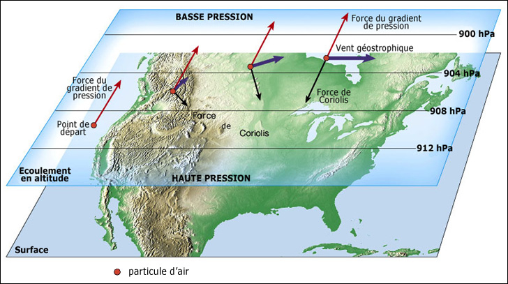
Refer to figure . gls ground based augmentation system landing system or gbas landing system is an advanced satellite based navigation system used for precision approaches it is also called 'differential gps' and it combines the benefits of a precision approach with the assistance of a gbas ground based augmentation system gbas ground based augmentation system is a ground based system that enhances the accuracy integrity and availability of satellite based navigation signals gbas reduces the natural errors within the gnss system by providing very localised augmentation to the satellite signals via a vhf data broadcast vdb that a suitably equipped aircraft can receive and use to fix any position errors it corrects errors induced by satellite clocks ephemeris and ionospheric propagation to make the augmented gnss signal very accurate providing more reliable and precise navigation information to the aircraft errors in the receiver multipath signals and some small atmospheric propagation errors can still occur but the intention is to get the accuracy below 1m for aircraft on final approach when gls is used for an approach it means that the aircraft is utilizing the gbas system to receive precise and accurate guidance during the landing phase in summary a gls approach is a precision approach that utilizes the assistance of the gbas system to provide highly accurate guidance for the aircraft during landing exemple 435 (1) precision; (2) ground(1) precision; (2) ground

What factors contribute to the formation of user equivalent range error uere ?

Question 199-36 : Combination of various errors including selective availability sa ephemeris error ee satellite clock error and atmospheric delays position dilution of precision pdop and ephemeris error ee satellite clock error and tropospheric delay geometric dilution of precision gdop and ionospheric delay
The term user equivalent range error uere is the combination of all satellite and sis signal in space errors and includes all gnss errors except for dilution of precision which is a different type of error .selective availability sa is included in the user equivalent range error uere .selective availability .selective availability sa was a deliberate measure introduced by the u s .department of defense in the mid 1990s to intentionally degrade the accuracy of civilian global positioning system gps signals .this degradation reduced the precision of civilian gps fixes to around 100 meters .sa was achieved by introducing random errors in the satellite clock times known as dithering sv clock time .in 2000 the u s .government discontinued sa ensuring significantly improved accuracy for civilian gps users and assuring that it would not be reintroduced ..global navigation satellite system gnss positioning is based on the pseudorange between satellites and receivers .the 'time of flight' of radio signals from several satellites to a receiver is used to calculate pseudorange or pseudo distances .the term 'pseudorange' is used to distinguish it from true range as it may be affected by various sources of error in time of flight measurement .even the smallest timing errors can result in large position errors for example a millionth of a second timing error can create a distance error 0 16 nm .various types of error may degrade precision including the following .. ionospheric and tropospheric errors. satellite clock errors. ephemeris data errors. receiver quality. multipath error. dilution of precision dop ..ionospheric errors .the ionosphere is the layer of the atmosphere between approximately 50 km to 1000 km above the earth's surface .this layer contains ions which are electrically charged .when the gnss signal passes through this layer its interaction with theses ions reduces its speed and therefore introduces an error .tropospheric errors or delays .due to the inherent precision of satellite based navigation systems changes in tropospheric conditions have a notable impact on the transmission of radio waves .fluctuations in factors like pressure temperature density and humidity influence the velocity of signal propagation .greater density and higher absolute humidity result in decreased signal propagation speed .satellite clock errors .although gnss satellites use the most precise atomic clocks featuring nanosecond accuracy the clock drift phenomena may cause minute inaccuracies which can produce errors that affect positioning .ephemeris data error .these are errors induced by the satellite's location .an 'ephemeris error' describes the difference between the expected and actual orbital position of a gnss satellite .because gnss receivers use the satellite's location in pseudorange calculations orbital error reduces gnss accuracy .the orbital errors arise through solar winds and varying gravitational forces such as those of the sun and the moon .receiver quality .the hardware used within the receiver may limit precision by introducing inaccuracies in receiver timing .multipath errors .multipath errors appear when a gnss signal arrives at the receiver gnss antenna after having been reflected from an object such as the surface of a building .the reflected signal clearly has to travel further to reach the antenna and so it arrives with a slight delay .this delay can cause positional error .dilution of precision dop .dop error may be caused by the relative positions in three dimensional space of the satellites used to calculate a position .to get a better understanding the concept of geometrical dop gdop is often used .poor gdop values mean 'bad' positioning of satellites .on the contrary 'well' distributed satellites produce good values .satellites that are closer together will greate a less accurate position measurement whereas satellites which are well spread around the sky will give a more accurate position of the receiver as the spheres of pseudorange cut each other at better angles exemple 439 Combination of various errors including selective availability (sa), ephemeris error (ee), satellite clock error, and atmospheric delays.Combination of various errors including selective availability (sa), ephemeris error (ee), satellite clock error, and atmospheric delays.

Required navigation performance rnp is a concept that applies to navigation ?

Question 199-37 : Within an airspace within an airspace and with a specific time interval only in an airspace using satellite navigation systems within rnav tracks only
.required navigation performance rnp is a concept that applies to navigation performance within an airspace .the rnp type is based on the navigation performance accuracy to be achieved within the airspace .an aircraft equipped to operate to rnp 1 and better should be able to compute an estimate of its position error depending on the sensors being used and time elapsed exemple 443 Within an airspace.Within an airspace.

According to annex 6 rnp type is defined as a containment value expressed as a ?

Question 199-38 : I nautical miles ii 95% i nautical miles ii 90% i kilometers ii 95% i kilometers ii 90%
.icao annex 6 defines two kinds of navigation specifications . rnp specification a navigation specification based on area navigation that includes the requirement for performance monitoring and alerting designated by the prefix rnp e g rnp 4 rnp apch .and. rnav specification a navigation specification based on area navigation that does not include the requirement for performance monitoring and alerting designated by the prefix rnav e g rnav 5 rnav 1 .note the performance based navigation manual doc 9613 volume ii contains detailed guidance on navigation specifications .icao doc 9613 volume ii .system performance monitoring and alerting .accuracy during operations in airspace or on routes designated as basic rnp 1 the lateral total system error must be within ±1 nm for at least 95 per cent of the total flight time the along track error must also be within ±1 nm for at least 95 per cent of the total flight time exemple 447 (i) nautical miles (ii) 95%(i) nautical miles (ii) 95%

According to annex 6 what is the definition of required navigation performance ?

Question 199-39 : A statement of the navigation performance necessary for operation within a defined airspace a statement of the navigation performance required during a pilot skill test a statement of the navigation performance necessary during flight tests for a new aircraft type a statement of the navigation performance required when installing a new navigation aid on the ground
exemple 451 A statement of the navigation performance necessary for operation within a defined airspace.A statement of the navigation performance necessary for operation within a defined airspace.

Which of the following statements best describes pbn performance based ?

Question 199-40 : Is not sensor specific is similar to conventional navigation requiring ground based infrastructure requires the development of sensor specific routes and procedures is based on sensor specific navigation specifications
Icao pbn manual doc . 9613 .performance based navigation pbn .the pbn concept specifies that aircraft rnav system performance requirements be defined in terms of the accuracy integrity availability continuity and functionality which are needed for the proposed operations in the context of a particular airspace concept . the pbn concept represents a shift from sensor based to performance based navigation . performance requirements are identified in navigation specifications which also identify the choice of navigation sensors and equipment that may be used to meet the performance requirements .pbn offers a number of advantages over the sensor specific method of developing airspace and obstacle clearance criteria .a reduces the need to maintain sensor specific routes and procedures and their associated costs .b avoids the need for developing sensor specific operations with each new evolution of navigation systems which would be cost prohibitive .c allows for more efficient use of airspace route placement fuel efficiency and noise abatement .d clarifies how rnav systems are used and.e facilitates the operational approval process for operators by providing a limited set of navigation specifications intended for global use .in slightly simpler terms the pbn concept of airspace moves away from being routed via particular nav aids or being limited by the nav aids in a particular area or on a particular aircraft . as pbn is not sensor specific all that is required is the correct accuracy integrity etc to fly in particular airspace it is far simpler and easy to upgrade in future exemple 455 Is not sensor-specific.Is not sensor-specific.


~

Exclusive rights reserved. Reproduction prohibited under penalty of prosecution.

7919 Free Training Exam