The time transmitted by a navstar gps satellite is ? [ Answer reports ]
Question 198-1 : Gps utc gmt lt
 Gps.
Gps. The acronym given to an aircraft based augmentation system abas whereby a ?
Question 198-2 : Raim receiver autonomous integrity monitoring aaim aircraft autonomous integrity monitoring laas local airborne augmentation system capu central air processor unit
 Raim (receiver autonomous integrity monitoring).
 In general a gnss receiver is able to determine ?
Question 198-3 : A three dimensional position groundspeed and a precise time reference only a three dimensional position and groundspeed only a three dimensional position only a three dimensional position and a time reference
 A three dimensional position, groundspeed and a precise time reference.
 By using egnos in combination with gps ?
Question 198-4 : The integrity is improved by reducing the mean failure reporting time from up to 3 hours to 6 seconds no improvements are obtained apart from the redundancy a better position accuracy is obtained but the integrity of the system is not improved the errors caused by multi path and noise are eliminated
 The integrity is improved by reducing the mean failure reporting time from up to 3 hours to 6 seconds.
 Assume that one of the satellites used by a gps receiver is faulty when the ?
Question 198-5 : Is able to detect that one of the satellites is faulty but is unable to identify the faulty one is not active as the software needs at least 8 satellites to function correctly is unable to detect and identify the faulty satellite is able to detect that one of the satellites is faulty and is able to identify the faulty one
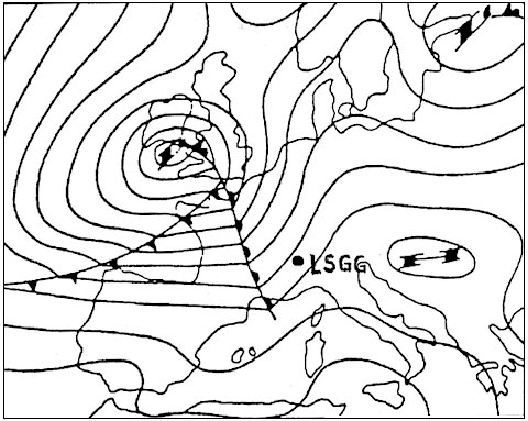 Is able to detect that one of the satellites is faulty but is unable to identify the faulty one.
 Aaim aircraft autonomous integrity monitoring is a type of airborne based ?
Question 198-6 : Relies on gnss information as well as information from additional on board sensors relies on information from additional on board sensors only relies on gnss information only can only function within the range of a ground based augmentation system
 Relies on gnss information as well as information from additional on-board sensors.
 Which statement from the choice below characterises a satellite based ?
Question 198-7 : Sbas is able to provide approach and landing operations with vertical guidance sbas is an augmentation device for ground based augmentation systems the sbas monitor stations send corrected positions to the users within the range of the station the ground reference station transmits corrections directly to the user by vhf/uhf data link
 Sbas is able to provide approach and landing operations with vertical guidance.
 The fully operational galileo global navigation satellite system gnss will ?
Question 198-8 : 1 30 satellites 2 3 orbital planes 3 23222 km 1 30 satellites 2 4 orbital planes 3 19100 km 1 24 satellites 2 4 orbital planes 3 20200 km 1 24 satellites 2 6 orbital planes 3 12539 km
 1. 30 satellites 2. 3 orbital planes 3. 23222 km
 Which statement about satellite based augmentation systems sbas is correct ?
Question 198-9 : The use of sbas improves both the accuracy and the integrity of the position of the user the use of sbas improves neither the integrity nor the accuracy of the position of the user but augments the number of satellites available the use of sbas improves the accuracy of the position of the user but does not improve the integrity the use of sbas improves the integrity of the position of the user but does not improve the accuracy
 The use of sbas improves both the accuracy and the integrity of the position of the user.
 How is the final approach segment fas of a gbas precision approach procedure ?
Question 198-10 : The gbas ground facility transmits the approach path guidance parameters to the gbas equipped aircraft the gnss space segment transmits the approach path guidance parameters to the gbas equipped aircraft the gbas reference receivers transmit error correction messages to the ground based azimuth and elevation guidance transmitters the gbas ground facility transmits an error correction message to the ground based azimuth and glidepath guidance transmitters
 The gbas ground facility transmits the approach-path guidance parameters to the gbas-equipped aircraft.
 The navigation message of a gps satellite contains the parameters of the model ?
Question 198-11 : The receiver to calculate the delay of gps signals passing through the ionosphere the use of the satellites with the least tropospheric delay the receiver to choose the satellites with the best geometric dilution of precision the authorised users to work on the l1 and l2 frequencies
 The receiver to calculate the delay of gps signals passing through the ionosphere.
 What is the minimum number of satellites required by a gps in order to obtain a ?
Question 198-12 : 4 6 3 5
 4
4 Which of the following satellite navigation systems has full operational ?
Question 198-13 : Navstar/gps nnss transit glonass cospas sarsat
 Navstar/gps
 Errors in gps satellite orbits are due to ?
Question 198-14 : The solar wind and the gravitation of the sun moon and planets solar and lunar precession earth and lunar precession the lunar wind and the gravitation of the earth moon and stars
 The solar wind and the gravitation of the sun, moon and planets.
 One of the advantages of a satellite based augmentation system sbas over a ?
Question 198-15 : The coverage area of an sbas is much larger than that of a gbas an sbas does not like a gbas need ground stations for the estimation of the pseudo range corrections the rate at which the pseudo range corrections reach the users is much higher for a gbas than for an sbas the pseudo range corrections of an sbas are much more accurate than those of a gbas
 The coverage area of an sbas is much larger than that of a gbas.
 In relation to the navstar/gps satellite navigation system what is involved in ?
Question 198-16 : Fixed ground stations compute position errors and transmit correction data to a suitable receiver on the aircraft signals from satellites are received by 2 different antennas which are located a fixed distance apart this enables a suitable receiver on the aircraft to recognise and correct for multipath errors the difference between signals transmitted on the l1 and l2 frequencies are processed by the receiver to determine an error correction receivers from various manufacturers are operated in parallel to reduce the characteristic receiver noise error
 Fixed ground stations compute position errors and transmit correction data to a suitable receiver on the aircraft.
 When a gps position is augmented by egnos what time to alert can be expected ?
Question 198-17 : 6 seconds 15 seconds 0 3 seconds 10 seconds
 6 seconds
 In an aircraft based augmentation system abas the method of integrity ?
Question 198-18 : Receiver autonomous integrity monitoring raim aircraft station autonomous integrity monitoring asaim aircraft autonomous integrity monitoring aaim gnss autonomous integrity monitoring gaim
 Receiver autonomous integrity monitoring (raim).
 Which statement correctly describes the principle of sbas operation a ?
Question 198-19 : Geostationary satellites to gnss receivers distributed over a wide area geostationary satellites to gnss receivers located in a small local area ground based transmitters to gnss receivers distributed over a wide area ground based transmitters to gnss receivers located in a small local area
 Geostationary satellites to gnss receivers distributed over a wide area.
 Which of the following correctly describes the principle of receiver autonomous ?
Question 198-20 : Requires at least five satellites with good geometry to provide the service of detecting faulty signals and alerting the crew is guaranteed to be available for all scheduled flight operations at mid latitudes must be assured at all times in order to utilise global navigation satellite system gnss signals in any augmentation system is available if range from at least three satellites is supplemented by barometric aiding
 Requires at least five satellites with good geometry to provide the service of detecting faulty signals and alerting the crew.
 Which statement about dilution of precision is correct the value of the ?
Question 198-21 : Geometry and the number of satellites in view accuracy with which the range between the satellite and receiver can be measured availability of receiver autonomous integrity monitoring software availability of aircraft based augmentation systems
 Geometry and the number of satellites in view.
 Which statement is correct about the sbas satellite based augmentation systems ?
Question 198-22 : In an sbas the pseudo range corrections are sent to the users by geostationary satellites in an sbas the pseudo range correction are sent to the users by the satellite of the satellite systems e g by gps satellites for gps in an sbas the pseudo range correction are determined by geostationary satellites and sent to the users by a network of ground stations in an sbas the pseudo range corrections are determined by geostationary satellites and sent to the users by the satellite of the satellite systems e g by gps satellites for gps
 In an sbas the pseudo range corrections are sent to the users by geostationary satellites.
 The system capable of on the ground measuring the signal errors transmitted by ?
Question 198-23 : Gbas tbas sbas abas
 Gbas
Gbas Which statement about a satellite based augmentation system sbas is correct ?
Question 198-24 : Sbas is able to provide guidance for precision approaches sbas is an augmentation device for ground based augmentation systems sbas is able to provide approach and landing operations with horizontal guidance only sbas is able to provide approach and landing operations with vertical guidance only
 Sbas is able to provide guidance for precision approaches.
 How does the gbas precision approach work ?
Question 198-25 : A gbas ground station sends correction data to the aircraft which uses the data to determine the correct azimuth and glidepath a gbas ground station sends correction signals to a ground transmitter which sends azimuth and glidepath information to the aircraft a gbas satellite sends azimuth and glidepath information to the aircraft a gbas station sends approach path information directly to the aircraft
 A gbas ground station sends correction data to the aircraft, which uses the data to determine the correct azimuth and glidepath.
 What does abas stand for ?
Question 198-26 : Aircraft based augmentation systems aircraft based application safety aerial broadcast application systems aircraft based augmentation safety
 Aircraft-based augmentation systems.
 Maximum coverage of a ground based augmentation system gbas station is… ?
Question 198-27 : 20 nm 10 nm 12 nm 30 nm
 20 nm
20 nm How is the gps receiver able to calculate aircraft's ground speed ?
Question 198-28 : Using the space vehicle sv doppler frequency shift using the time measured from the signal leaving the satellite to the receiver using the pseudo range measurements using aircraft position and known reference points on the ground
 Using the space vehicle (sv) doppler frequency shift.
 For a satellite to be visible to a gps receiver ?
Question 198-29 : It needs a higher elevation than 5° above the horizon it needs a higher elevation than 5° below the horizon it needs a higher elevation than 15° above the horizon it needs a higher elevation than 55° above the horizon
 It needs a higher elevation than 5° above the horizon.
 Geometric dilution of precision gdop error can be minimized when… ?
Question 198-30 : One satellite is directly overhead and 3 others are close to the horizon 120 degrees apart three satellites are spaced by 120 degrees in the vertical plane and one satellite is directly overhead two satellites are spaced by 180 degrees in azimuth one satellite is directly overhead and one satellite is directly opposed to the satellite overhead four satellites are spaced by 90 degrees in azimuth
 One satellite is directly overhead and 3 others are close to the horizon 120 degrees apart.
 Referring to the navstar/gps satellite navigation system what is the meaning of ?
Question 198-31 : It is a technique that ensures the integrity of the provided data by redundant measurements it is a technique whereby the receivers of the world wide distributed monitor stations – ground segment – automatically determine the integrity of the navigation message it is a method whereby a receiver ensures the integrity of the pseudo random noise prn code transmitted by the satellites it is the ability of the gps satellites to check the integrity of the data transmitted by the monitoring stations of the ground segment
 It is a technique that ensures the integrity of the provided data by redundant measurements.
 You are flying at high latitude and you are unable to identify your position ?
Question 198-32 : Irs and barometric altimeter barometric altimeter and clock only on board clock to aid time reference and sbas ins and clock
 Irs and barometric altimeter.
 What is the name of a main chinese gnss system ?
Question 198-33 : Beidou gagan egnos wass
 Beidou
 Which of the follwing codes can an unauthorized aircraft read ?
Question 198-34 : C/a codes neither c/a nor p codes p and c/a codes p codes
 C/a codes
 Which system is capable of measuring on the ground the signal errors ?
Question 198-35 : Sbas abas rbas gbas
 Sbas
Sbas What does the term 'sbas' stand for ?
Question 198-36 : Satellite based augmentation system supplement based augmentation system service broadcast application system satellite based area system
 Satellite based augmentation system
 What is the minimum ground based augmentation system gbas plan coverage ?
Question 198-37 : 15 nm from the landing threshold within 35° apart the final approach path and 10° apart between 15 and 20 nm 25 nm from the landing threshold within 45° apart the final approach path and 20° apart between 25 and 20 nm 25 nm from the landing threshold within 35° apart the final approach path and 10° apart between 25 and 30 nm 15 nm from the landing threshold within 45° apart the final approach path and 20° apart between 15 and 20 nm
 15 nm from the landing threshold within 35° apart the final approach path and 10° apart between 15 and 20 nm.
 In the global navigation satellite system gnss what is the user equivalent ?
Question 198-38 : Residual errors in the receivers which have not been corrected the correction for the receiver errors as transmitted in the navigation message inaccuracies from the geometry of the satellites above the user's horizon the correction for the receiver clock error as transmitted by a differential station
 Residual errors in the receivers which have not been corrected.
 In the navstar gps system what can authorised users calculate positions from ?
Question 198-39 : Pps as well as the less accurate sps c/a code as well as the less accurate sbas sps as well as the less accurate pps sbas as well as the less accurate c/a code
 Pps as well as the less accurate sps.
 An estimate of the position accuracy from the global navigation satellite ?
Question 198-40 : Geometric dilution of precision gdop and user equivalent range error uere the correction for the receiver clock error as transmitted by a differential station inaccuracies from the geometry of the satellites above the user's horizon user equivalent range error uere alone
 Geometric dilution of precision (gdop) and user equivalent range error (uere).
 ~
Exclusive rights reserved. Reproduction prohibited under penalty of prosecution.
7879 Free Training Exam
