Un compte Premium offert sur le site FCL.055 ! Rendez-vous sur www.fcl055-exam.fr puis créez un compte avec le même email que celui...   [Lire la suite]


Which of the following errors affects the use of vor ? [ Question security ]

Question 187-1 : Scalloping quadrantal error coastal refraction night effect
Site error is caused by uneven terrain for example hills trees buildings and long grass near the transmitter although the propagation has left the vor with ±1° accuracy propagation error still exists propagation error is caused by the terrain and distance at a certain range from the vor so called ‘bends’ or ‘scalloping’ can occur .vor scalloping is described as an imperfection or deviation in the received vor signal scalloping causes the signal to bend as a result of reflections from buildings and terrain scalloping also causes the course deviation indicator cdi to slowly or rapidly shift from side to side scalloping has a negative effect on the accuracy of the navigation aids used exemple 287 ScallopingScalloping

How can a dme interrogator distinguish between its own reply pulse pairs and ?

Question 187-2 : The pulse repetition frequency of the pulse pairs transmitted by the interrogator varies for each interrogator in a unique rhythm the dme transponder uses a slightly different randomly varying delay for each interrogating aircraft the time interval between both pulses of consecutive pulse pairs transmitted by the interrogator varies for each interrogator in a unique pattern on the y channel the time interval between the pulses of an interrogator pulse pair is 36 msec and of a transponder pulse pair 30 m/sec
Dme uses the uhf frequency band between 962 1213 mhz the aircraft dme equipment radiated coded pulse pairs which is then received at the ground station triggering the transponder to send a suitably formatted reply adjusted by +/ 63 mhz after a delay of 50 microseconds for each of the interrogation channels two reply frequencies are allocated one is 63 mhz higher than the transmission and the other 63 mhz lower the reason for using pulse pairs is to ensure the receivers do no accept random single pulses or other transmissions that are not addressed for this type of communication each pulse pair is spaced at 12 microseconds x channels or 36 microseconds y channels and the space of each pair of pulse pairs is different between each group and is randomly unique to each transmission exemple 291 The pulse repetition frequency of the pulse pairs transmitted by the interrogator varies, for each interrogator, in a unique rhythm.The pulse repetition frequency of the pulse pairs transmitted by the interrogator varies, for each interrogator, in a unique rhythm.

Which of the following alternatives is correct regarding audio and visual ?

Question 187-3 : Audio 1300 hz alternating dots and dashes visual amber light flashes audio 75 mhz 2 dashes per second visual blue light flashes audio 400 hz 2 dashes per second visual blue light flashes audio 3000 hz alternating dots and dashes visual amber light flashes

The outer marker middle marker and inner marker all emit an amplitude modulated horizontally polarised signal the beacons operate at a 75 mhz carrier frequency outer marker om to provide height distance and equipment function checks for aircraft on final approach aural identification a 400 hz low pitch tone keyed in a form of 2 dashes per second visual representation lights bluemiddle marker mm indicated the imminence of transition to visual guidance often defines the decision point aural identification a 1300 hz medium pitch tone keyed in a form of alternating dots and dashes with 3 dashes per second visual representation lights amberinner marker im indicates the imminence of arrival above the threshold aural identification a 3000 hz tone keyed continuous dots at a rate of 6 dots per second visual representation lights white exemple 295 Audio: 1300 hz, alternating dots and dashes. visual: amber light flashes.Audio: 1300 hz, alternating dots and dashes. visual: amber light flashes.

Of the approach aids listed below which option correctly identifies those that ?

Question 187-4 : Only 2 and 3 only 1 and 3 1 2 3 and 4 only 2 and 4
Locators operate on a frequency between 190 and 1750khz lf and mf . localiser operates on a frequency between 108 10 and 111 96 mhz vhf . marker beacons operate on a frequency of 75 mhz vhf . glide path operates on a frequency 328 6 and 335 4 mhz uhf exemple 299 Only 2 and 3Only 2 and 3

Middle marker beacons of an ils transmit at ?

Question 187-5 : 75 mhz 90 mhz 150 mhz 1300 hz
All ils marker beacons operate on 75 mhz vhf thus no frequency selections are necessary for the pilot and radiate a fan shaped field pattern giving to the pilot an indication of range from the threshold the purpose of the markers is to provide range information while on the approach they transmit an almost vertical beam almost all installations are equipped with an outer marker and a middle marker category 2 or 3 ils may be equipped with an inner marker as well audio and visual signals in the cockpit will indicate when the aircraft is passing overhead in many installations marker beacons are being replaced or supplemented by the use of a dme associated with the ils .the outer marker is located approximately 3 9 nautical miles from the runway threshold and is aligned across the front beam of the localiser its purpose is to provide height distance and equipment functioning checks to aircraft on final approach it is modulated at 400 hertz and keyed to transmit dashes continuously at a rate of 2 per second .the middle marker is aligned across the front beam of the localiser and is situated approximately 1050 metres from the runway threshold its purpose is to indicate the imminence in low visibility conditions of visual approach guidance this marker is modulated at 1300 hertz and keyed to transmit alternate dots and dashes · · · the rate is 2 dashes and 6 dots per second an aircraft on the glide slope over the middle marker should be roughly 200 feet above the touchdown zone elevation .the inner marker is modulated at 3000 hertz identified by a keyed continuous signal of 6 dots per second · · · · · and is located 75–450 metres from the runway threshold .summary .. . outer marker identifies glideslope intercept or the final approach fix light flashes blue . . . middle marker identifies decision height light flashes amber . . . inner marker identifies decision height for a cat ii ils light flashes white exemple 303 75 mhz.75 mhz.

The ils marker identified audibly by a series of dots 6/second is the… ?

Question 187-6 : Inner marker outer marker locator middle marker
The outer marker middle marker and inner marker all emit an amplitude modulated horizontally polarised signal the beacons operate at a 75 mhz carrier frequency outer marker om to provide height distance and equipment function checks for aircraft on final approach aural identification a 400 hz low pitch tone keyed in a form of 2 dashes per second visual representation lights bluemiddle marker mm indicated the imminence of transition to visual guidance often defines the decision point aural identification a 1300 hz medium pitch tone keyed in a form of alternating dots and dashes with 3 dashes per second visual representation lights amberinner marker im indicates the imminence of arrival above the threshold aural identification a 3000 hz tone keyed continuous dots at a rate of 6 dots per second visual representation lights white exemple 307 Inner marker.Inner marker.

The ils marker identified audibly by a series of alternate dots and dashes is ?

Question 187-7 : Middle marker outer marker locator inner marker
The outer marker middle marker and inner marker all emit an amplitude modulated horizontally polarised signal the beacons operate at a 75 mhz carrier frequency outer marker om to provide height distance and equipment function checks for aircraft on final approach aural identification a 400 hz low pitch tone keyed in a form of 2 dashes per second visual representation lights bluemiddle marker mm indicated the imminence of transition to visual guidance often defines the decision point aural identification a 1300 hz medium pitch tone keyed in a form of alternating dots and dashes with 3 dashes per second visual representation lights amberinner marker im indicates the imminence of arrival above the threshold aural identification a 3000 hz tone keyed continuous dots at a rate of 6 dots per second visual representation lights white exemple 311 Middle marker.Middle marker.

The audio frequency modulation of the middle marker shall be keyed as follows… ?

Question 187-8 : A continuous series of alternate dots and dashes 6 dots per second continuously 2 dashes per second continuously 3 dashes 3 dots and 3 dashes per second continuously
The outer marker middle marker and inner marker all emit an amplitude modulated horizontally polarised signal the beacons operate at a 75 mhz carrier frequency outer marker om to provide height distance and equipment function checks for aircraft on final approach aural identification a 400 hz low pitch tone keyed in a form of 2 dashes per second visual representation lights bluemiddle marker mm indicated the imminence of transition to visual guidance often defines the decision point aural identification a 1300 hz medium pitch tone keyed in a form of alternating dots and dashes with 3 dashes per second visual representation lights amberinner marker im indicates the imminence of arrival above the threshold aural identification a 3000 hz tone keyed continuous dots at a rate of 6 dots per second visual representation lights white exemple 315 A continuous series of alternate dots and dashes.A continuous series of alternate dots and dashes.

The ils outer marker modulation frequency is ?

Question 187-9 : 400 hz 3000 hz 1300 hz 1500 hz
All ils marker beacons operate on 75 mhz vhf thus no frequency selections are necessary for the pilot and radiate a fan shaped field pattern giving to the pilot an indication of range from the threshold .the purpose of the markers is to provide range information while on the approach .they transmit an almost vertical beam .almost all installations are equipped with an outer marker and a middle marker .category 2 or 3 ils may be equipped with an inner marker as well .audio and visual signals in the cockpit will indicate when the aircraft is passing overhead in many installations marker beacons are being replaced or supplemented by the use of a dme associated with the ils .the outer marker is located approximately 3 9 nautical miles from the runway threshold and is aligned across the front beam of the localiser .its purpose is to provide height distance and equipment functioning checks to aircraft on final approach .it is modulated at 400 hertz and keyed to transmit dashes continuously at a rate of 2 per second .the middle marker is aligned across the front beam of the localiser and is situated approximately 1050 metres from the runway threshold .its purpose is to indicate the imminence in low visibility conditions of visual approach guidance .this marker is modulated at 1300 hertz and keyed to transmit alternate dots and dashes · · · .the rate is 2 dashes and 6 dots per second .an aircraft on the glide slope over the middle marker should be roughly 200 feet above the touchdown zone elevation .the inner marker is modulated at 3000 hertz identified by a keyed continuous signal of 6 dots per second · · · · · and is located 75–450 metres from the runway threshold .summary .. . outer marker identifies glideslope intercept or the final approach fix light flashes blue . . . middle marker identifies decision height light flashes amber . . . inner marker identifies decision height for a cat ii ils light flashes white exemple 319 400 hz.400 hz.

According to the principle of operation in an ils the difference in depth of ?

Question 187-10 : Increase with displacement from the centreline increase from the centre position to half full scale of the indicator needle and decrease until full scale of the needle increase with left displacement from the centreline and decrease with right displacement from the centreline decrease with displacement from the centreline
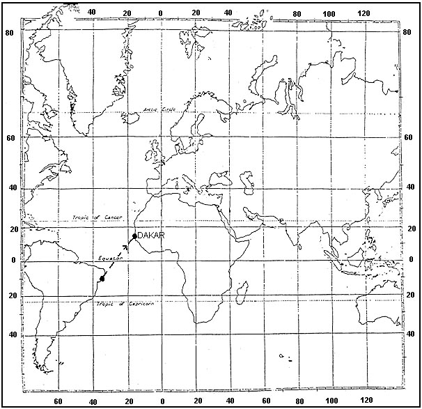
Refer to figure .the difference in depth modulation ddm is a principle used by the ils to define a position in an airspace the deviation detection of the aircraft from the desired track is based on two different overlapping lobes these lobes are radiated by both the localiser and the glide path antennas these consist of a 90 hz lobe and a 150 hz lobe .for the glide path .. . when the airborne receiver receives a stronger signal from the 90 hz lobe than the 150 hz lobe it means that the aircraft is above the ‘ideal’ glideslope . . . when the airborne receiver receives a stronger signal from the 150 hz lobe than the 90 hz lobe the aircraft will be below the ‘ideal’ glideslope . . . when both the signals received are at the same strength it means the aircraft will be on the ‘ideal’ glideslope and the glideslope needle will indicate zero . ..for the localiser the same method is used stronger signals from the 90 hz lobe means a displacement to the left whereas stronger signals from the 150 hz lobe means a right displacement in relation to the centreline when both the signals received are at the same strength it means the aircraft will be on the centreline and the localiser needle will indicate zero ..assume that you are on the centreline if you move away from the centrelline however still in the range of the localizer the ddm will increase ..ddm = am 90 hz am 150 hz / 100.therefore once you go off centreline either the 90 or 150 increases causing ddm to increase negative is also assumed to be an increase exemple 323 Increase with displacement from the centreline.Increase with displacement from the centreline.

The type of modulation of the ils frequency carrier is ?

Question 187-11 : Amplitude modulation phase modulation dual modulation frequency modulation
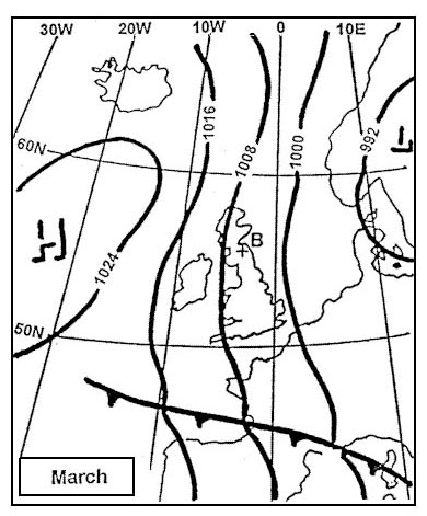
The modulation type of all ils transmitters is the good old amplitude modulation am the carrier oscillation in the localizer frequency range is 108 00 mhz to 111 975 mhz modulated with a 90hz and a 150hz tone signal .the ils works by sending 2 beams up from the landing runway one telling the pilots if they or high or low and the other telling them if they are left or right of the runway centreline the ils receiver on the aircraft measures the difference in depth of modulation ddpm between the signals for most ils’s the pilots should be lined up with the runway centreline and on a 3 degree glide path but on some ils’s like london city have a steeper approach of 5 5 degrees .this two modulated signals are produced from a horizontally polarized antenna complex beyond the far end of the approach runway they create an expanding field that is 21 2° wide about 1 500 feet 5 miles from the runway the field tapers to runway width near the landing threshold the left side of the approach area is filled with a vhf carrier wave modulated with a 90 hz signal the right side of the approach contains a 150 mhz modulated signal the aircraft’s vor receiver is tuned to the localizer vhf frequency that can be found on published approach plates and aeronautical charts the circuitry specific to standard vor reception is inactive while the receiver uses localizer circuitry and components common to both the signals received are passed through filters and rectified into dc to drive the course deviation indicator if the aircraft receives a 150 hz signal the cdi of the vor/ils display deflects to the left this indicates that the runway is to the left the pilot must correct course with a turn to the left this centers course deviation indicator on the display and centers the aircraft with the centerline of the runway if the 90 hz signal is received by the vor receiver the cdi deflects to the right the pilot must turn toward the right to center the cdi and the aircraft with the runway center line annex1 .like the localizer the glideslope transmits two signals one modulated at 90 hz and the other modulated at 150 hz the aircraft’s glideslope receiver deciphers the signals similar to the method of the localizer receiver it drives a vertical course deviation indicator known as the glideslope indicator the glideslope indicator operates identically to the localizer cdi only 90° to it the vor/ils localizer cdi and the glideslope are displayed together on whichever kind of instrumentation is in the aircraft annex2 exemple 327 Amplitude modulation.Amplitude modulation.

One of the possible disturbances of the ils signal is 'scalloping' which ?

Question 187-12 : Scalloping causes rapid indicator changes from side to side of the intended approach path which cannot be followed by the aircraft scalloping are minor changes or bends which can be followed by the aircraft scalloping are rapid changes or bends which can be followed by the aircraft scalloping are major changes or bends in the approach path which cannot be followed by the aircraft
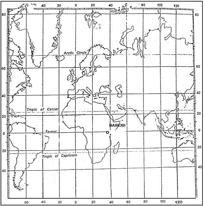
Scalloping is a type of error in radio signal transmission which causes oscillatory propagation distortion due to presence of ground and/or atmospheric conditions it results in rapid fluctuations of the needles on the cdi/hsi which are impossible to follow exemple 331 Scalloping causes rapid indicator changes from side to side of the intended approach path which cannot be followed by the aircraft.Scalloping causes rapid indicator changes from side to side of the intended approach path which cannot be followed by the aircraft.

What is the reason that dme utilises pulse pairs instead of single pulses ?

Question 187-13 : To distinguish dme transmissions from transmissions of other radar systems utilising single pulses to increase the number of aircraft that can simultaneously use the dme station to determine the dme range to be able to use a separate interrogation and reply frequency and thus to increase the number of dme stations that can transmit in the same part of the dme frequency band to increase the accuracy and reliability of the range measurement
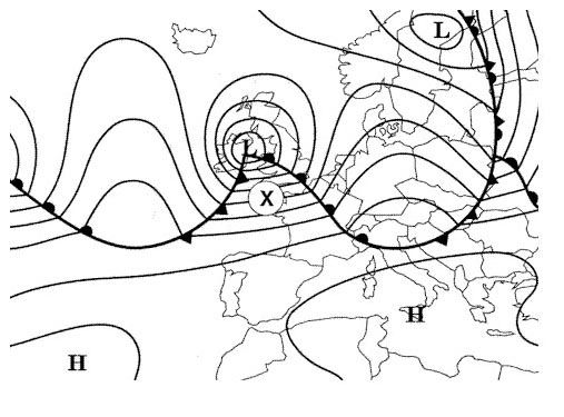
Dme uses the uhf frequency band between 962 1213 mhz the aircraft dme equipment radiated coded pulse pairs which is then received at the ground station triggering the transponder to send a suitably formatted reply adjusted by +/ 63 mhz after a delay of 50 microseconds for each of the interrogation channels two reply frequencies are allocated one is 63 mhz higher than the transmission and the other 63 mhz lower the reason for using pulse pairs is to ensure the receivers do no accept random single pulses or other transmissions that are not addressed for this type of communication each pulse pair is spaced at 12 microseconds x channels or 36 microseconds y channels and the space of each pair of pulse pairs is different between each group and is randomly unique to each transmission exemple 335 To distinguish dme transmissions from transmissions of other (radar) systems utilising single pulses.To distinguish dme transmissions from transmissions of other (radar) systems utilising single pulses.

If two dme ranges are plotted on the chart and used to fix the aircraft ?

Question 187-14 : Two circular position lines intersecting at two points the distance from each transmitter being the slant range two circular position lines intersecting at two points the distance from each transmitter being the plan range two straight lines intersecting at one point the distance from each transmitter being the slant range two straight lines intersecting at one point the distance from each transmitter being the plan range
Refer to figure .the dme displays distance information from a fix this distance being the slant range between the transmitter and the aircraft the position of the aircraft may be anywhere on a circle with the dme in the centre with a radius that is the range from the dme two overlapping circles will intersect at two points exemple 339 Two circular position lines intersecting at two points, the distance from each transmitter being the slant range.Two circular position lines intersecting at two points, the distance from each transmitter being the slant range.

Which option correctly identifies the approach aid s listed below to which the ?

Question 187-15 : Only 4 3 and 4 1 and 3 only 1
Locators operate on a frequency between 190 and 1750khz mf localiser operates on a frequency between 108 10 and 111 96 mhz vhf marker beacons operate on a frequency of 75 mhz vhf glide path operates between the frequencies 328 6 and 335 4 mhz uhf exemple 343 Only 4.Only 4.

What radio navigation aid would be associated with the transmission frequency ?

Question 187-16 : Ils localiser vor station vdf mls
108 mhz and 112 mhz frequency band is shared between ils and vor frequencies .from 112 mhz to 117 975 mhz the band belongs to vor alone and spacing is reduced to 50 khz thus 108 2 mhz and 113 35 mhz would be vor frequencies and 108 1 mhz would not .within the vor ils shared frequency range the allocated frequencies are as follows .vor = even 100 khz numerals.108 00 108 05 108 20 108 25 to 111 80 111 85.ils = odd 100 khz numerals.108 10 108 15 108 30 108 35 to 111 90 111 95 so 110 35 is between them exemple 347 Ils localiserIls localiser

To enter a holding pattern based on a vor/dme fix which entry sectors are ?

Question 187-17 : 1 and 3 1 and 2 1 2 and 3 2 and 3
Refer to figure .icao doc 8168.1 4 7 dme arc entry.dme arc entry at the fix the aircraft shall enter the holding pattern in accordance with either the sector 1 or sector 3 entry procedure ..sector 1 procedure => parallel entry .sector 2 procedure => offset entry .sector 3 procedure => direct entry exemple 351 1 and 3.1 and 3.

On an ils approach when flying overhead the outer marker the colour of the ?

Question 187-18 : Blue green amber white
The outer marker middle marker and inner marker all emit an amplitude modulated horizontally polarised signal the beacons operate at a 75 mhz carrier frequency outer marker om to provide height distance and equipment function checks for aircraft on final approach aural identification a 400 hz low pitch tone keyed in a form of 2 dashes per second visual representation lights bluemiddle marker mm indicated the imminence of transition to visual guidance often defines the decision point aural identification a 1300 hz medium pitch tone keyed in a form of alternating dots and dashes with 3 dashes per second visual representation lights amberinner marker im indicates the imminence of arrival above the threshold aural identification a 3000 hz tone keyed continuous dots at a rate of 6 dots per second visual representation lights white exemple 355 Blue.Blue.

Mls installations notified for operation unless otherwise stated provide ?

Question 187-19 : ±40° about the nominal course line out to a range of 20 nm ±20° about the nominal course line out to a range of 20 nm ±20° about the nominal course line out to a range of 10 nm ±40° about the nominal course line out to a range of 30 nm
Refer to figure . the icao annex 10 declares a requirement for a minimum coverage area within which the mls must provide full serviceability for the approach a wide area is allocated for mls precision navigation that is a circular arc with a 20 nm radius from the threshold with ± 40º from the transmitter in each direction of the runway centreline exemple 359 ±40° about the nominal course line out to a range of 20 nm.±40° about the nominal course line out to a range of 20 nm.

There are two ndbs one 20 nm inland and the other 50 nm inland from the coast ?

Question 187-20 : Greater from the beacon that is 50 nm inland greater from the beacon that is 20 nm inland the same from both beacons when the aircraft is on a relative bearing of 180° and 360° the same from both beacons when the aircraft is on a relative bearing of 090° and 270°
Refer to figure .ndbs send out low or medium frequency radio waves they actually generate two waves a ground wave that follows the earth and a sky wave that bounces off of the ionosphere in this case were only talking about the ground wave .when the ground wave crosses a shoreline and moves out to sea it bends towards the coast .coastal refraction changes in conductivity from land to sea.electrical differences between land and sea affect radio waves .as low frequency waves cross the shoreline they move abruptly from an area of low conductivity land to an area of high conductivity water .that rapid change in conductivity changes the radio wave's 'phase velocity '.what's that imagine the crest of a wave moving across the ocean the speed that the crest moves is the wave's phase velocity .radio waves are no different .as the phase velocity changes the wave's frequency what you dialed into the radio receiver stays the same .to decrease this error pilot must use .. . stations closer to the coast . . . stations that produce signal crossing the cost line as close to 90° as possible. . . use higher cruising altitude as the refraction error decreases with altitude. ..note the laws of conservation of energy and momentum come into play and the wave bends this is called refraction for a more in depth look at the physics check out snell's law exemple 363 Greater from the beacon that is 50 nm inlandGreater from the beacon that is 50 nm inland

When an ndb fails which kind of warning is visible in the cockpit ?

Question 187-21 : No warning on a moving card adf a red button on a radio magnetic indicator a flag alarm on a digital navigation display the acronym ‘ndb’ in red
Ndb failure warning.unline vor or ils systems that have failure warning indications the ndb does not warn the pilot in the case of a failure the ndb is a simple transmitter the adf receives the signal and displays the direction of the radio source since adf receivers do not have a 'flag' to warn the pilot when erroneous bearing information is being displayed the pilot should continuously monitor the ndb's identification when the ndb itself fails the pilot might notice a searching needle on their display much line when it is out of range of the receiver exemple 367 No warning.No warning.

The dme line of position is a circle with radius ?

Question 187-22 : A the ground distance and centre the dme station the slant range and centre the dme station the ground distance and centre the aircraft the slant range and centre the aircraft
A dme is used for determining the distance from a ground dme transmitter compared to other vhf/uhf navaids a dme is very accurate the distance information can be used to determine the aircraft position or flying a track that is a constant distance from the station this is referred to as a dme arc .there are several way to plot a route on a chart .. . straight route plotted between radio beacons. . . direct route plotted without reference to any paricular radio beacons and fixes are calculated along the track based on position lines plotted from radio beacons. ..in general a position line is a circle with radius the ground distance between the point and the ground station and centre at the ground station .pay attention there are some quite similar questions regarding dme poistion lines with very different answer the main problem is about the dme distance should a pilot consider dme distace plotted on a chart like a slant or a ground range distance .in general we can affirm that there is a difference between ground range and slant range but that difference is negligible and not worth considering until you are very close to the beacon at which point plotting becomes quite immaterial and difficult owing to the relatively rapid changes in distance i e 3 nm change in range is not significant when 150 nm from the beacon but it is significant when you are only 5 nm from the beacon .as a rule of thumb discrepancies only start to appear within 1 nm per 1 000' of height e g when flying at 10 000' the discrepancies only start to appear within 10 nm at 20 000 within 20 nm etc even then they are very small and hardly worth worrying about e g at 35 000' 35 nm ground distance = 35 6 nm dme distance and 10 nm gnd dist = 12 nm dme dist exemple 371 A the ground distance and centre the dme-station.A the ground distance and centre the dme-station.

An aircraft has a magnetic heading of 290°and is on vor radial 280° which ?

Question 187-23 : 100° 290° 280° 110°

Refer to figure .to start with the heading is given in the question as a 'red herring' it is not a useful piece of information the cdi does not have a heading input so is not affected by any heading changes .after discounting the heading we can now draw out the scenario that we are in our aircraft is on radial 280 from the vor and the question asks us what we need to set the obs omni bearing selector to in order to get a centred indication and a 'to' indicator that means that we want to know what track to fly to go directly towards the beacon in this case being on radial 280 means that we are 280º from the vor so we would have to fly a track of 100º to the vor exemple 375 100°100°

The bfo selector switch on the adf control panel must be in the 'on' position ?

Question 187-24 : Hear the ident of ndbs using n0n a1a transmissions adjust the loop to the aural null position stop the loop rotation hear the ident of ndbs using n0n a2a transmissions
Navigational ndbs have an unmodulated carrier wave icao classification n0n .station identification is transmitted at roughly ten second intervals .older systems interrupt the carrier wave keying to send an unmodulated but also inaudible morse code ident classified as a1a .user will have also erratic indications while the signal is interrupted in this type of beacon .to make the unmodulated parts of the a1a signal audible adf equipment incorporates a beat frequency oscillator bf0 that produces a signal slightly removed from the received frequency that is then mixed with it .the mixing of the two frequencies produces an audible beat frequency tahat is the difference of the two .summary selecting the bfo on makes the n0n carrier wave audible and allows the a1a type of ident to be heard .note bfo is not needed for an a2a signal which is already modulated to an audible frequency exemple 379 Hear the ident of ndbs using n0n a1a transmissions.Hear the ident of ndbs using n0n a1a transmissions.

An ndb is on a relative bearing of 316° from an aircraft given ?

Question 187-25 : 254° 074° 252° 072°
Initially we can use the compass heading and relative bearing to calculate the compass bearing to the ndb .to do this we just add the two numbers together .270º + 316º = 586º too large so take 360º away = 226º compass bearing.then to use cdmvt to calculate the true bearing to the ndb off this remember to use the variation at the aircraft as that is where the direction is measured for ndb/adf operations .. . . compass. deviation. magnetic. variation. true. . . 226º. 2ºw . 224º. 30ºe + . 254º. . ......so the true bearing from the aircraft to the ndb is 254º exemple 383 254°254°

Given the following information what relative bearing will be shown on the rbi ?

Question 187-26 : 188° 352° 008° 172°
Refer to figure the aircraft needs to maintain a magnetic course of 257º away from the station a left wind 230ºt/20 kt is being experienced therefore a wind correction angle must be applied to the left in order to maintain the desired track .to calculate the wca we must either convert the magnetic track into true or the wind into magnetic the question gives a magnetic variation of 6ºe => variation east magnetic least the wind direction is therefore 230º 6º = 224º calculate the wind correction angle using the flight computer set wind direction under 'true index' 224º set the centre point over tas 80 kt and mark wind velocity up from centre point over 100 kt set the course under 'true index' 257º wind correction angle reads between centre line and wind velocity mark => wca of approx 8ºwe can now calculate the magnetic heading = 257º 8º = 249ºmagnetic bearing = relative bearing + magnetic headingthe magnetic bearing to the station is the reciprocal of the magnetic bearing from the station 257º 180º = 077ºmagnetic bearing = relative bearing + magnetic heading .077º = rb + 249º .rb = 077º 249º .rb = 172º + 360º = 188º exemple 387 188°188°

On the qdr of 075° in the vicinity of the station with a magnetic heading of ?

Question 187-27 : 320° 040° 140° 220°
Refer to figure . qdm = magnetic bearing from the aircraft to the station . qdr = magnetic bearing from the station to the aircraft radial if our qdr radial is 075º then our qdm is the reciprocal of that which is 255º then you can think of it one of two ways our qdm of 255º is 40º to the left of our current heading 295º and the relative bearing that is 40º left of our nose is 320º . . you could also use the formula . mh + rb = qdm mh = magnetic heading rb = relative bearing qdm as described above rearranged to make . rb = qdm mh = 255º 295º = 40º which is too low so add 360º = 320º relative bearing exemple 391 320°320°

During day time the range of an ndb depends on ?

Question 187-28 : The power output and the nature of the earth’s surface over which the ground wave travels the power output the altitude of the aircraft and the elevation of the ndb the ionospheric refraction index the altitude of the pertaining ionospheric layer the wave length and the power output the atmospheric refraction index the wave length the elevation of the ndb and the power output
Several factors affect the range of an ndb transmission the most significant effect is the transmission power output depending on the desired range of operation different types of ndbs have different transmission powers the range obtained is proportional to the square of the power transmitted as a result a range twice as far requires four times the power the ndb range is also limited by frequency lower frequencies result in longer ground waves . the earth’s surface over which the ground wave travels also has an impact on the range of an ndb multipath propagation phenomenon results in radio signals reaching the receiving antenna by two or more paths this can result in a false indication of the adf needle that points to the source of the reflection and not the ndb in use the altitude at which the aircraft travels can also have an effect on the ndb range for instance in mountainous terrain an ndb may not be received at low level but could be received higher up exemple 395 The power output and the nature of the earth’s surface over which the ground wave travels.The power output and the nature of the earth’s surface over which the ground wave travels.

Which statement is true about the use of the doppler effect in a doppler vor ?

Question 187-29 : The doppler effect is used to create a signal which is received by the aircraft’s vor receiver as a frequency modulated signal by using the doppler effect it is possible to determine the range of the aircraft from the vor station more accurately the doppler effect is used to create a signal which is received by the aircraft’s vor receiver as an amplitude modulated signal by using the doppler effect it is also possible to determine the aircraft’s approach speed to the vor
Doppler vor is an evolution of cvor and provides improved signal quality and accuracy by reducing scalloping errors the reference signal of dvor is amplitude modulated and the variable signal is frequency modulated exactly the opposite of cvor the frequency modulated signal is less prone to interference when compared to the amplitude modulated signal which makes the rotating variable signal fm make direction determination more accurate .the doppler effect is generated by electronically rotating the variable signal via this set of circular elements the variable signal is emitted in a rotating sequence at 30 revolutions per second when the signal is heading towards a receiver a positive doppler shift is experienced and the received frequency is slightly higher when it is moving away it is slightly lower .doppler effect in a vor is not used to detect velocity the vor does not measure range exemple 399 The doppler effect is used to create a signal which is received by the aircraft’s vor-receiver as a frequency modulated signal.The doppler effect is used to create a signal which is received by the aircraft’s vor-receiver as a frequency modulated signal.

An aircraft is flying on a heading of 270° m the vor obs is also set to 270° ?

Question 187-30 : Nw se sw ne
Refer to figure .let's start by mentioning that the heading is not at all important or useful here it is included to confuse us as the cdi course deviation indicator does not have a heading input so it makes no difference .start by drawing the vor and the known radials from it in this case we can just draw the 270º radial line because the question says that we have 270º set on the obs omni bearing selector course and it is showing a 'from' indication this means that we are nearest to the 270º from not the 270º to course which is the 270 radial .this immediately means that we are to the west of the vor we must then interpret the cdi indication which thinks that we are wanting to fly along the 270 radial outbound from the vor if the cdi is giving us a fly left indication then we are to the right of this outbound course so we are north of it that means we are in the nw sector of the vor exemple 403 NwNw

An aircraft is flying a heading of 245° towards a vor at fl300 the hsi ?

Question 187-31 : The vor will be approached along radial 070 the aircraft will pass north of the vor the vor will be approached along radial 080 the aircraft will pass south of the vor
Refer to figure .selected course 255º to meaning that the aircraft is positioned on or close to the reciprocal of 255º over r075 .full deflection of a cdi equals 10º there are 2 dots on each side therefore each dot equals 5º .the cdi is on the left inner dot which means that the selected course is 5º left of the aircraft and consequently the aircraft is 5º to the right of the selected course .. the selected radial is 075º inbound since the aircraft is 5º to the right of it it is flying on radial 075 – 5 = r070 exemple 407 The vor will be approached along radial 070.The vor will be approached along radial 070.

Your aircraft is heading 075° m the obs is set to 025° the vor indications ?

Question 187-32 : 205° and 295° 295° and 025° 115° and 205° 025° and 115°
Refer to figure .we are going to recreate the image on the right of the above annex a 'plan view' of the situation first start by drawing the vor and known radials from it the easiest known radials are often the obs course and the reciprocal of that that is important as in this case the obs course is 025º but we have a 'to' indication showing when we set this so we are closer to the reciprocal course which is the 205º radial or the '025 to' course .as this is a quadrant question we would also recommend adding in the two other dividing lines as shown in the diagram radial 295 and 115 here to correctly define the quadrants .now we must work out what the cdi course deviation indicator thinks is happening it believes that we want to fly course 025º it knowns our radial is not on the '025' side of the vor so it gives us a 'to' indication instead of a 'from' indication now we can mark the southernmost and westernmost quadrants as 'to' quadrants and that is the area our aircraft could be in .this also means that the cdi thinks we want to fly the 025 to course towards the vor and the 'fly right' indication means we are left of track which means we are to the west of the desired track we are therefore in the quadrant between radials 205º and 295º from the vor .note radials are magnetic bearings from the station also called qdr and the heading is not at all important to this question as cdis have no heading input so therefore do not know it exemple 411 205° and 295°.205° and 295°.

The obs is set on 048° to appears in the window the needle is close to full ?

Question 187-33 : 238° 038° 058° 218°
Refer to figure .start by drawing the vor and the known radials from it in this case we can draw the obs course the 048º radial line also we must add the opposite radial to 048º which is 228º as the question also mentions that the cdi has the 'to' indication showing that means that the course of 228º is going to take us closer to the vor if we fly it .therefore we are closer to the 228º radial as we are only a few degrees deflection from this course .now the vor thinks that we want to fly that exact radial but inbound to the beacon we can therefore call it the '048º to' course so it is going to give us fly right/fly left indications from our current position remember it does not know our heading it assumes we are heading in the correct direction therefore a fly right indication means that we are to the left of that inbound track so we are south east of the '048º to' course which is the 228º radial .full scale deflection of a vor cdi course deviation indicator is 10º so we have close to 10º deviation therefore our radial is close to 228º + 10º = 238º exemple 415 238°238°

Given the following information where does the hsi course deviation bar appear ?

Question 187-34 : Behind the aeroplane symbol with the from flag showing ahead of the aeroplane symbol with the from flag showing behind the aeroplane symbol with the to flag showing ahead of the aeroplane symbol with the to flag showing
Refer to figure .the hsi gives a pictorial representation of the navigational position of the aircraft with reference to a selected course .in this case the selected course is 250º which equates to a 10º displacement from the current radial 240º .now if the aircraft was flying away from the station along radial 240º the cdi needle would be fully deflected to the right this would indicate that the selected radial was located to the right of the aircraft .however the aircraft is actually following a heading of 160º which means that the selected course is behind the aircraft therefore the cdi indicator should be displaced behind the aircraft symbol in the instrument exemple 419 Behind the aeroplane symbol with the from flag showing.Behind the aeroplane symbol with the from flag showing.

An aircraft is situated at 30°n 005°e with a magnetic variation of 10°w a ?

Question 187-35 : 287° 282° 293° 284°
Refer to figure .aircraft 5ºe is west of the vor station 13ºe => true bearing of the aircraft is 270º.radio signals are magnetic and travel along great circles . 1 convert true bearing into magnetic bearing .vor radial information is determined at the vor station therefore we use the magnetic variation at the vor .use the mnemonic variation west magnetic best variation east magnetic least .variation 15ºw.magnetic bearing = true bearing + variation.magnetic bearing = 270º + 15º w = 285º. 2 calculate and apply the conversion angle ca .ca is the angle between the great circle and rhumb line tracks .conversion angle ca = change of longitude x sin lat / 2.conversion angle ca = 8º x sin 30º / 2.conversion angle ca = 2º.. the gct > rlt thus we add the conversion angle 285º + 2º = 287º exemple 423 287°287°

The captain of an aircraft flying at fl100 wishes to obtain weather information ?

Question 187-36 : 125 nm 125 km 12 5 nm 1 250 km

Refer to figure .vors transmit their signals via vhf very high frequency radio transmissions these travel in straight lines and will not go through solid objects such as buildings mountains the ocean etc this question mentions gaining the aerodrome weather from the vor which is possible as many airfield vors have the atis readout on the vor audio frequency .we call these signals 'line of sight' as if the antennas can 'see' each other they can transmit between each other of course that depends on the power of the transmission as higher power transmitters allow for a greater range .with the earth being curved this does pose a problem for long range transmissions between aircraft and ground stations as the aircraft may not be within line of sight of the ground station the ways to fix this are to get closer or go higher .the higher the aircraft gets the further it can 'see' so that means it can communicate with radio stations further away .the formula for the expected range of a transmission earth curvature limited is .distance nm = 1 23 x sqrt height of transmitter ft + 1 23 x sqrt height of receiver ft .if either the transmitter or receiver is at sea level 0 ft then you can cut out one term from the equation making it .distance nm = 1 23 x sqrt height ft .in this case we are at fl 100 10 000 ft so our maximum range is .1 23 x sqrt 10 000 = 1 23 x 100 = 123 nm closest answer 125 nm exemple 427 125 nm125 nm

The effect of masking the dme antenna of the aircraft from the ground ?

Question 187-37 : The airborne installation switching to the memory mode for about 10 to 15 seconds the airborne equipment switching directly to the search mode the signal controlled search circuit scs blanking the dme display the ground installation not sending any pulse pairs
Important note the current correct option is technically wrong kindly consult icao annex 10 3 5 4 7 2 5 distance measuring equipment dme is a type of secondary radar system that provides slant range using the pulse technique the aircraft’s interrogator transmits a stream of psuedo random omni directional pulse pairs on the carrier frequency of the ground transponder the ground transponder then receives these waits 50 microseconds and repeats those pulse pairs outwards at a frequency 63 mhz above the interrogation frequency the airborne system identifies its own unique stream of pulse pairs and measures the time of arrival electronically between the start of the interrogation and the reception of the ground transponder's replies as there is only one interrogation frequency and one reply frequency for each dme ground station they can only service a certain number of pulses per second and it ends up meaning that the dme becomes saturated with around 100 aircraft using it and it will then prioritise the pulses with the strongest signal aircraft attempting to search for a dme emit 150 pulses per second but after 15000 pulses reduce that to 60 pulses per second and later on to 24 pulses per second when fully 'locked on' as the dme can only handle 2700 pulses per second reliably this ends up being approximately 100 aircraft some searching some locked on once locked on if the aircraft 'loses' the dme replies at any time then the equipment will go into memory mode which maintains the dme range changing at the same rate for up to 8 10 seconds before dropping out completely into search mode this is useful for when the ident sounds every 40 seconds as no pulses are sent during that time it is also useful for momentary interruptions such as this question exemple 431 The airborne installation switching to the memory mode for about 10 to 15 seconds.The airborne installation switching to the memory mode for about 10 to 15 seconds.

What approximate rate of descent is required in order to maintain a 3° glide ?

Question 187-38 : 600 ft/min 550 ft/min 950 ft/min 800 ft/min
Now all of this could be calculated from first principles going down into the trigonometry thankfully easa do not expect us to be able to do trigonometry on the approach so we have useful shortcuts and 'rules of thumb' to use .one such rule is that .rate of climb/descent ft/min = groundspeed nm x gradient % .this is an approximation but is actually very close so very useful for us in many questions .we can make this question even easier still as a 3º glide path is the most common for approaches .3º is equivalent to a gradient of 5% so the rod = 5 x groundspeed this is the same for every 3º glide path of course so very useful to remember .rod = 120 x 5 = 600 ft/min exemple 435 600 ft/min.600 ft/min.

What approximate rate of descent is required in order to maintain a 3° glide ?

Question 187-39 : 450 ft/min 650 ft/min 550 ft/min 400 ft/min
Now all of this could be calculated from first principles going down into the trigonometry thankfully easa do not expect us to be able to do trigonometry on the approach so we have useful shortcuts and 'rules of thumb' to use .one such rule is that .rate of climb/descent ft/min = groundspeed nm x gradient % .this is an approximation but is actually very close so very useful for us in many questions .we can make this question even easier still as a 3º glide path is the most common for approaches .3º is equivalent to a gradient of 5% so the rod = 5 x groundspeed this is the same for every 3º glide path of course so very useful to remember .rod = 90 x 5 = 450 ft/min exemple 439 450 ft/min.450 ft/min.

Assuming a five dot display on either side of the ils localiser cockpit display ?

Question 187-40 : 1° to the left 1° to the right 2° to the left 2° to the right
Refer to figure .vor and ils indications in the cockpit are very similar as they mostly use the same instruments the most basic instrument that can be used is the cdi course deviation indicator and more complex would be an rmi vor only and then a hsi horizontal situation indicator which actually contains a basic cdi in the centre the cdi indicates which direction the aircraft should fly to get on the desired track and the amount of deviation we call these 'fly left' and 'fly right' indications depending on which way the indicator goes you can have 2 dot displays where full deflection either direction is only 2 dots but more common on training aircraft is a 5 dot display so you can see the deflection more accurately on either display vors have a full scale deflection of 10° meaning that each dot on a 5 dot display is a 2° deviation ils localisers on the other hand are much more accurate with a full scale deflection of only 2 5° meaning that each dot on a 5 dot display is worth only 0 5° of deviation this is 4 x more accurate than vorsin this question the indicator is deflected 2 dots to the right we call this a 'fly right' indication and it means that our aircraft is 2 dots 2 x 0 5° = 1° left of the localiser course exemple 443 1° to the left.1° to the left.


~

Exclusive rights reserved. Reproduction prohibited under penalty of prosecution.

7439 Free Training Exam