According to icao which symbol indicates a tropical revolving storm . 301 ? [ MCQ aircraft ]
Question 154-1 : Symbol c symbol a symbol d symbol b
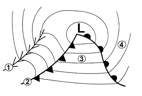 Symbol c)
 According to icao which symbol indicates widespread haze . 301 ?
Question 154-2 : Symbol b symbol c symbol a symbol d
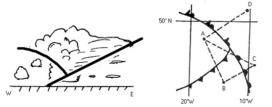 Symbol b)
 According to icao which symbol indicates a severe line squall . 301 ?
Question 154-3 : Symbol a symbol c symbol d symbol b
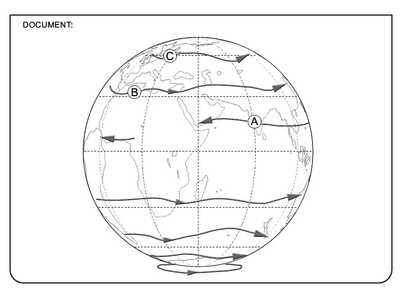 Symbol a)
 What does the term sigmet signify ?
Question 154-4 : A sigmet is a warning of dangerous meteorological conditions a sigmet is a flight forecast issued by the meteorological station several times daily a sigmet is a brief landing forecast added to the actual weather report a sigmet is an actual weather report at an aerodrome and is generally issued at half ho y intervals
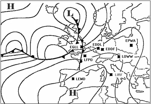 A sigmet is a warning of dangerous meteorological conditions.
 What does the term trend signify ?
Question 154-5 : It is a landing forecast added to the actual weather report it is the actual weather report at an aerodrome and is generally issued at half ho y intervals it is a warning of dangerous meteorological conditions it is a flight forecast issued by the meteorological station several times daily
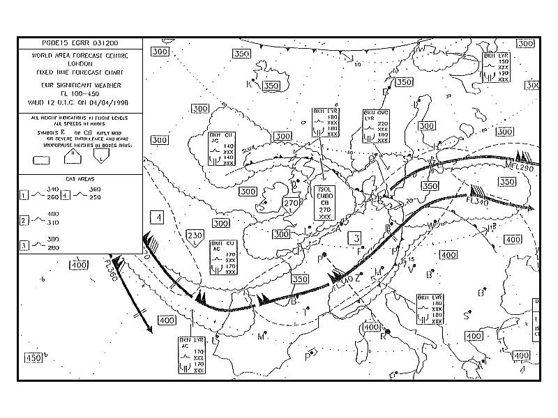 It is a landing forecast added to the actual weather report.
 Which of these statements best describes the weather most likely to be ?
Question 154-6 : Visibility 10 kilometres or more main cloudbase 3000 feet wind 250° temperature 18°c visibility 10 kilometres or more main cloudbase 1200 feet gusts up to 45 knots severe rainshowers meteorological visibility 4000 metres temperature 15°c gusts up to 35 knots visibility 4000 metres gusts up to 25 knots temperature 18°c
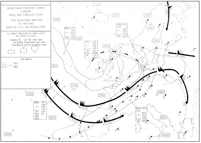 Visibility 10 kilometres or more, main cloudbase 3000 feet, wind 250°, temperature 18°c.
 Which of the following weather reports could be in accordance with the ?
Question 154-7 : 15003kt 9999 bkn100 17/11 q1024 nosig = 24009kt 6000 ra sct010 ovc030 12/11 q1007 tempo 4000 = 29010kt 9999 sct045tcu 16/12 q1015 reshra nosig = 04012g26kt 9999 bkn030 11/07 q1024 nosig =
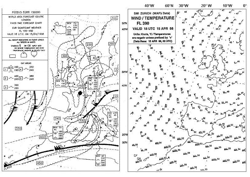 15003kt 9999 bkn100 17/11 q1024 nosig =
 Which of the following statements is an interpretation of the metar .25020g38kt ?
Question 154-8 : Gusts of 38 knots thunderstorm with heavy hail dew point 18°c mean wind speed 20 38 knots visibility 1200 metres temperature 23°c broken cloud base 600 feet and 1500 feet temperature 18°c wind 250° thunderstorm with moderate hail qnh 1016 hpa
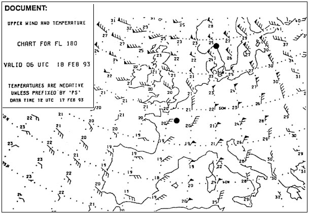 Gusts of 38 knots, thunderstorm with heavy hail, dew point 18°c.
 Which of the following statements is an interpretation of the sigmet .lsas ?
Question 154-9 : Moderate to severe clear air turbulence to be expected north of the alps intensity increasing danger zone between fl 260 and fl 380 zone of moderate to severe turbulence moving towards the area north of the alps intensity increasing pilots advised to cross this area above fl 260 severe turbulence observed below fl 260 north of the alps pilots advised to cross this area above fl 380 moderate to severe clear air turbulence of constant intensity to be expected north of the alps
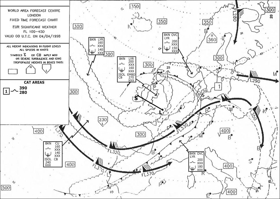 Moderate to severe clear air turbulence to be expected north of the alps. intensity increasing. danger zone between fl 260 and fl 380.
 Which of the following statements is an interpretation of the sigmet .lggg ?
Question 154-10 : Thunderstorms must be expected in the western part of the athens fir the thunderstorm zone is moving east intensity is constant thunderstorms have formed in the eastern part of the athens fir and are slowly moving west athens airport is closed due to thunderstorms the thunderstorm zone should be east of athens by 1820 utc the thunderstorms in the athens fir are increasing in intensity but are stationary above the western part of the athens fir
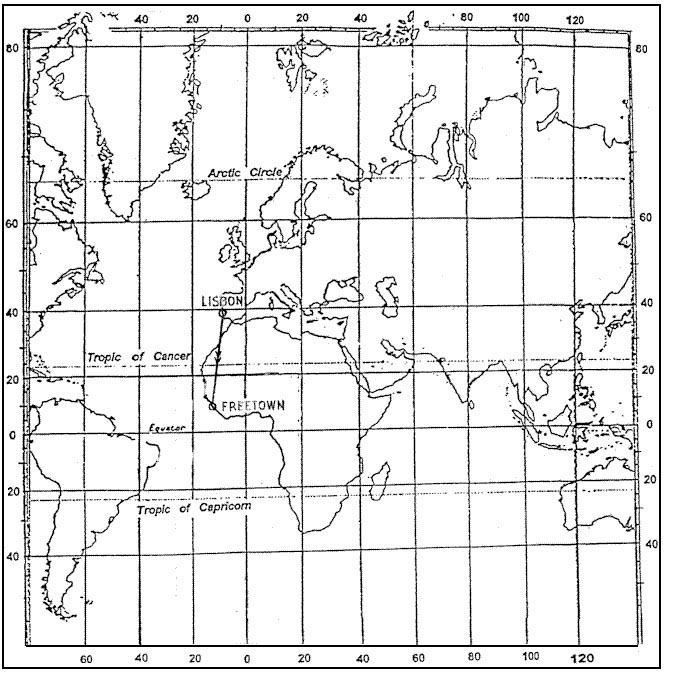 Thunderstorms must be expected in the western part of the athens fir. the thunderstorm zone is moving east. intensity is constant
 Compare the following taf and volmet reports for nice .taf 240600z 240716 ?
Question 154-11 : That the weather at nice is clearly more volatile than the taf could have predicted earlier in the morning that the weather conditions at 0920 were actually predicted in the taf that the weather in nice after 0920 is also likely to be as predicted in the taf that the volmet speaker has got his locations mixed up because there is no way the latest volmet report could be so different from the taf
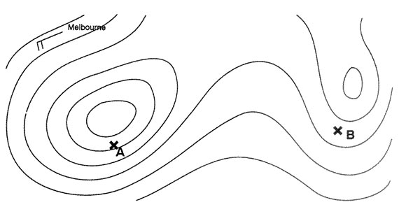 That the weather at nice is clearly more volatile than the taf could have predicted earlier in the morning.
 Runway visual range rvr is ?
Question 154-12 : Usually better than visibility reported when visibility is less than 2000 m reported in airmet and metar measured with ceilometers alongside the runway
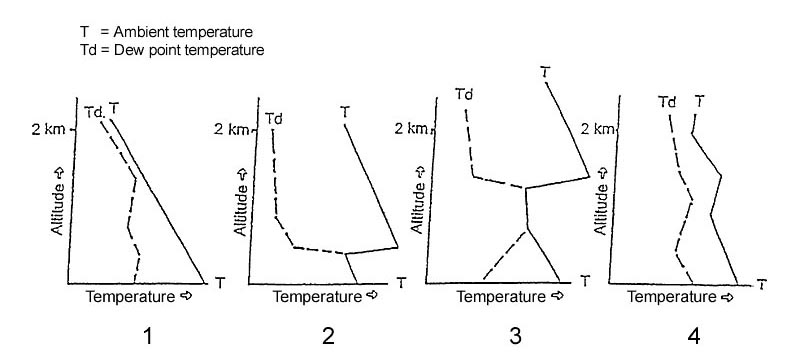 Usually better than visibility.
 What information is given on a significant weather chart ?
Question 154-13 : The significant weather forecast for the time given on the chart the significant weather that is observed at the time given on the chart the significant weather in a period 3 hours before and 3 hours after the time given on the chart the significant weather forecast for a period 6 hours after the time given on the chart
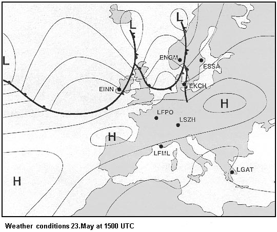 The significant weather forecast for the time given on the chart
 A pilot is warned of severe icing at certain flight levels by information ?
Question 154-14 : Swc and sigmet taf and metar metar and sigmet taf and sigmet
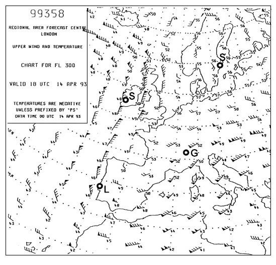 Swc and sigmet.
 An isohypse of the 500 hpa pressure surface is labelled with the number 552 ?
Question 154-15 : Topography is 552 decameters above msl pressure is 552 hpa topography is 552 meters above msl pressure altimeter will overread by 552 ft
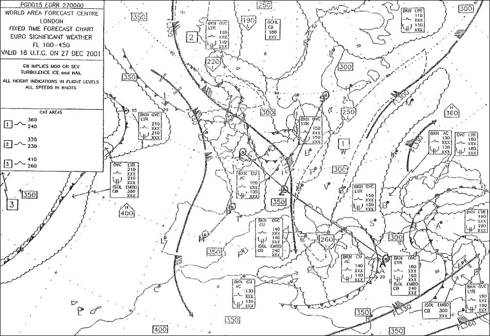 Topography is 552 decameters above msl.
 The validity of a taf is ?
Question 154-16 : Stated in the taf 2 hours between 6 and 9 hours 9 hours from the time of issue
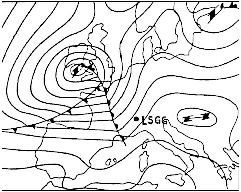 Stated in the taf.
 Atis information contains ?
Question 154-17 : Meteorological and operational information only meteorological information operational information and if necessary meteorological information only operational information
 Meteorological and operational information
 If cavok is reported then ?
Question 154-18 : No low drifting snow is present no clouds are present low level wind shear has not been reported any cb's have a base above 5000 ft
 No low drifting snow is present.
 Runway visual range can be reported in ?
Question 154-19 : A metar a taf a sigmet both a taf and a metar
 A metar.
 Sigmet information is issued as a warning for significant weather to ?
Question 154-20 : All aircraft light aircraft only vfr operations only heavy aircraft only
 All aircraft
 The wind direction in a metar is measured relative to ?
Question 154-21 : True north magnetic north grid north the 0 meridian
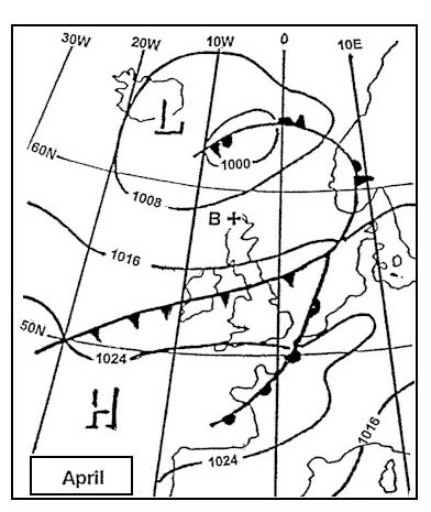 True north.
 A speci is ?
Question 154-22 : An aviation special weather report an aviation routine weather report a warning for special weather phenomena a forecast for special weather phenomena
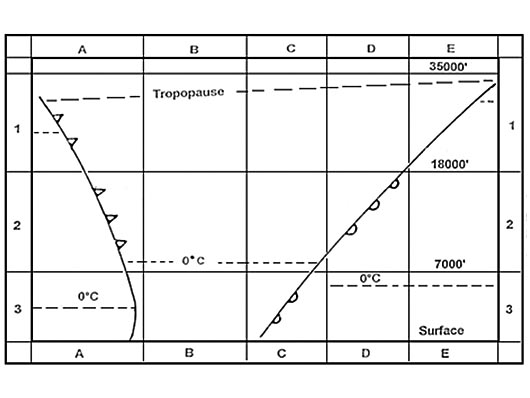 An aviation special weather report
 On the european continent metars of main airports are compiled and distributed ?
Question 154-23 : 0 5 hour 1 hour 2 hours 3 hours
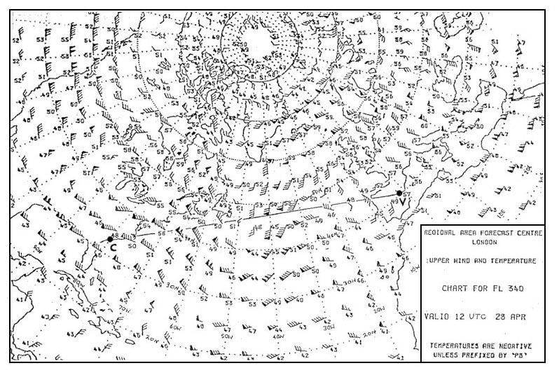 0.5 hour.
 The rvr as reported in a metar is always the ?
Question 154-24 : Value representative of the touchdown zone average value of the a b and c positions highest value of the a b and c positions lowest value of the a b and c positions
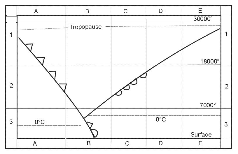 Value representative of the touchdown zone.
 The cloud base reported in the metar is the height above ?
Question 154-25 : Airfield level mean sea level the pressure altitude of the observation station at the time of observation the highest terrain within a radius of 8 km from the observation station
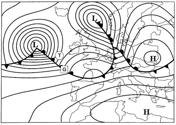 Airfield level.
 What values are used for the forecasted wind at higher levels ?
Question 154-26 : Direction relative to true north and speed in knots direction relative to magnetic north and speed in knots direction relative to magnetic north and speed in km/h direction relative to grid north and speed in km/h
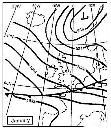 Direction relative to true north and speed in knots.
 In what hpa range is an upper weather chart for fl 340 situated ?
Question 154-27 : 300 200 hpa 400 300 hpa 500 400 hpa 600 500 hpa
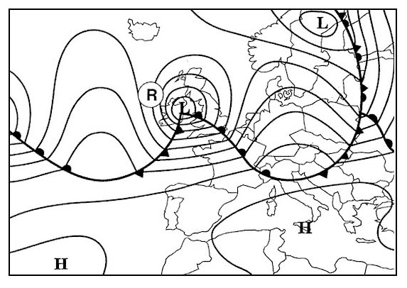 300 - 200 hpa.
 Isobars on a surface chart are lines of equal ?
Question 154-28 : Qff qfe qne qnh
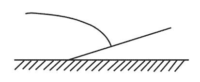 Qff
Qff A metar message is valid ?
Question 154-29 : At the time of observation for 2 hours for 9 hours for the hour following the observation
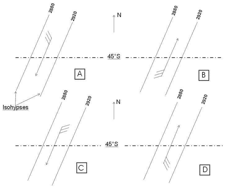 At the time of observation.
 In a metar message br and hz mean respectively ?
Question 154-30 : Br = mist hz = haze br = fog hz = haze br = mist hz = smoke br = mist hz = widespread dust
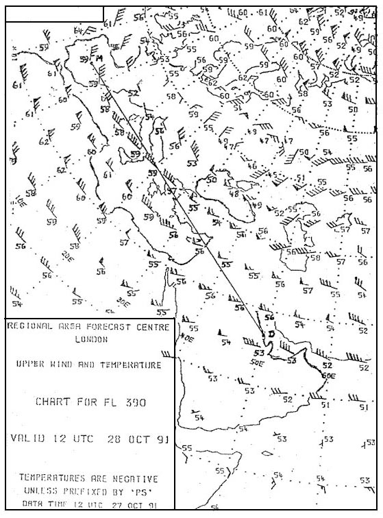 Br = mist hz = haze.
 In a metar message the wind group is 23010mps this means ?
Question 154-31 : Wind from 230° true at 20 knots wind from 230° true at 10 miles per hour wind from 230° magnetic at 20 knots wind from 230° magnetic at 10 miles per hour
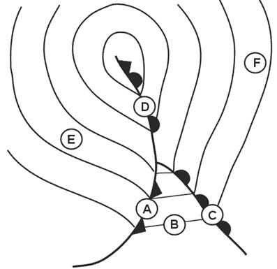 Wind from 230° true at 20 knots
 On a significant weather chart we see the following for the area where a vfr ?
Question 154-32 : We will be in solid clouds and consequently a vfr flight is not possible we will probably have to divert around some cumulus tops we will fly just below the cloud base where the cloud cover is between 5 and 7 oktas we will fly above a solid cloud cover
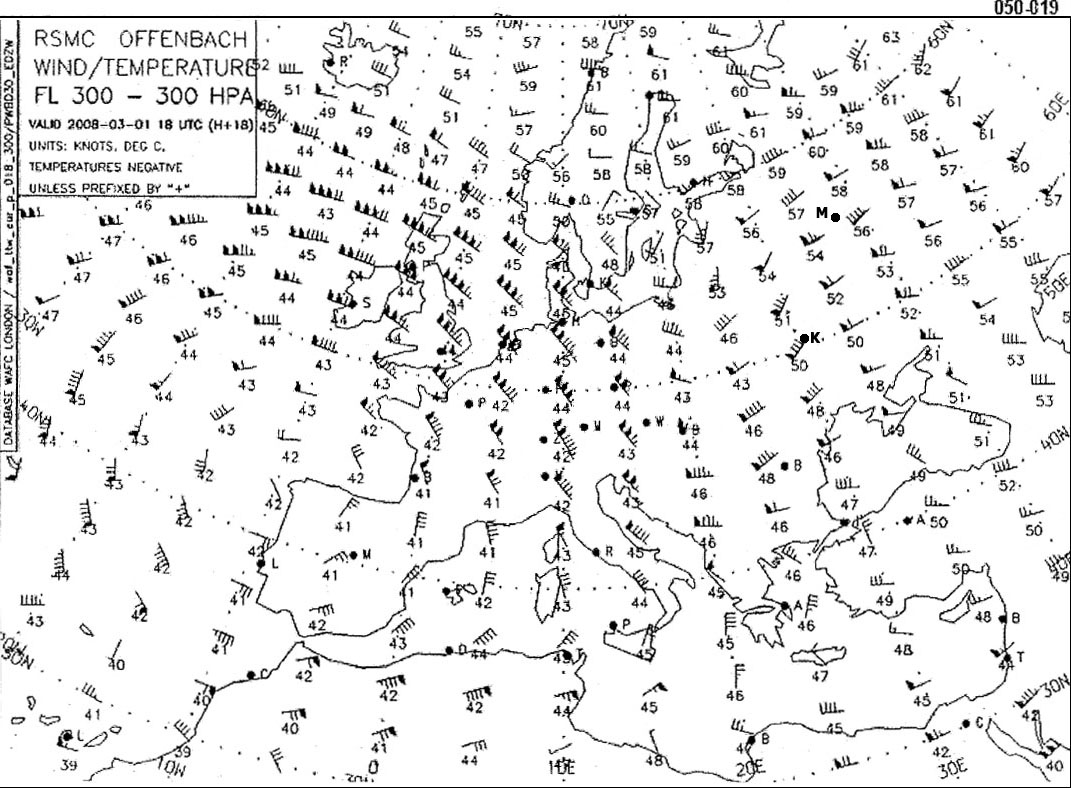 We will be in solid clouds and consequently a vfr flight is not possible.
 On the significant weather chart we see the following indications .sct ?
Question 154-33 : The instability of the air mass between the surface and the top of cumulus clouds system waves a wind shear the surface radiation
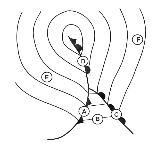 The instability of the air mass between the surface and the top of cumulus clouds.
 Refer to the following taf message .lfxx 180800z 1809/1818 22020kt 6000 sct015 ?
Question 154-34 : At 900 feet agl between 900 and 1500 feet amsl between 900 and 1500 feet agl at 1500 feet agl
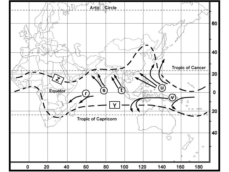 At 900 feet agl.
 The taf weather messages are ?
Question 154-35 : Airport forecasts ho y or semi ho y weather observations special weather observations landing forecasts of the 'trend' type
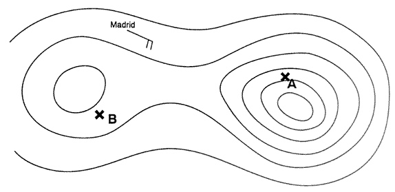 Airport forecasts.
 The term prob as used in a taf message indicates the probability in percentage ?
Question 154-36 : 30 or 40 20 or 30 25 or 35 35 or 50
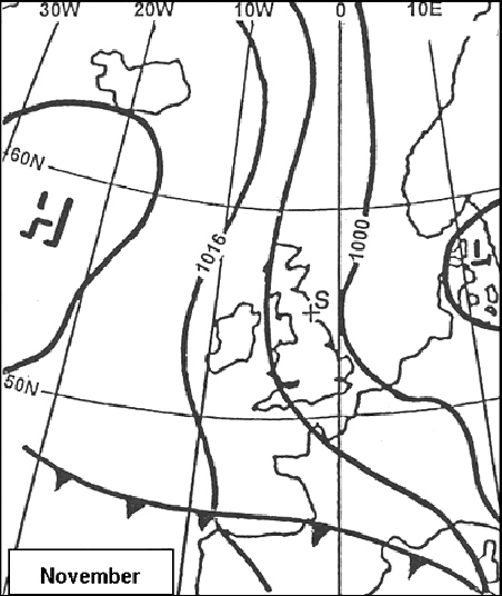 30 or 40.
 What type of precipitation might occur at 1700 utc .mkjp 160430z 160606 36010kt ?
Question 154-37 : Heavy rain showers light drizzle continuous moderate rain intermittent light rain
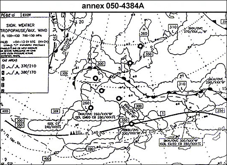 Heavy rain showers
 What is the lowest possible cloudbase forecast for 2300 utc .eddf 272200z ?
Question 154-38 : 5000 feet 3000 feet 500 feet 1500 feet
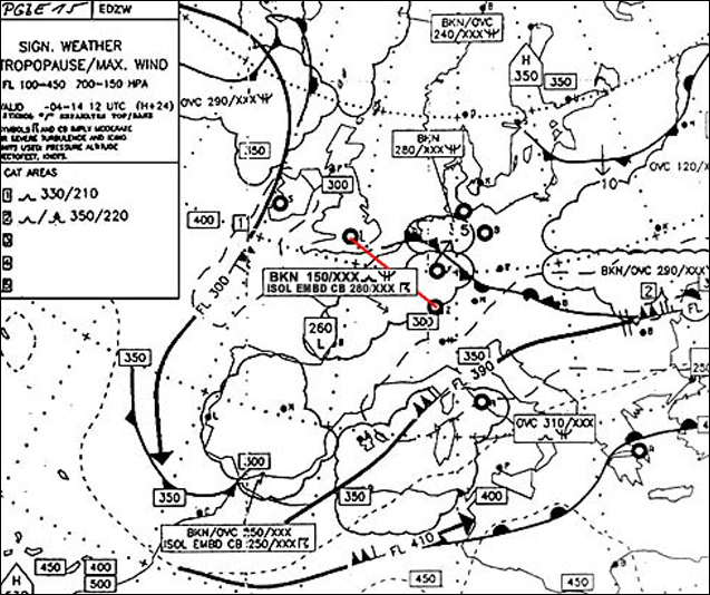 5000 feet.
 What is the meaning of the expression 'few' ?
Question 154-39 : 1 2 oktas 3 4 oktas 5 7 oktas 8 oktas
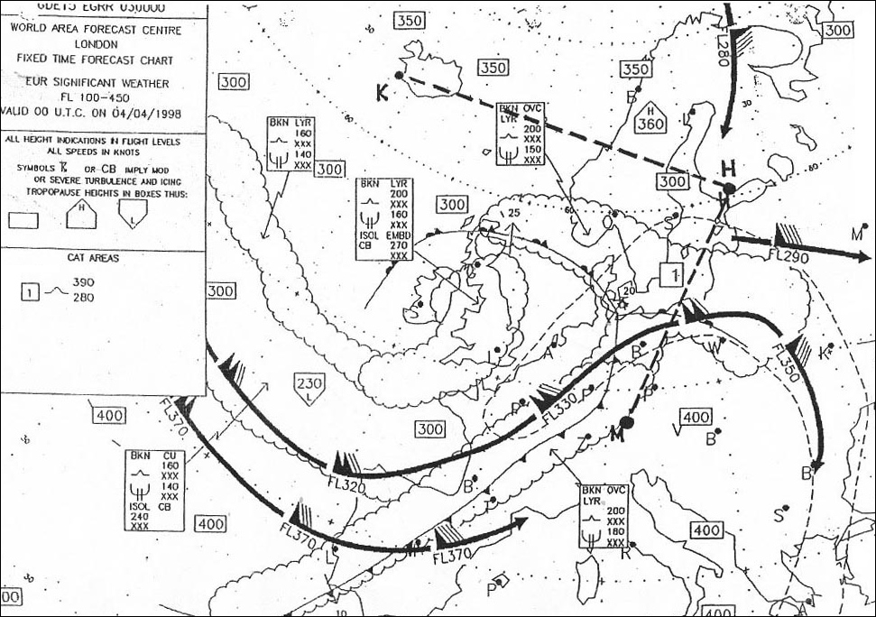 1 - 2 oktas.
 Which of the following layers of fog above land is coded as mifg ?
Question 154-40 : A layer of 5 feet deep a layer of 10 feet deep a layer of 15 feet deep a layer of 20 feet deep
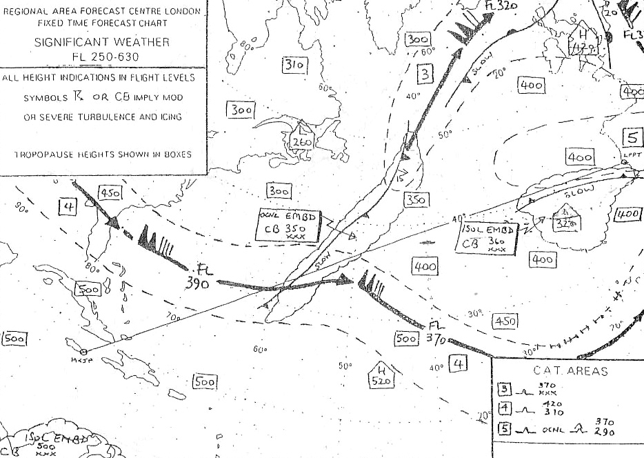 A layer of 5 feet deep.
 ~
Exclusive rights reserved. Reproduction prohibited under penalty of prosecution.
6119 Free Training Exam
