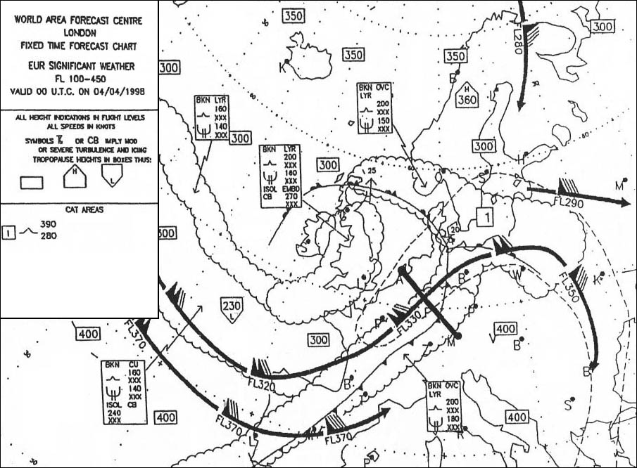
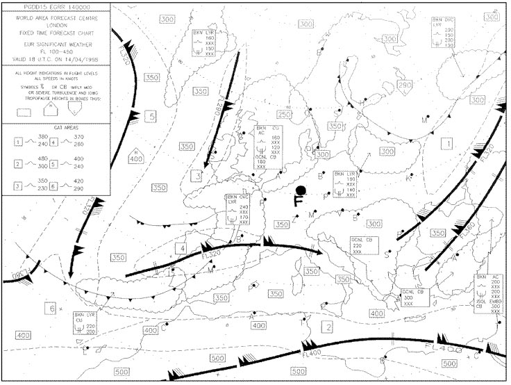
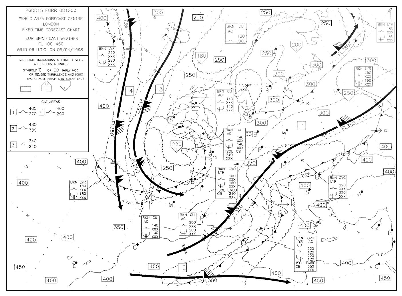
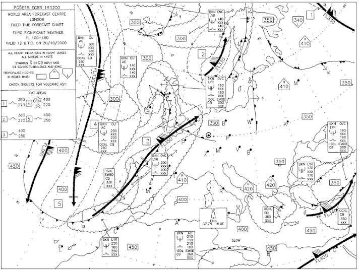
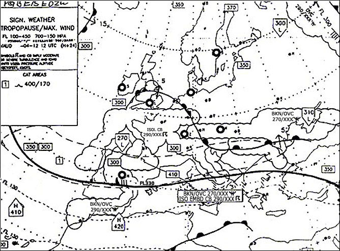
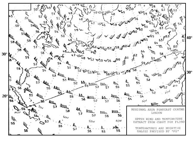
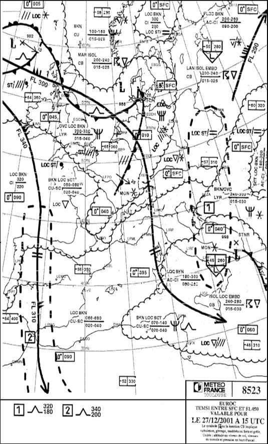
Which of these statements is true . 312 ? [ Certification weather ]
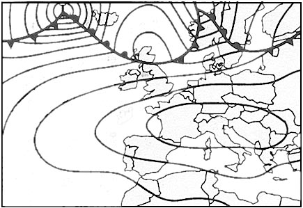
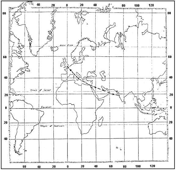
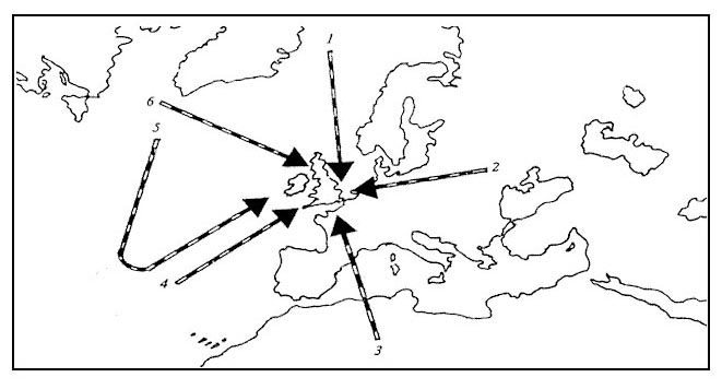
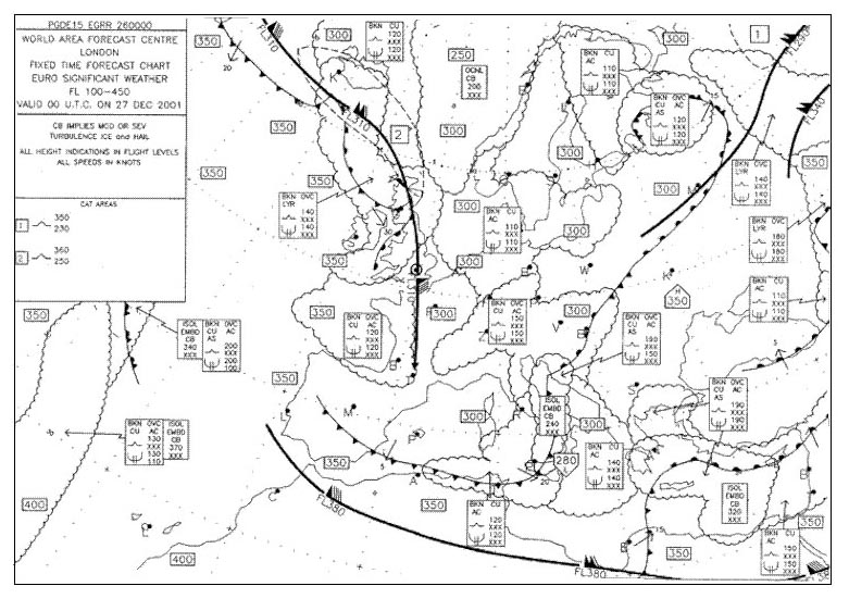
Question 148-1 : Scattered thunderstorms can be expected over france turbulence is likely to be encountered at fl 410 over madrid freezing level above madrid is higher than fl 120 the front to the north of london is moving south
 Scattered thunderstorms can be expected over france.
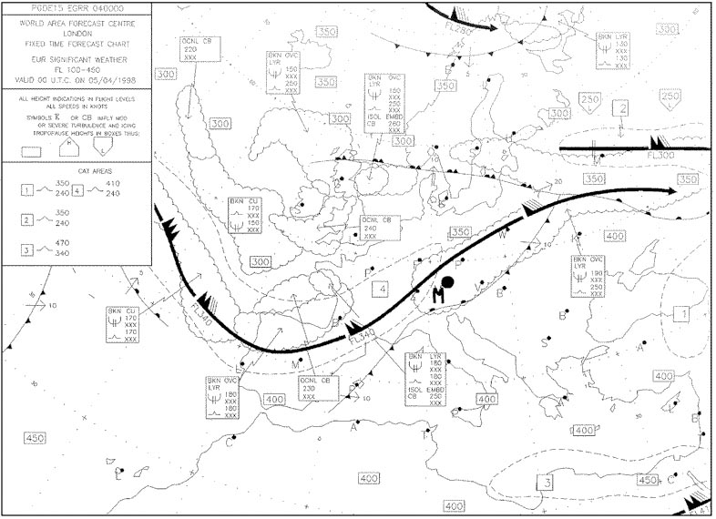
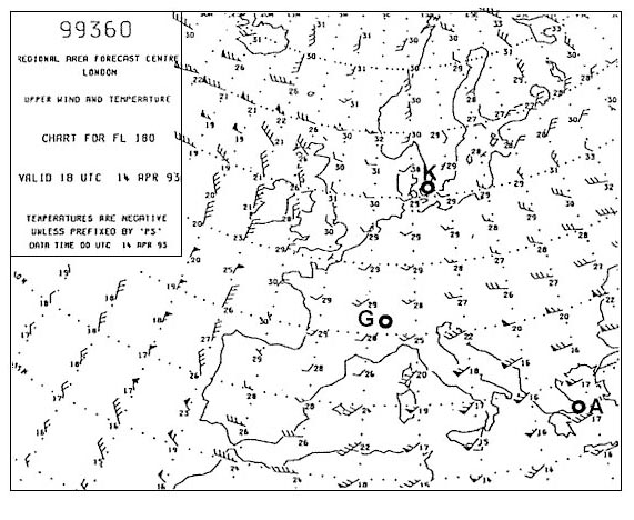
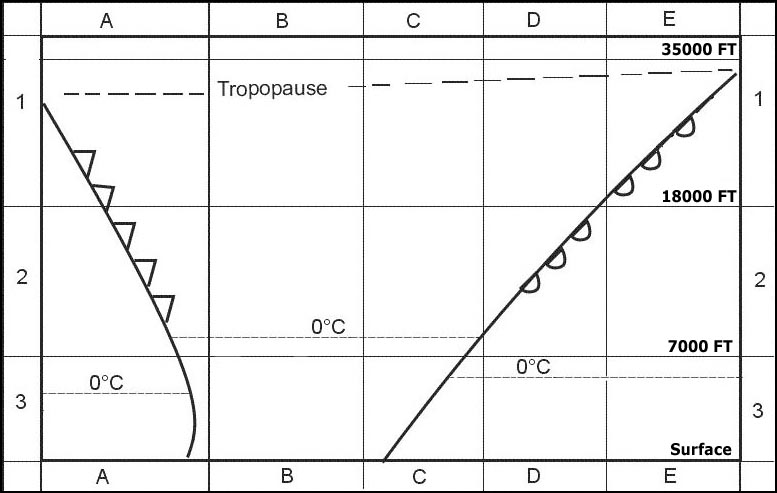
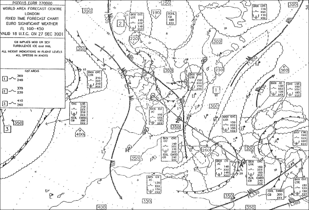
 On which of these routes would you not need to worry about icing at fl 170 . 313 ?
Question 148-2 : London stockholm madrid vienna paris lisbon zurich athens
 London - stockholm
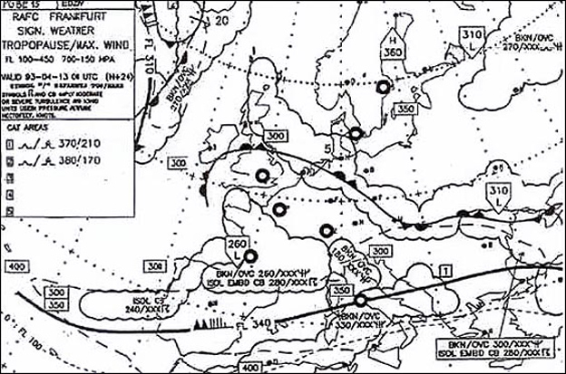
 You have been flying for some time in dense layered cloud the outside air ?
Question 148-3 : Severe airframe icing is unlikely under these conditions severe airframe icing is quite likely under these conditions if you do not have weather radar on board there is no need to worry as cb is unlikely to form in such cloud in a dense layered cloud icing is unlikely also at an outside air temperature of 5°c
 Severe airframe icing is unlikely under these conditions.
 Thunderstorms in exceptional circumstances can occur in a warm front if ?
Question 148-4 : The warm air is unstable the cold air is unstable the cold air is stable the warm air is stable
 The warm air is unstable.
 Low level wind shear is likely to be greatest ?
Question 148-5 : At the top of a marked surface based inversion at the condensation level when there is no night radiation at the condensation level when there is strong surface friction at the top of the friction layer
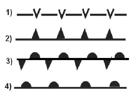 At the top of a marked surface-based inversion.
 In which of the following situations is an aircraft most susceptible to icing ?
Question 148-6 : Level flight below a rain producing cloud when oat is below zero degrees c flying in dense cirrus clouds level flight in snowfall below a nimbostratus layer flying in heavy drizzle
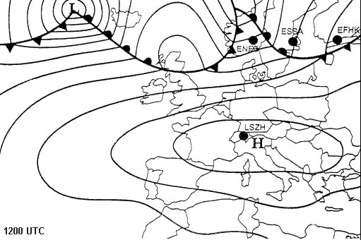 Level flight below a rain producing cloud when oat is below zero degrees c.
 A winter day in northern europe with a thick layer of stratocumulus clouds and ?
Question 148-7 : A high probability for icing in clouds severe icing may occur in the upper part due to accumulation of large droplets decreasing visibility due to snowfall below cloud base but only light icing in clouds reduced visibility and light icing in clouds turbulence due to a strong inversion but no icing because clouds consist of ice crystals
 A high probability for icing in clouds. severe icing may occur in the upper part due to accumulation of large droplets.
 Which one of the following statements concerning the formation of aircraft ?
Question 148-8 : A cloud consisting of both supercooled water droplets and ice crystals produces aircraft icing greatest risk of icing conditions is experienced in cirrus clouds risk for icing increases when cloud temperature decreases well below minus 12 degrees c probability of icing increases when dry snow starts to fall from a cloud
 A cloud consisting of both supercooled water droplets and ice crystals produces aircraft icing
 The presence of altocumulus lenticularis is an indication of the ?
Question 148-9 : Presence of mountain waves risk of orographic thunderstorms development of thermal lows presence of valley winds
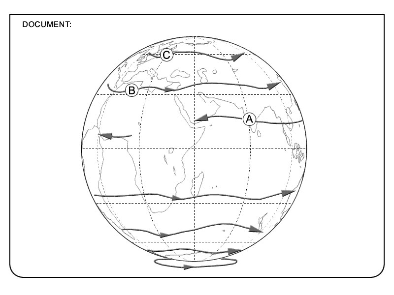 Presence of mountain waves
 Low level vertical wind shear can be expected during the night ?
Question 148-10 : In association with radiation inversions in unstable atmospheres and early morning only in winter and early morning only in summer
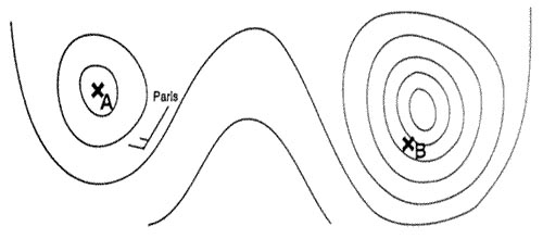
 In association with radiation inversions
 Fair weather cumulus often is an indication of ?
Question 148-11 : Turbulence at and below the cloud level poor visibility at surface smooth flying conditions below the cloud level a high risk of thunderstorms
 Turbulence at and below the cloud level.
 Visibility is reduced by haze when ?
Question 148-12 : Dust particles are trapped below an inversion a light drizzle falls a cold front just passed small water droplets are present
 Dust particles are trapped below an inversion
 The most dangerous low level wind shears are encountered ?
Question 148-13 : When strong ground inversions are present and near thunderstorms in areas with layered clouds and wind speeds higher than 35 kt during any period when wind speed is greater than 35 kt and near valleys near valleys and at the windward side of mountains
 When strong ground inversions are present and near thunderstorms
 Vertical wind shear is ?
Question 148-14 : A change of horizontal wind direction and/or speed with height a change of vertical wind speed with horizontal distance a change of horizontal wind direction and/or speed with horizontal distance a horizontal shear of vertical wind
 A change of horizontal wind direction and/or speed with height.
 The most hazardous type of cloud that may be encountered on a cross country ?
Question 148-15 : Cumulonimbus stratocumulus cumulus cirrus
 Cumulonimbus.
 During the life cycle of a thunderstorm which stage is characterized ?
Question 148-16 : Dissipating stage initial stage mature stage tornado stage
 Dissipating stage.
 What feature is normally associated with the initial stage of a thunderstorm ?
Question 148-17 : Continuous updraft roll cloud frequent lightning rain or hail at the surface
 Continuous updraft.
 Large hail stones ?
Question 148-18 : Are typically associated with severe thunderstorms only occur in thunderstorms of mid latitudes are entirely composed of clear ice only occur in frontal thunderstorms
 Are typically associated with severe thunderstorms
 Which of the statements is true concerning squall lines ?
Question 148-19 : For severe squall lines a sigmet is issued severe squall lines only occur in the tropics for severe squall lines a taf is issued severe squall lines always move from northwest to southeast
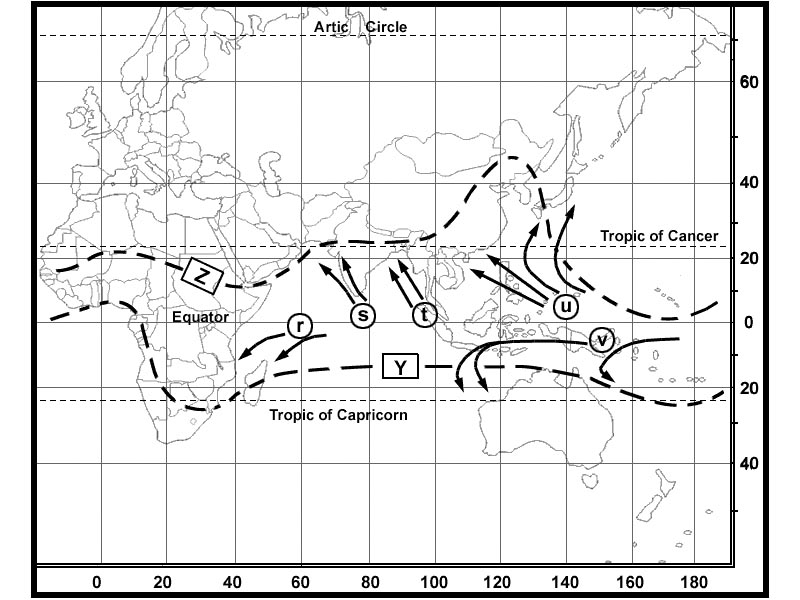 For severe squall lines a sigmet is issued
 A gust front is ?
Question 148-20 : Formed by the cold air outflow from a thunderstorm normally encountered directly below a thunderstorm characterized by heavy lightning another name for a cold front
 Formed by the cold air outflow from a thunderstorm
 What are the requirements for the formation of a thunderstorm ?
Question 148-21 : An adequate supply of moisture conditional instability and a lifting action a cumulus cloud with sufficient moisture associated with an inversion water vapour and high pressure a stratocumulus cloud with sufficient moisture
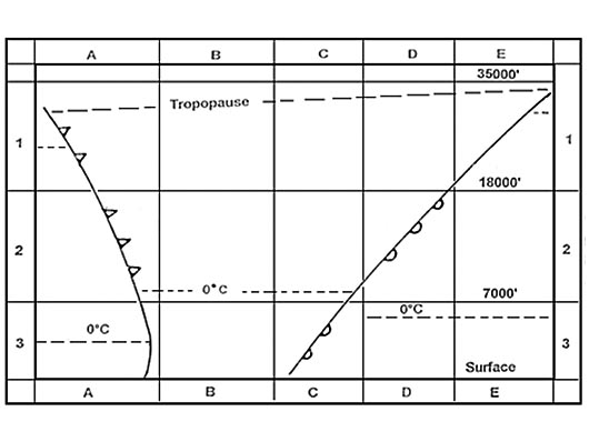 An adequate supply of moisture, conditional instability and a lifting action
 In which of the following areas is the highest frequency of thunderstorms ?
Question 148-22 : Tropical polar subtropical temperate
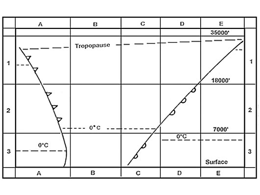 Tropical.
 A microburst with its damaging winds at the surface ?
Question 148-23 : Has a diameter up to 4 km has a life time of more than 30 minutes is always associated with thunderstorms occurs only in tropical areas
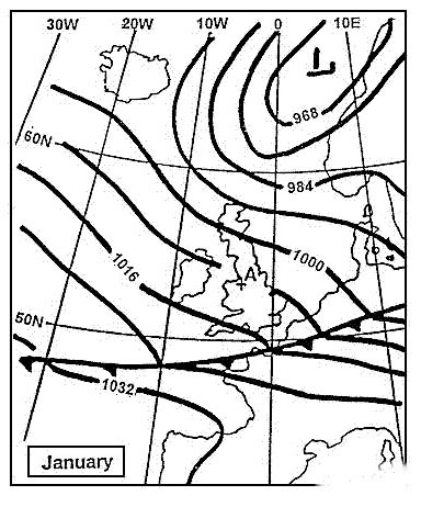 Has a diameter up to 4 km.
 Thunderstorms can occur on a warm front if the ?
Question 148-24 : Warm air is moist and the environmental lapse rate exceeds the saturated adiabatic lapse rate cold air is moist and the environmental lapse rate is less than the dry adiabatic lapse rate warm air is moist and the environmental lapse rate is less than the saturated adiabatic lapse rate cold air is moist and the environmental lapse rate exceeds the saturated adiabatic lapse rate
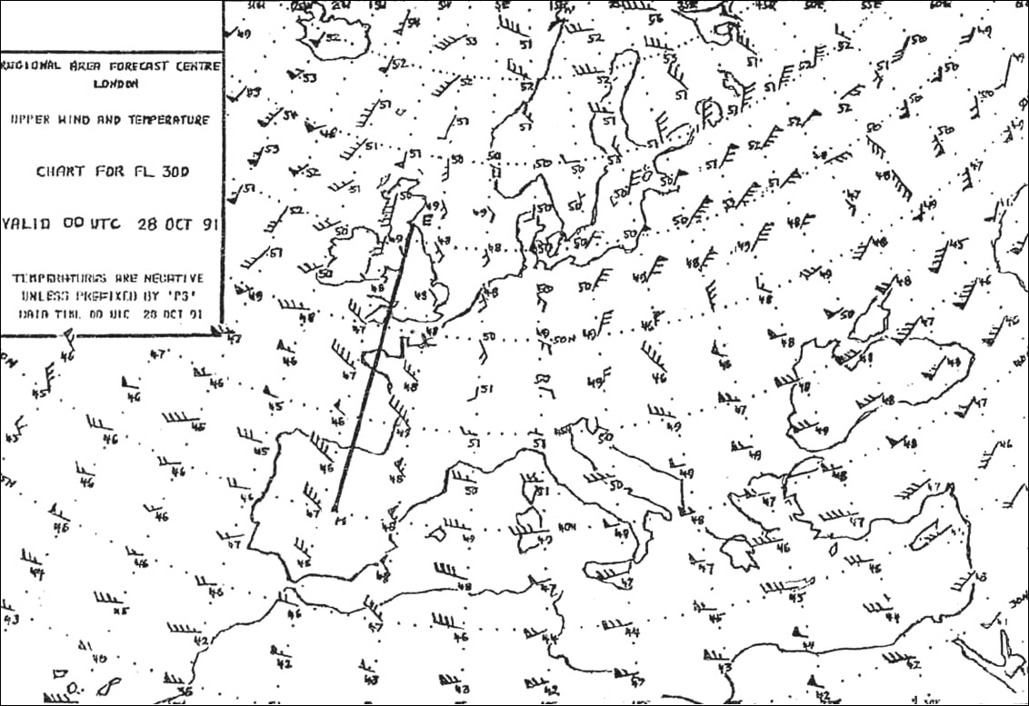 Warm air is moist and the environmental lapse rate exceeds the saturated adiabatic lapse rate
 With which type of cloud are tornadoes associated ?
Question 148-25 : Cumulonimbus stratus cumulus mediocris nimbostratus
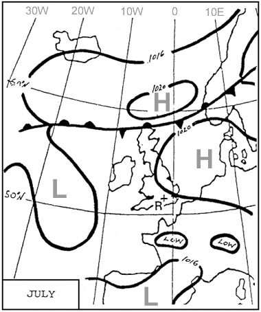 Cumulonimbus.
 The diameter of a typical tornado is ?
Question 148-26 : 100 to 150 metres only a few metres about 2 to 6 km in the order of 10 km
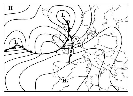 100 to 150 metres.
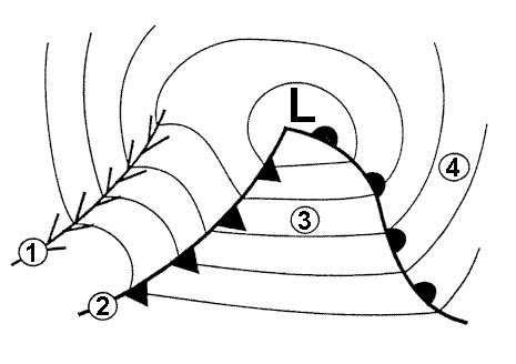
 In which stage of the life cycle of a single thunderstorm cell occur both up ?
Question 148-27 : Mature stage cumulus stage dissipating stage in all stages
 Mature stage.
 During the formation of rime ice in flight water droplets freeze ?
Question 148-28 : Rapidly and do not spread out slowly and do not spread out slowly and spread out rapidly and spread out
 Rapidly and do not spread out.
 Supercooled droplets can be encountered ?
Question 148-29 : At any time of the year only in winter above 10000 ft only in winter at high altitude in winter only in high clouds
 At any time of the year.
 Clear ice is formed when supercooled droplets are ?
Question 148-30 : Large and at a temperature just below freezing small and at a temperature just below freezing small and freeze rapidly of any size at temperatures below 35°c
 Large and at a temperature just below freezing
 Freezing precipitation occurs ?
Question 148-31 : Mainly in the form of freezing rain or freezing drizzle only in the precipitation of a cold front only in the precipitation of a warm front mainly in the form of freezing hail or freezing snow
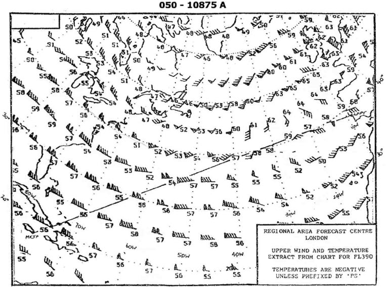 Mainly in the form of freezing rain or freezing drizzle.
 In the vicinity of industrial areas smoke is most likely to affect surface ?
Question 148-32 : There is a low level inversion the surface wind is strong and gusty cumulus clouds have developed in the afternoon a rapid moving cold front has just passed the area
 There is a low level inversion.
 Freezing fog consists of ?
Question 148-33 : Supercooled water droplets frozen water droplets frozen minute snow flakes ice crystals
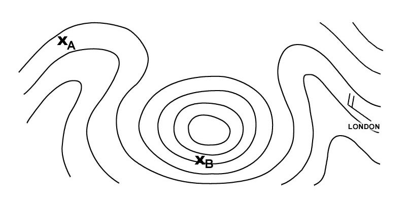 Supercooled water droplets.
 Clear ice is dangerous because it ?
Question 148-34 : Is heavy and is difficult to remove from the aircraft surfaces is translucent and only forms at the leading edges is not translucent and forms at the leading edges spreads out and contains many air particles
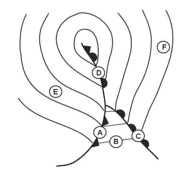 Is heavy and is difficult to remove from the aircraft surfaces.
 Hoar frost forms on an aircraft as a result of ?
Question 148-35 : Water vapour turning directly into ice crystals on the aircraft surface freezing rain striking the aircraft droplets forming on the aircraft and then freezing small super cooled droplets striking the aircraft
 Water vapour turning directly into ice crystals on the aircraft surface
 On a clear summer day turbulence caused by solar heating is most pronounced ?
Question 148-36 : During the early afternoon immediately after sunset during early morning hours before sunrise about midmorning
 During the early afternoon
 Clear ice forms as a result of ?
Question 148-37 : Supercooled water droplets spreading during the freezing process water vapour freezing to the aircraft ice pellets splattering on the aircraft supercooled droplets freezing on impact
 Supercooled water droplets spreading during the freezing process.
 The type of icing that occurs in dense clouds with large supercooled drops that ?
Question 148-38 : Clear ice hoar frost rime ice cloudy ice
 Clear ice.
 Below a low level inversion visibility is often ?
Question 148-39 : Moderate or poor because there is no vertical exchange very good at night very good in the early morning moderate or poor due to heavy snow showers
 Moderate or poor because there is no vertical exchange.
 Given the following metar .eddm 250850z 33005kt 2000 r26r/p1500n r26l/1500n br ?
Question 148-40 : Visibility is reduced by water droplets runway 26r and runway 26l have the same rvr rvr on runway 26r is increasing there is a distinct change in rvr observed
 Visibility is reduced by water droplets.
 ~
Exclusive rights reserved. Reproduction prohibited under penalty of prosecution.
5879 Free Training Exam
