The arrows labelled 'v' represent the mean tracks of tropical revolving storms ? [ Certification weather ]
Question 145-1 : December to april and are called cyclones december to april and are called hurricanes may to november and are called typhoons may to november and are called willy willys
 December to april and are called cyclones.
 In the north atlantic you can often see a series of depressions located in a ?
Question 145-2 : Are normally generated at the polar front are residuals of tropical cyclones in the florida area are primarily generated by the vaporization process that takes place above the ocean are mostly generated by convergence between the subtropical highs and the equatorial trough
What are the typical weather conditions in an area with a flat pressure pattern ?
Question 145-3 : Generally fine weather possibly thunderstorms in the afternoon or evening fine weather with strong westerly winds steady rainfall only short term weather improvements
 Generally fine weather, possibly thunderstorms in the afternoon or evening.
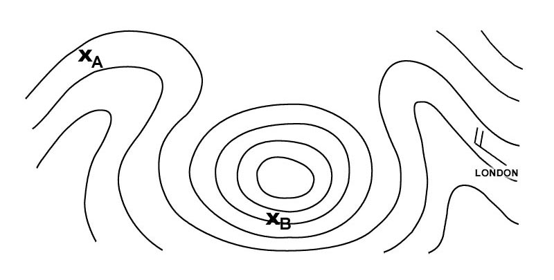
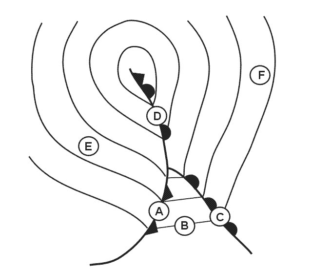
 What change in pressure will occur at point b during the next hour . 392 ?
Question 145-4 : Approximately constant pressure a rise in pressure a drop in pressure irregular fluctuations
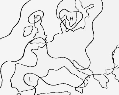 Approximately constant pressure.
 A stationary observer in the northern hemisphere is situated in front of a ?
Question 145-5 : Veering initially veers then backs initially backs then veers backing
 Veering.
 The eye of a hurricane ?
Question 145-6 : Extends from the surface to the top of the hurricane is filled with air which is colder than the air in the surrounding regions has a diameter of a least 100 nm cannot be spotted by satellites
 Extends from the surface to the top of the hurricane.
 What type of clouds visible even at a long distance could indicate the presence ?
Question 145-7 : Dense cirrus ci nimbostratus ns spread over a large area frequent stratocumulus sc excessive accumulation of cumulus cu
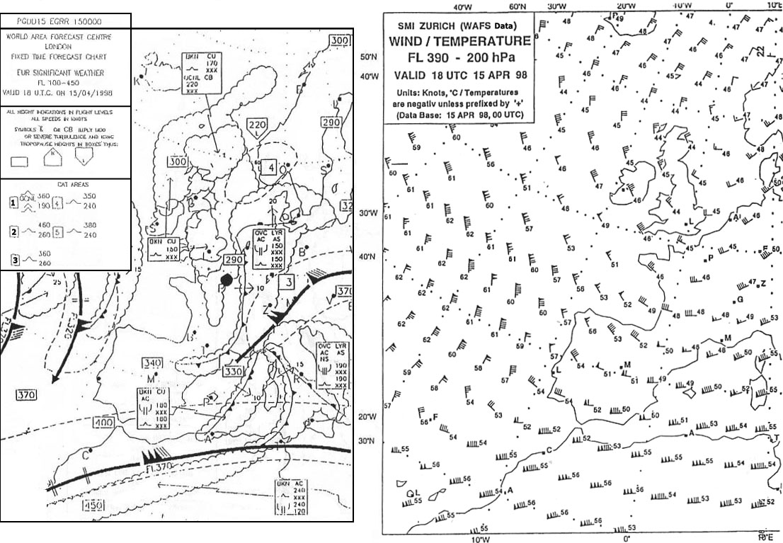 Dense cirrus (ci).
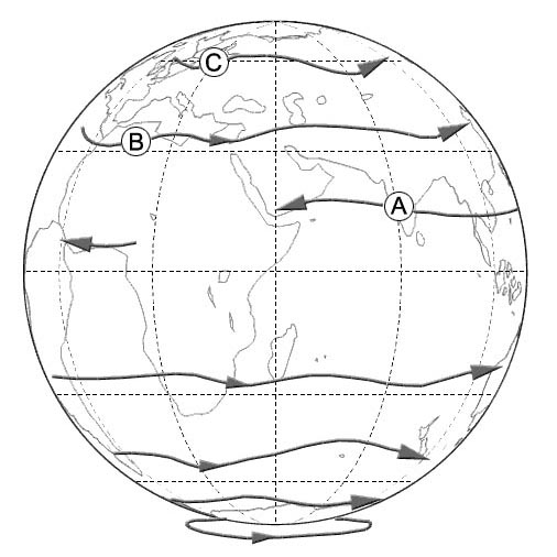
 Assuming a generalised zonal system of world wind circulation the travelling ?
Question 145-8 : S and y t and x only t u and w
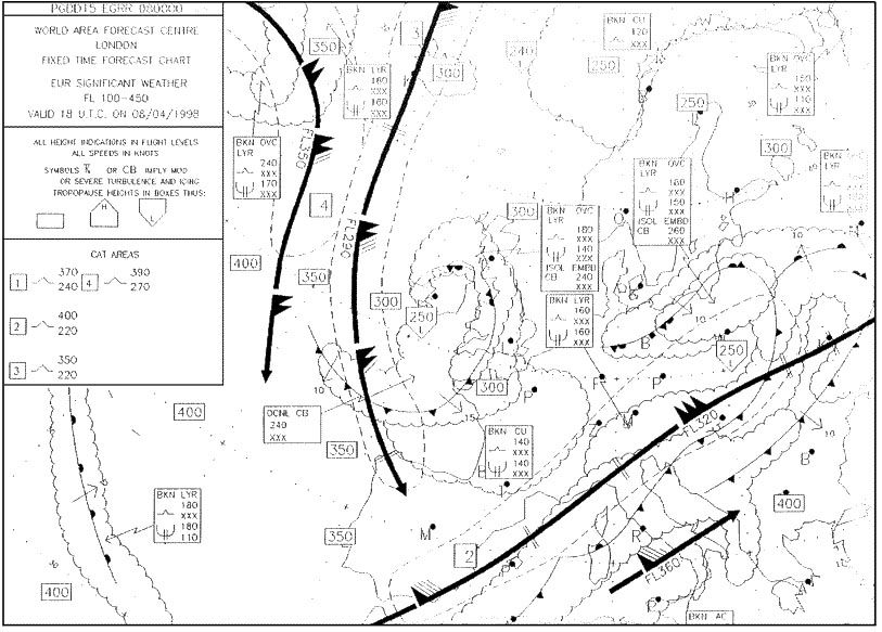 S and y.
 Troughs are extensions of ?
Question 145-9 : Low pressure areas and generally have large amounts of cloud low pressure areas and generally have small amounts of cloud high pressure areas and generally have small amounts of cloud high pressure areas and generally have small amounts of cloud
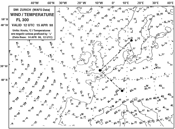 Low pressure areas and generally have large amounts of cloud.
 Refer to the chart 050 10850a the pressure system essentially located in square ?
Question 145-10 : A ridge a col a trough a low
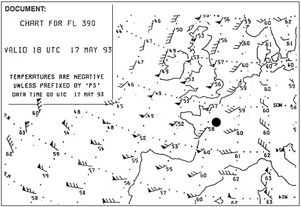 A ridge.
 An aircraft is flying from point a to point b at the flight level corresponding ?
Question 145-11 : The true altitude will be higher over b than over a the true altitude will be higher over a than over b wind speed over b is higher than over a the wind speeds over a and b are equal
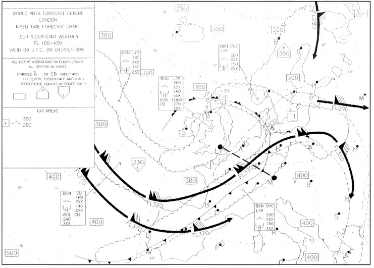 The true altitude will be higher over b than over a.
 Refer to annex 050 10720a .assuming a generalised zonal system of world ?
Question 145-12 : Subtropical high pressure systems intertropical convergence zone itcz travelling low pressure systems ne trade winds systems
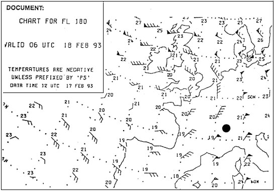 Subtropical high pressure systems.
 In temperate latitudes what weather conditions may be expected over land during ?
Question 145-13 : Calm winds haze ts sh cb ts ns
 Calm winds, haze.
 Which weather phenomena are typical for the northern side of the alps with ?
Question 145-14 : Good visibility turbulence continuous precipitation severe turbulence decrease in temperature moderate to severe icing icing huge mass of clouds
 Good visibility, turbulence.
 What weather is prevalent in easterly waves ?
Question 145-15 : Thunderstorms and rain continuous rain clear skies frontal weather
 Thunderstorms and rain.
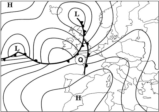
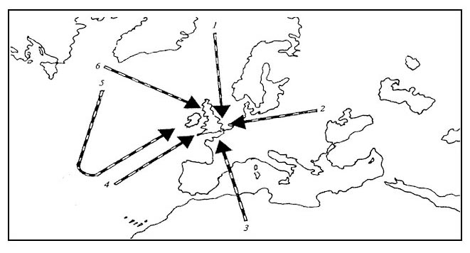
 Assuming the usual direction of movement to which position will the polar ?
Question 145-16 : Position 3 position 4 position 2 position 1
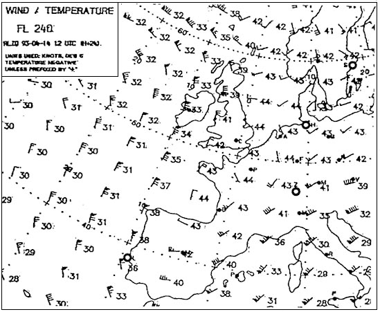 Position 3.
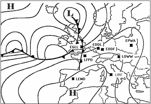
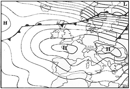
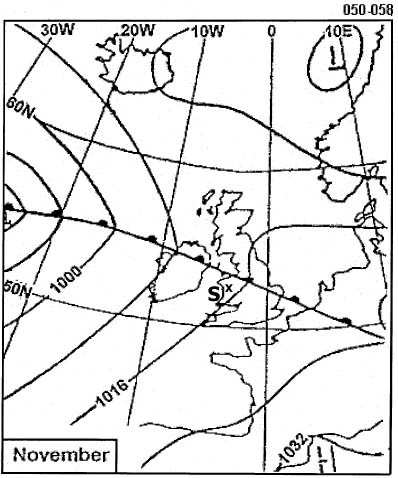
 Under the weather conditions depicted which of the following statements is ?
Question 145-17 : Thunderstorms may occur in the summer months over central europe severe gradient wind likely over central europe moderate to strong foehn in the alps radiation fog is unlikely in central europe in the winter
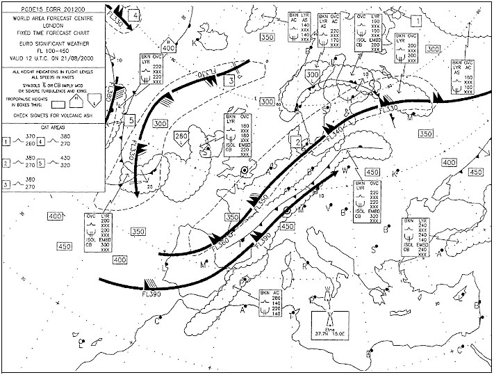 Thunderstorms may occur in the summer months over central europe.
 For an aircraft what are the meteorological dangers associated with a harmattan ?
Question 145-18 : Dust and poor visibility thunderstorms sand up to fl 150 hail
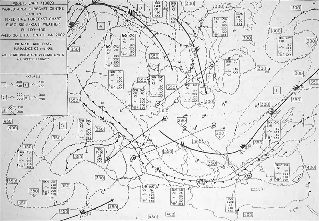 Dust and poor visibility.
 What is the strong relatively cold katabatic wind blowing down the northern ?
Question 145-19 : Bora ghibli mistral scirocco
 Bora.
Bora. Which one of the following statements regarding the intertropical convergence ?
Question 145-20 : Frequent and widespread thunderstorms are to be expected within the area of the itcz thunderstorms seldom occur within the area of the itcz the itcz is always associated with a strong jet stream the itcz does not change its position during the course of the year
 Frequent and widespread thunderstorms are to be expected within the area of the itcz.
 In which of the following bands of latitude is the intertropical convergence ?
Question 145-21 : 0° 7°n 3° 8°s 8° 12°s 7° 12°n
 0° - 7°n.
 When are the rainy seasons in equatorial africa ?
Question 145-22 : March to may and october to november december to february and july to october march to may and august to october april to july and december to february
 March to may and october to november.
 Which of the following best describes the intertropical convergence zone ?
Question 145-23 : The zone where the trade winds of the northern hemisphere meet those of the southern hemisphere the zone where the harmattan meets the north easterly trade winds over africa the zone where cold fronts form in the tropics the zone where the west winds meet the subtropical high pressure belt
 The zone where the trade winds of the northern hemisphere meet those of the southern hemisphere.
 What is the likely track for a hurricane in the caribbean area ?
Question 145-24 : West in the earlier stages and later turning north east east then south west deep into the usa west in the earlier stages and later turning south east
 West in the earlier stages and later turning north east.
 During which seasons are hurricanes most likely to appear in the northern ?
Question 145-25 : Summer and autumn winter all seasons winter and spring
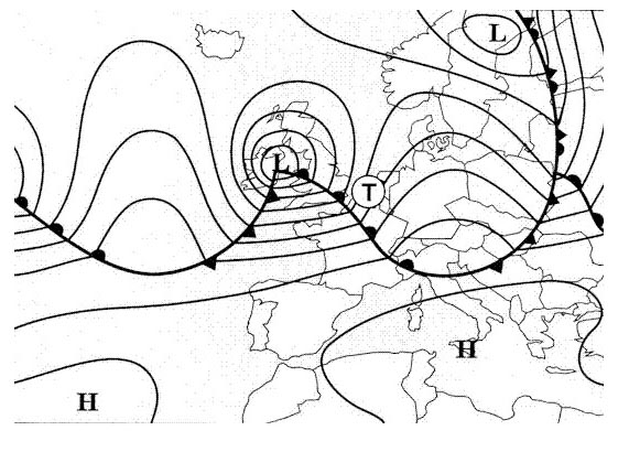 Summer and autumn.
 At what time of the year are typhoons most likely to occur over the southern ?
Question 145-26 : July to november september to january january to may may to july
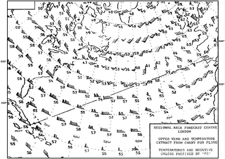 July to november.
 On which coast of north america is the danger of tropical revolving storms the ?
Question 145-27 : Se coast w coast n coast ne coast
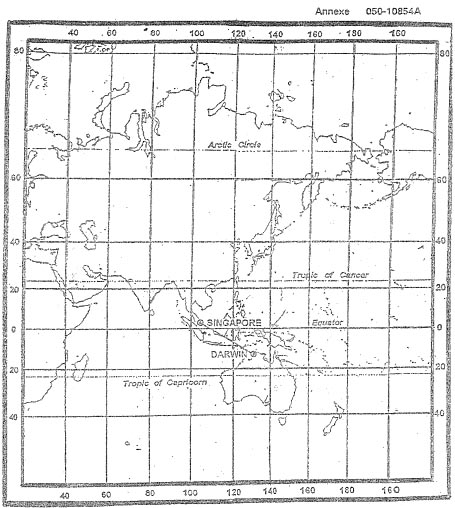 Se coast.
 What is characteristic of the pamperos ?
Question 145-28 : A marked advance of cold air in south america katabatic winds in the atlas mountains a marked advance of cold arctic air in north america foehn conditions in the spanish pyrenees
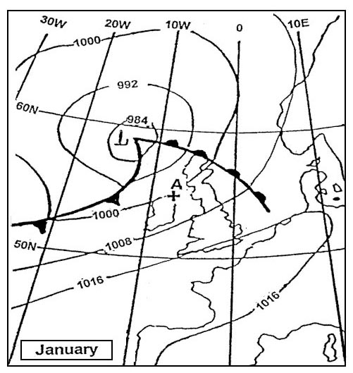 A marked advance of cold air in south america
 Where during a flight from marseille to dakar in july may the itcz be ?
Question 145-29 : In the vicinity of dakar at the latitudes of gibraltar at the latitudes of algeria near the canary islands
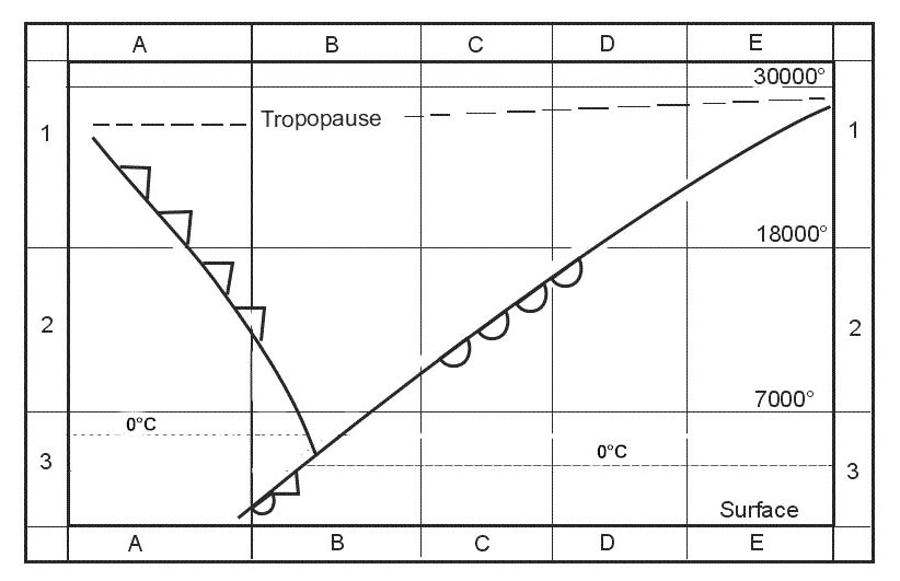 In the vicinity of dakar.
 Which wind systems converge on the itcz when it lies at the equator ?
Question 145-30 : Se trade winds and ne trade winds sw monsoon and nw monsoon sw monsoon and nw trade winds nw monsoon and sw trade winds
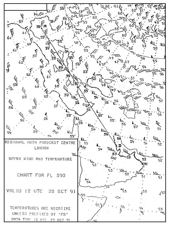 Se trade winds and ne trade winds
 From which direction do the trade winds blow in the southern hemisphere ?
Question 145-31 : Se ne sw n
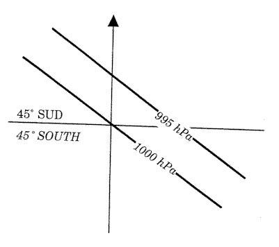 Se
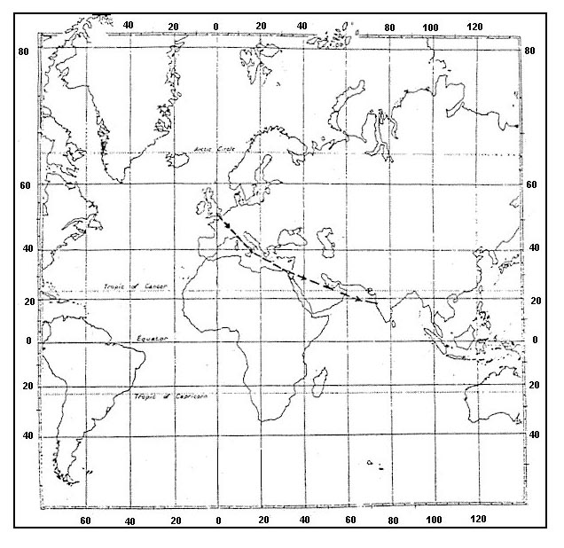
Se Considering the route indicates from lisbon to freetown the harmattan is a . 290 ?
Question 145-32 : Ne wind affecting north west africa during november to april reducing visibility in rising dust sw monsoonal wind causing extensive areas of advection fog along the west african coast south of 15°n warm southerly dust bearing wind affecting the coast of north africa localised depression giving squally winds
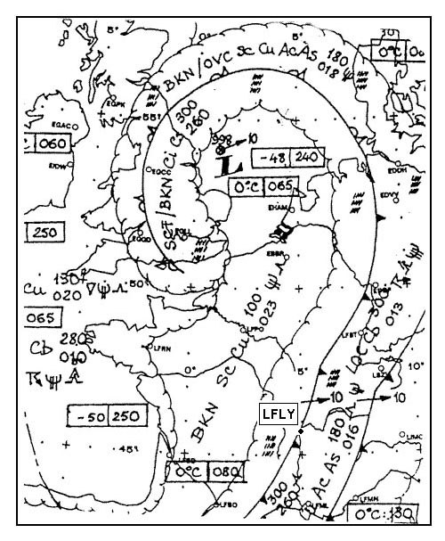 Ne wind affecting north-west africa during november to april reducing visibility in rising dust.
 In which month does the humid monsoon in india start ?
Question 145-33 : In june in october in december in march
 In june.
 The intertropical convergence zone itcz particularly affects ?
Question 145-34 : Western africa between 10°n and 20°n and the northern coasts of the arabian sea in july western africa at a latitude of 25°n in july the atlantic ocean between latitudes 10°n and 30°n depending on the time of year western africa where it is situated between the 10°n and 30°n parallels depending on the time of the year
 Western africa between 10°n and 20°n and the northern coasts of the arabian sea in july.
 The chinook is a ?
Question 145-35 : Warm and dry wind that forms as air descends on the leeward side of the rocky mountains very cold wind with blowing snow downslope wind that occurs particularly at night as air cools along mountain slopes warm anabatic wind up the slopes of snowfields or glaciers
 Warm and dry wind that forms as air descends on the leeward side of the rocky mountains.
 A dry sand and dust laden north easterly wind that blows in winter over large ?
Question 145-36 : Harmattan scirocco pampero khamsin
 Harmattan
 The transition from sw to ne monsoon in india occurs in ?
Question 145-37 : September october november july august september december january february february march april
 September, october, november.
 Which of the following statements concerning the intertropical convergence zone ?
Question 145-38 : There are frequent occurrences of cb it lies totally in the northern hemisphere in july and totally in the southern hemisphere in january it does not change its position over the oceans during the year it is an area of low pressure and low relative humidity
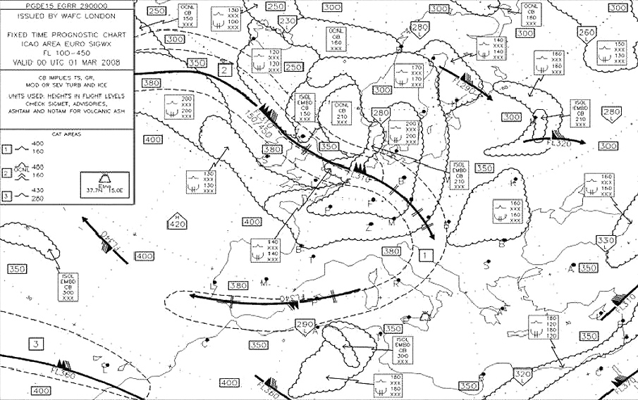 There are frequent occurrences of cb.
 An easterly wave is a ?
Question 145-39 : Wave in a trade wind belt moving from east to west with severe convective activity in rear of its trough wave like disturbance in the monsoon regime of india moving from east to west with severe convective activity ahead of its trough small scale wave disturbance in the tropics moving from east to west with severe convective activity ahead of its trough disturbance in the higher levels associated with the equatorial easterly jet moving from east to west with severe convective activity in rear of its trough
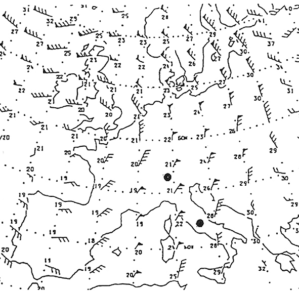 Wave in a trade wind belt, moving from east to west, with severe convective activity in rear of its trough.
 The prevailing surface wind in the area of the west coast of africa north of ?
Question 145-40 : Sw monsoon in summer and ne tradewind in winter ne monsoon in winter and se tradewind in summer sw monsoon in winter and ne monsoon in summer ne tradewind in summer and se tradewind in winter
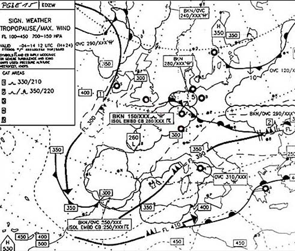 Sw monsoon in summer and ne tradewind in winter.
 ~
Exclusive rights reserved. Reproduction prohibited under penalty of prosecution.
5759 Free Training Exam
