A cold air pool ? [ Certification weather ]
Question 144-1 : Is usually most evident in the circulation and temperature fields of the middle troposphere and may show little or no sign on a surface chart develops usually in winter when very unstable maritime polar or maritime arctic air currents stream southwards along the eastern side of an extensive ridge of high pressure in association with occluded systems normally disappears at night and occurs almost exclusively in summer occurs frequently in winter to the south of the alps when this region is under the influence of cold north westerly airstream
 Is usually most evident in the circulation and temperature fields of the middle troposphere and may show little or no sign on a surface chart
 The stable layer at some height in the low troposphere of an older high ?
Question 144-2 : Subsidence inversion friction inversion radiation inversion trade wind inversion
 Subsidence inversion.
 A blocking anticyclone in the northern hemisphere is ?
Question 144-3 : A warm anticyclone quasi stationary situated between 50°n and 70°n quasi stationary situated between 50°n and 70°n a cold anticyclone situated between 50°n and 70°n a cold anticyclone steering depressions a cold anticyclone steering depressions situated over scandinavia
 A warm anticyclone, quasi stationary, situated between 50°n and 70°n.
 Which statement is true for hurricanes in the north atlantic ?
Question 144-4 : From the earth's surface up to the tropopause the core is warmer than its surroundings they intensify rapidly after landfall the diameter is 50 500 m their greatest frequency of occurrence is in winter
 From the earth's surface up to the tropopause the core is warmer than its surroundings.
 Assume that an aircraft is flying in the northern hemisphere at the 500 hpa ?
Question 144-5 : If in this pressure surface the wind comes from the direction 360 degrees then true altitude is increasing if in this pressure surface the wind comes from the direction 180 degrees then true altitude is increasing if in this pressure surface the wind comes from the direction 270 degrees then true altitude is increasing if in this pressure surface the wind comes from the direction 090 degrees then true altitude is increasing
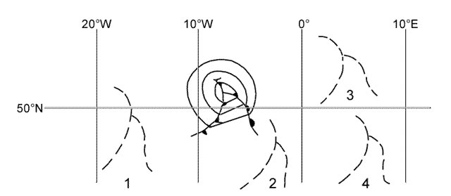 If in this pressure surface the wind comes from the direction 360 degrees, then true altitude is increasing.
 An aircraft is flying at fl 180 in the northern hemisphere with a crosswind ?
Question 144-6 : It decreases it increases it remains constant without knowing temperatures at fl 180 this question can not be answered
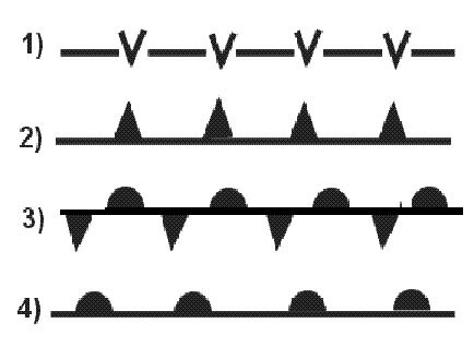 It decreases.
 Which of the following is true concerning an aircraft that is flying at fl180 ?
Question 144-7 : There is no cross wind there is a cross wind from the left there is a cross wind from the right without knowing temperature at fl 180 this question can not be answered
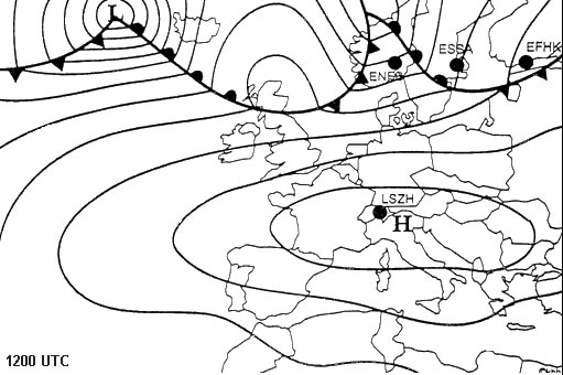 There is no cross wind.
 The reason for the fact that the atmospheric pressure of a polar front ?
Question 144-8 : The temperature contrasts between arctic and equatorial areas are much greater in winter the low pressure activity of the sea east of canada is higher in winter the strong winds of the north atlantic in winter are favourable for the development of lows converging air currents are of greater intensity in winter
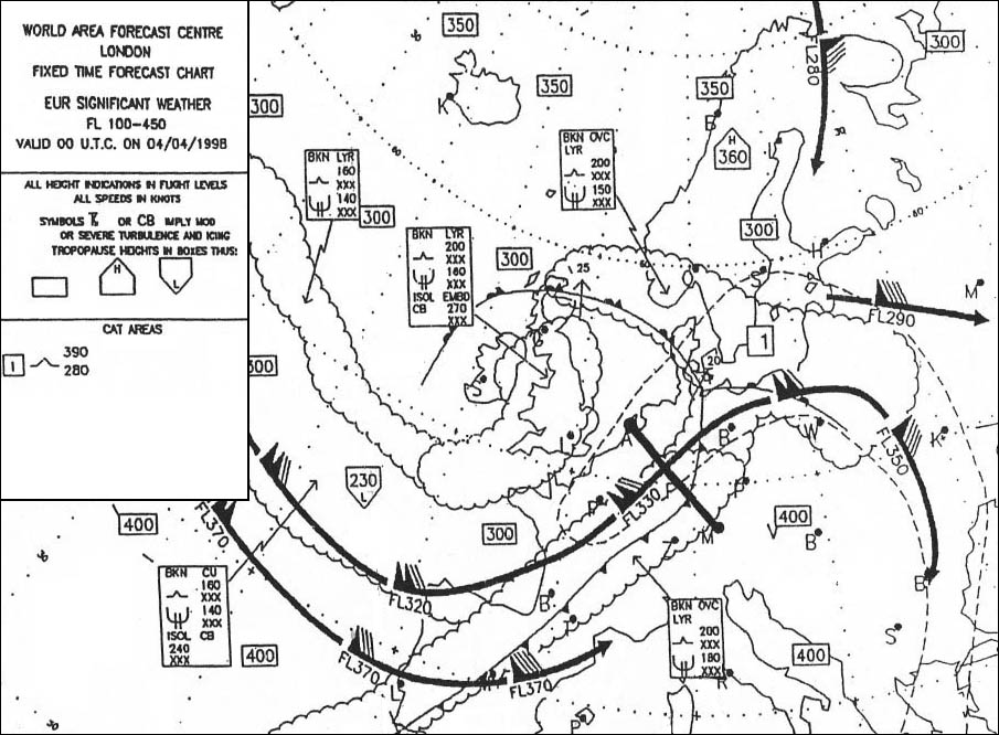 The temperature contrasts between arctic and equatorial areas are much greater in winter.
 In which of the following areas do surface high pressure systems usually ?
Question 144-9 : Azores se usa sw europe greenland azores ne canada iceland sw usa azores greenland sw europe ne canada
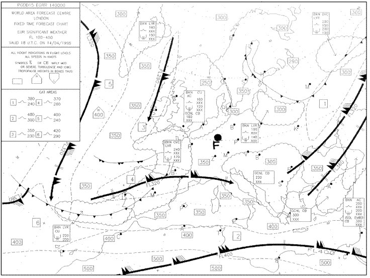 Azores, se usa, sw europe.
 In the northern hemisphere with an anticyclonic pressure system the geostrophic ?
Question 144-10 : 340°/20 kt 030°/20 kt 340°/28 kt 030°/28 kt
 340°/20 kt.
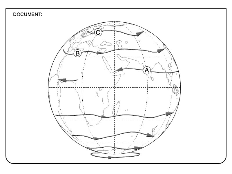
 Select the answer which you consider will complete correctly the following ?
Question 144-11 : Iceland / greenland usa siberia azores
 Iceland / greenland.
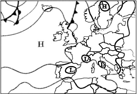
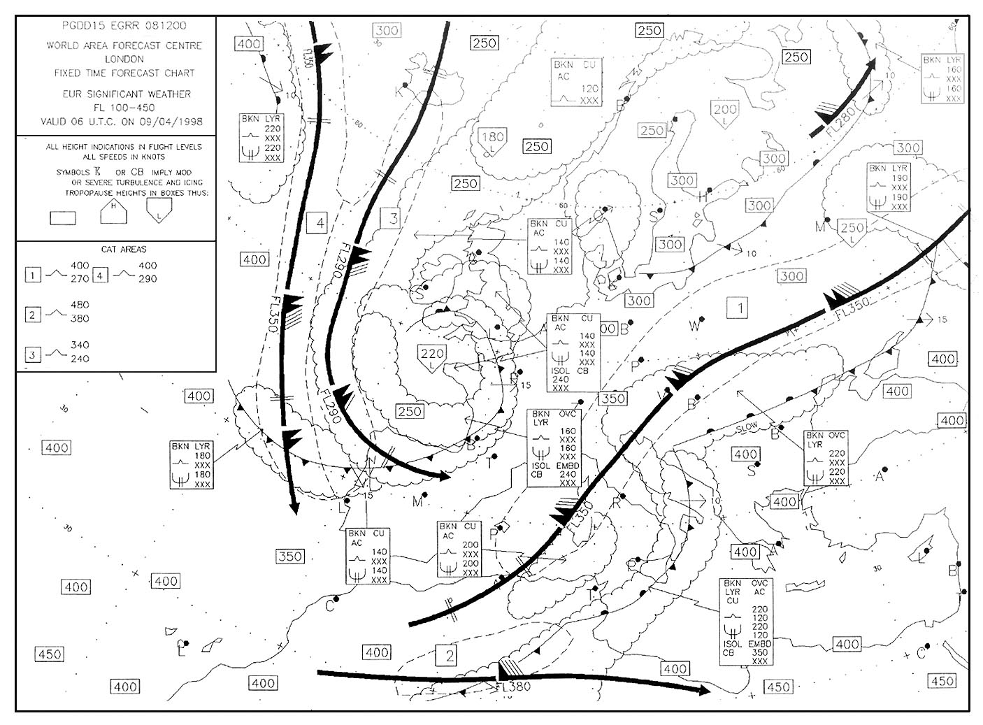
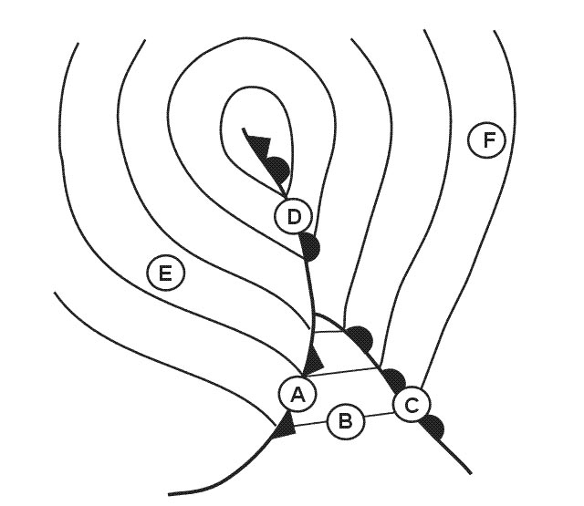
 The pressure system at position 'd' is . 319 ?
Question 144-12 : A col a secondary low a trough of low pressure a ridge of high pressure
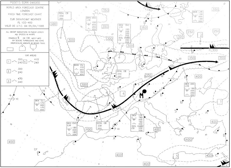 A col.
 Considering the north atlantic region between 30°n and 65°n and the adjacent ?
Question 144-13 : Azores high and weak low over ne canada scandinavian high and azores high weak low over ne canada and scandinavian high azores low and icelandic high
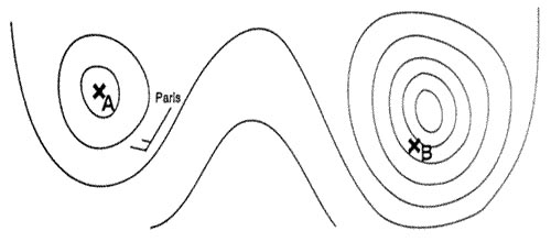 Azores high and weak low over ne canada.
 Considering the north atlantic region between 30°n and 65°n together with the ?
Question 144-14 : Azores siberia siberia iceland canaries ne canada iceland greenland iberian peninsula
 Azores, siberia.
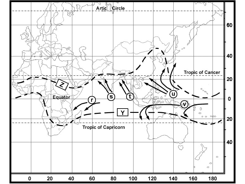
 The arrows labelled 'r' represent the mean tracks of tropical revolving storms ?
Question 144-15 : December to april and are called cyclones december to april and are called tornadoes june to october and are called typhoons june to october and are called hurricanes
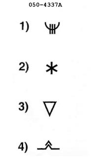 December to april and are called cyclones
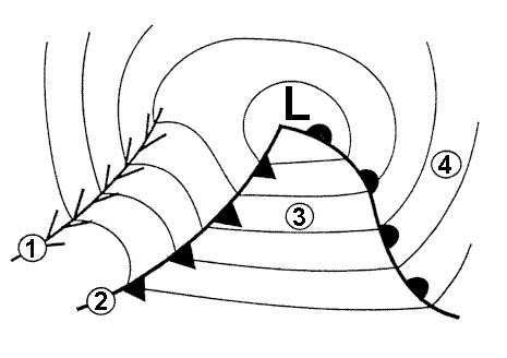
 Which is true of a secondary depression in the northern hemisphere ?
Question 144-16 : It tends to move round the primary in a cyclonic sense it tends to move round the primary in an anticyclonic sense it rapidly closes on and merges with the primary it tends to maintain its position relative to the primary
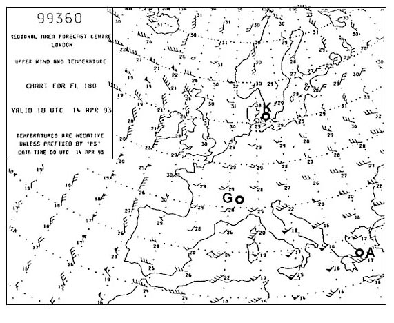 It tends to move round the primary in a cyclonic sense.
 The arrows labelled 's' represent the mean tracks of tropical revolving storms ?
Question 144-17 : May to november and are called cyclones december to april and are called cyclones may to november and are called hurricanes december to april and are called typhoons
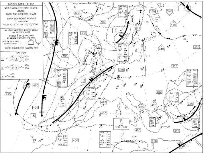 May to november and are called cyclones.
 The arrows labelled 't' represents the mean track of tropical revolving storms ?
Question 144-18 : June to october and are called cyclones december to april and are called hurricanes june to october and are called tornadoes june to october and are called hurricanes
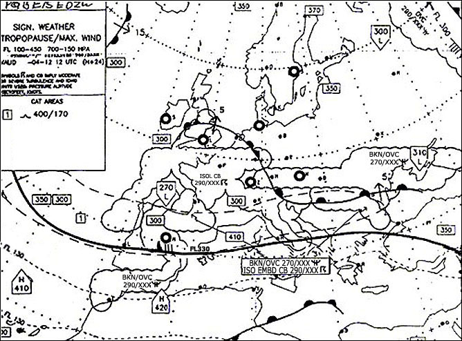 June to october and are called cyclones.
 The arrows labelled 'u' represent the tracks of tropical revolving storms which ?
Question 144-19 : July to october and are called typhoons january to march and are called willy willies may to july and are called cyclones december to april and are called tornadoes
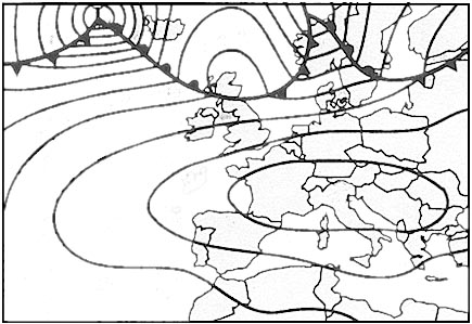 July to october and are called typhoons.
 When if at all is a tropical revolving storm most likely to affect darwin on ?
Question 144-20 : December to april may to july august to october not experienced at darwin
 December to april.
 A trough of low pressure on a surface synoptic chart is an area of ?
Question 144-21 : Convergence and widespread ascent divergence and subsidence divergence and widespread ascent convergence and subsidence
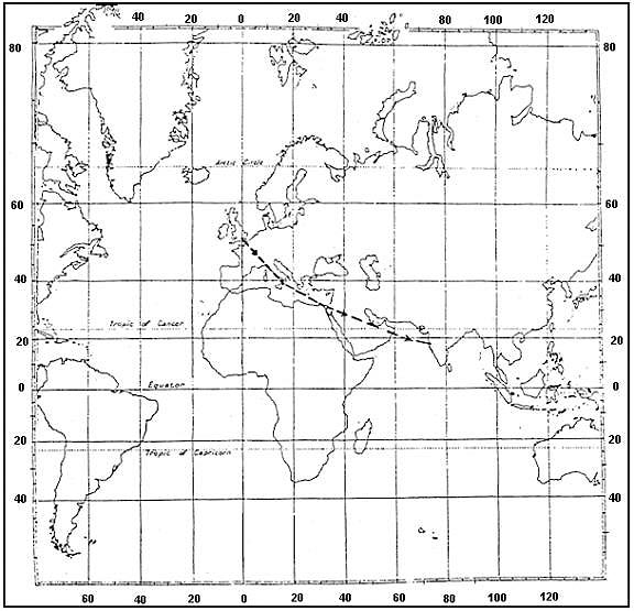 Convergence and widespread ascent.
 Which is true of a typical non frontal thermal depression ?
Question 144-22 : It forms over land in summer it forms over the ocean in summer it forms over the ocean in winter it forms over land in winter
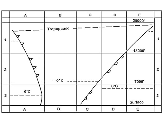 It forms over land in summer.
 During summer an anticyclone covers the british isles giving mainly clear skies ?
Question 144-23 : Become southerly to southwesterly and increase in velocity by afternoon back to nw and strengthen by mid afternoon increase from the north by mid morning becoming calm towards evening veer to easterly before becoming calm by the afternoon
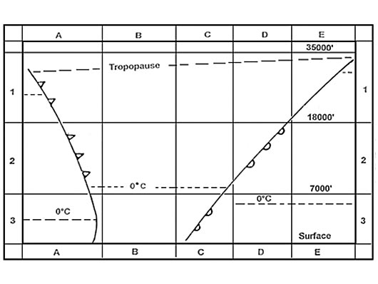 Become southerly to southwesterly and increase in velocity by afternoon.
 During summer a weak pressure gradient covers a coastal airfield in eastern ?
Question 144-24 : Easterly to southeasterly and increase in velocitiy by afternoon easterly and then westerly by afternoon westerly and increase in velocity by afternoon westerly and then southerly by evening
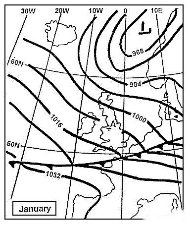 Easterly to southeasterly and increase in velocitiy by afternoon.
 For the same horizontal distance between adjacent isobars the gradient wind ?
Question 144-25 : 50°n with a cyclonic circulation 50°n in an anticyclone 30°n with a cyclonic circulation 30°n in an anticyclone
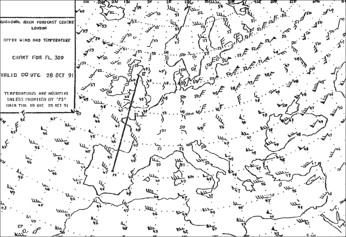 50°n with a cyclonic circulation.
 Over which areas can tropical cyclones occur ?
Question 144-26 : Caribbean sea gulf of bengal indian ocean east of madagascar india arabic sea atlantic ocean at 2°s australia gulf of bengal atlantic ocean at 20°s caribbean sea indian ocean at 20°s pacific ocean at 2°n
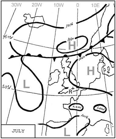 Caribbean sea, gulf of bengal, indian ocean east of madagascar.
 The hurricane season in the caribbean is mainly from ?
Question 144-27 : July until november october until january january until april april until july
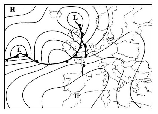 July until november.
 Which statement about hurricanes in the north atlantic is correct ?
Question 144-28 : Their eye can be well observed by weather satellites they intensify after landfall they move towards the equator they move with a speed of at least 60 kt
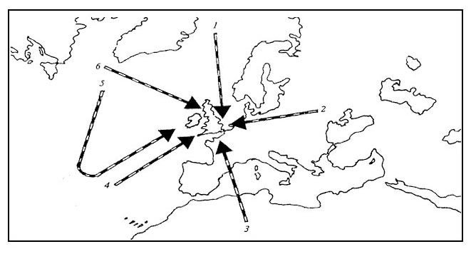 Their eye can be well observed by weather satellites
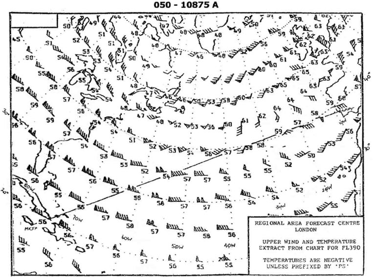
 You are flying at fl 340 250 hpa on the northern hemisphere .the wind is ?
Question 144-29 : Increase decrease decrease only if the pressure at the surface is decreasing on your route increase only if the temperature at your flight level is rising on your route
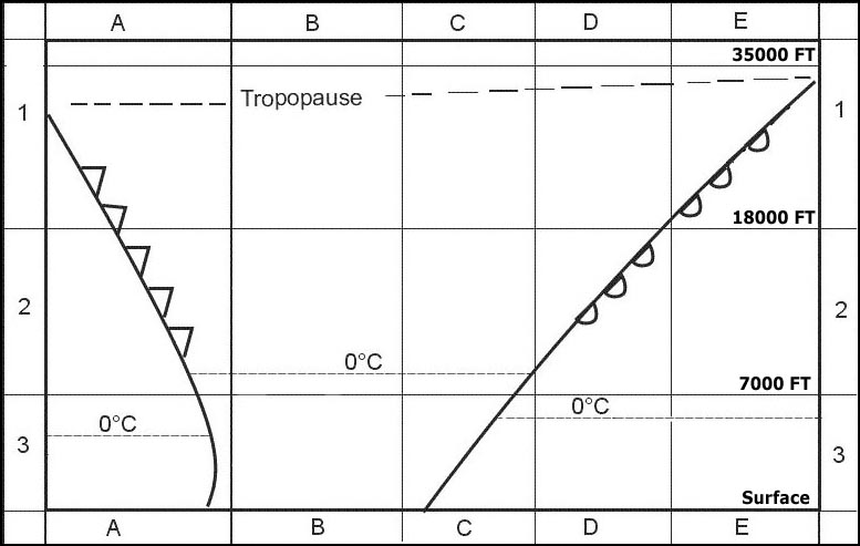 Increase.
 You are flying in the northern hemisphere at 2000 ft over a flat country area ?
Question 144-30 : From your right from your left from ahead from behind
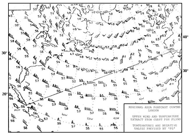 From your right.
 Why do tropical revolving storms tend to develop mostly in the western parts of ?
Question 144-31 : Because there is a maximum of humidity as a result of the trade winds long sea passage because they are areas in which there is a strong progressive wind shear with increase of height because there is a maximal temperature difference between land mass and sea because the gulf formation of the coastlines triggers a strong rotary circulation
 Because there is a maximum of humidity as a result of the trade winds long sea passage
 Over the indian ocean and the bay of bengal tropical cyclones are ?
Question 144-32 : Occasionally observed in the average 12 per year rare in the average one every two years never observed frequently observed in the average 15 per year over the indian ocean but never over the bay of bengal
 Occasionally observed, in the average 12 per year.
 Tropical revolving storms are not formed in ?
Question 144-33 : South atlantic ocean gulf of bengal waters around the philippines south indian ocean
 South atlantic ocean.
 Between which latitudes are you most likely to find the region of travelling ?
Question 144-34 : 45° 70° 25° 45° 15° 25° 10° 15°
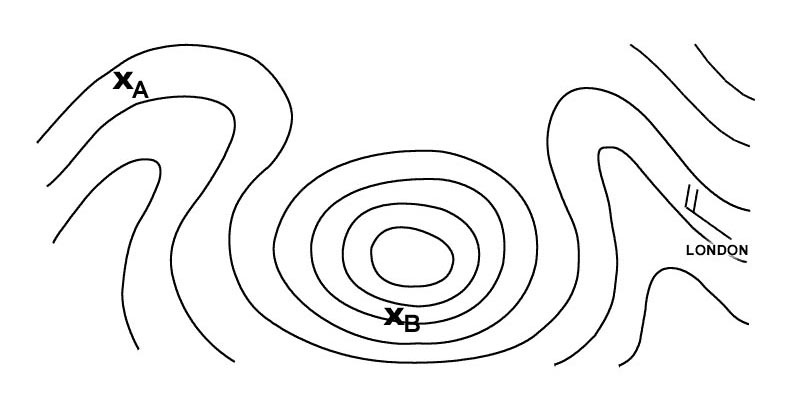 45° - 70°.
 A stationary observer in the northern hemisphere is situated in front of a ?
Question 144-35 : Backs veers initially veers then backs initially backs then veers
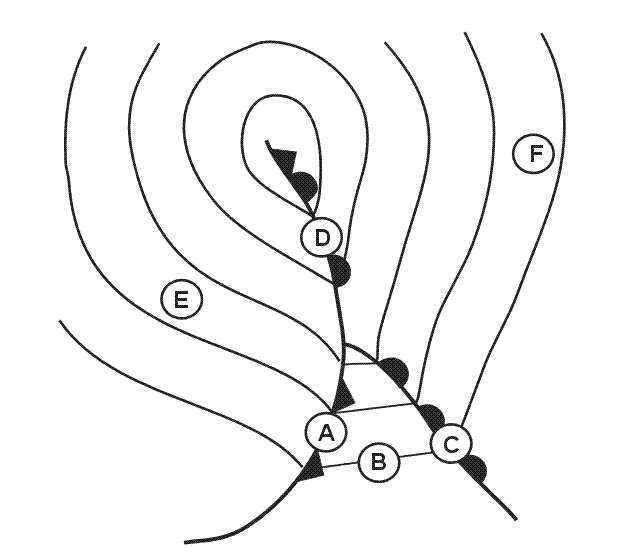 Backs.
 The region of the globe where the greatest number of tropical revolving storms ?
Question 144-36 : The north west pacific affecting japan taiwan korea and the chinese coastline the caribbean sea affecting the west indies mexico and the south east coastline of the usa the south western indian ocean affecting madagascar mauritius and the island of reunion the northern indian ocean affecting india sri lanka and bangladesh
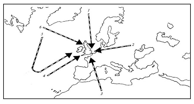 The north-west pacific, affecting japan, taiwan, korea and the chinese coastline.
 Which of the following statements is correct ?
Question 144-37 : At the equator horizontal motions do not induce any horizontal coriolis force the coriolis force is inversely proportional to the sine of latitude the coriolis force is directed in the same sense at all latitudes in gradient wind the coriolis force is in balance with the horizontal pressure gradient force and the frictional force
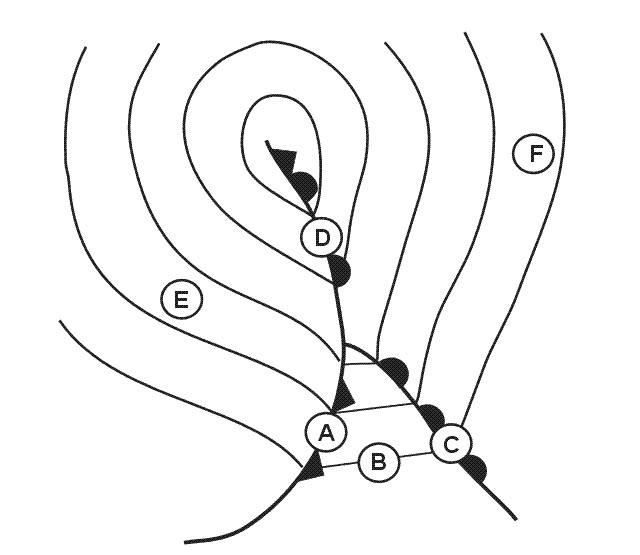 At the equator horizontal motions do not induce any horizontal coriolis force
 In the middle of the eye of a hurricane the wind speed is ?
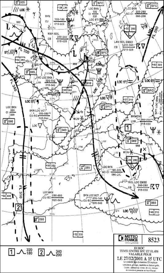
Question 144-38 : Lower than 63 knots and the air is descending lower than 63 knots and the air is ascending higher than 63 knots and the air is ascending higher than 63 knots and the air is descending
 Lower than 63 knots and the air is descending.
 The geographical area where the frequency of the tropical revolving storms is ?
Question 144-39 : South of chinese sea and philippines south atlantic ocean indonesia arabian sea maritime zone west of india
 South of chinese sea and philippines.
 Which of the following is correct regarding a warm anticyclone ?
Question 144-40 : It increases in intensity with increasing altitude apart from a surface inversion the temperature increases with increasing altitude it remains the same strength up to the tropopause it weakens with altitude
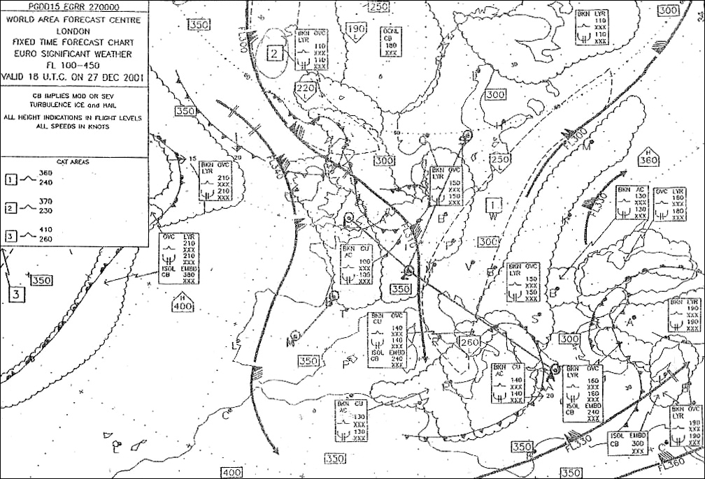 It increases in intensity with increasing altitude.
 ~
Exclusive rights reserved. Reproduction prohibited under penalty of prosecution.
5719 Free Training Exam
