An observer on the northern hemisphere is under influence of the wind system of ? [ Certification weather ]
Question 141-1 : Continuously backing continuously veering initially backing then veering initially veering then backing
In a warm front occlusion ?
Question 141-2 : The warm air is lifted the warm front overtakes the cold front the warm front becomes a front aloft the cold air is lifted
 The warm air is lifted.
 An air mass is unstable when ?
Question 141-3 : An ascending parcel of air continues to rise to a considerable height temperature and humidity are not constant pressure shows a marked variation over a given horizontal area temperature increases with height
An air mass is stable when ?
Question 141-4 : Lifted air returns to its original level temperature in a given area drops off very rapidly with height pressure is constant the lapse rate is 1°c per 100 m
 Lifted air returns to its original level.
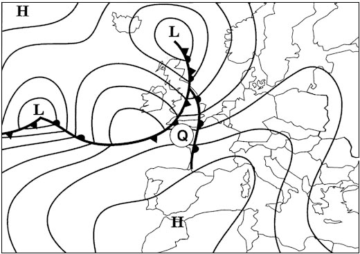
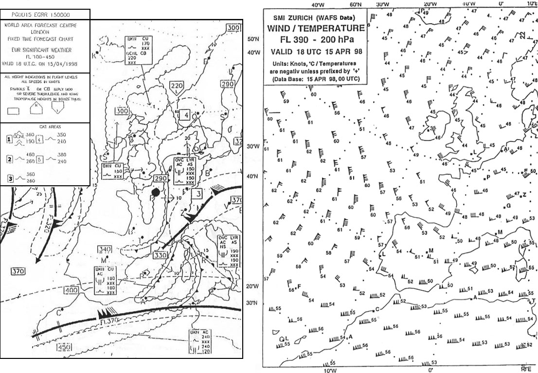
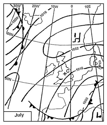
 The weather most likely to be experienced at position 'r' is . 326 ?
Question 141-5 : Fine and warm at first ac castellanus and cb in late afternoon with thunderstorms early morning fog lifting to low stratus increasing amounts of as and ns heavy rain overcast with drizzle and hill fog
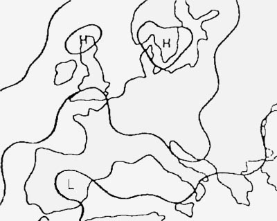 Fine and warm at first, ac castellanus and cb in late afternoon with thunderstorms.
 An occlusion has the characteristics of a warm front when ?
Question 141-6 : The cold air behind is warmer than the cold air ahead the cold air behind is colder than the cold air ahead the cold air behind is lifted by the warm air the cold air ahead is lifted
 The cold air behind is warmer than the cold air ahead.
 An unstable air mass will normally be characterised by ?
Question 141-7 : Cumuliform cloud and good visibility except in precipitation stratiform cloud continuous light rain from medium level layer cloud poor visibility due to haze at the lower levels
 Cumuliform cloud and good visibility except in precipitation
 Cold air pools ?
Question 141-8 : Are most evident in the temperature and wind fields of the upper levels can easily be recognized on synoptic surface charts only occur at mid latitudes only occur in winter
 Are most evident in the temperature and wind fields of the upper levels.
 Considering the north atlantic between 30°n and 65°n the mean position of the ?
Question 141-9 : Florida to sw england newfoundland to iceland iceland to norway ne canada to portugal
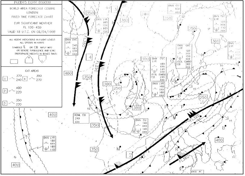 Florida to sw england.
 Considering the north atlantic region between 30°n and 65°n the mean position ?
Question 141-10 : Newfoundland to n scotland florida to sw england ne canada to iceland greenland to spain
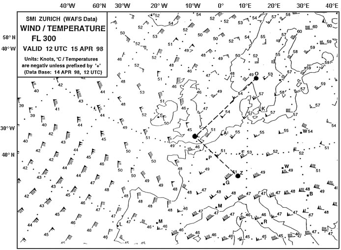 Newfoundland to n scotland.
 For an airfield located in the british isles the passage of a warm front will ?
Question 141-11 : Rise in temperature rise in dew point temperature wind veers and decreases a fall in temperature rise in dew point temperature wind backing and decreasing rapid improvement in visibility pressure falling rapidly wind veering and increasing rise in temperature rapid rise in pressure wind backs and becomes gusty
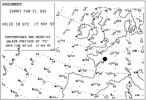 Rise in temperature, rise in dew point temperature, wind veers and decreases.
 In the weather pattern behind a cold front the visibility outside precipitation ?
Question 141-12 : Good and the precipitation is showers good and the precipitation is steady rain low and the precipitation is showers low and the precipitation is steady rain
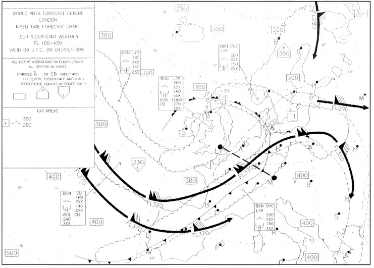 Good and the precipitation is showers.
 The passage of a warm front can be associated with areas of fog the types of ?
Question 141-13 : Frontal fog and advection fog advection fog and radiation fog arctic smoke and frontal fog advection fog and steaming fog
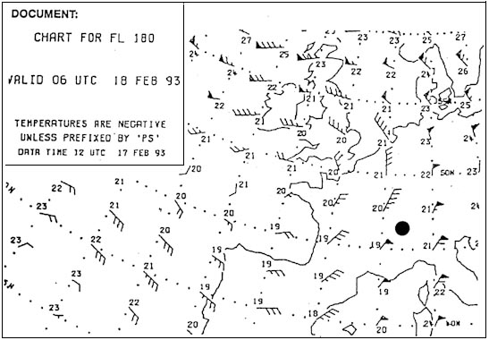 Frontal fog and advection fog.
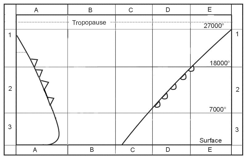
 The pressure system indicated when in a vertical cross section the lower ?
Question 141-14 : Cold high pressure area cold low pressure area warm low pressure area warm high pressure area
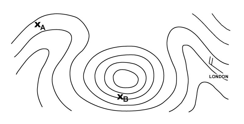 Cold high pressure area.
 The lowest cloud type observed is stratus fractus and there is moderate ?
Question 141-15 : The main body of the warm or cold front or of the occlusion behind the cold front the warm sector the high pressure area
 The main body of the warm or cold front, or of the occlusion.
 What is signified if an occlusion is described as 'cold' ?
Question 141-16 : The air ahead of the associated warm front is less cold than the air behind the associated cold front it derives from a polar depression the air ahead of the associated warm front is colder than the air behind the associated cold front on meeting the warm front the cold front moves up the warm frontal surface
 The air ahead of the associated warm front is less cold than the air behind the associated cold front.
 When a front has to cross a chain of mountains its activity ?
Question 141-17 : Strengthens 'upwind' of the mountains decreases when it reaches the mountains is not disturbed by the mountains ceases immediately
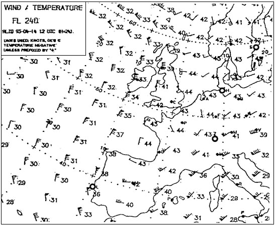 Strengthens 'upwind' of the mountains.
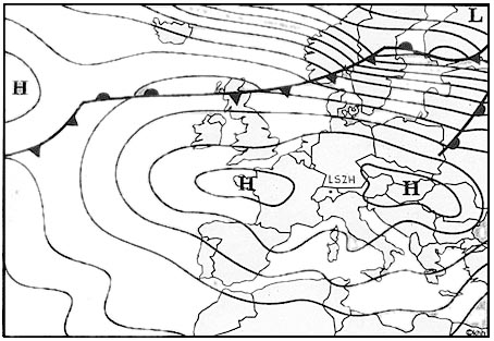
 When flying at 5000 ft in the northern hemisphere over plains with an ?
Question 141-18 : A head wind from the left from the right a tail wind
 A head wind.
 What type of weather can usually be expected in a polar maritime air mass over ?
Question 141-19 : Showers and good visibility continuous rain and poor visibility drizzle and low stratus sky clear
 Showers and good visibility.
 Which statement is correct for a warm occlusion ?
Question 141-20 : The cold front becomes a front aloft the warm front overtakes the cold front the warm front becomes a front aloft both fronts become fronts aloft
 The cold front becomes a front aloft.
 The air mass in the warm sector of a polar front is ?
Question 141-21 : Tropical air polar air arctic air equatorial air
 Tropical air.
 Which two air masses are most likely to govern weather in western europe ?
Question 141-22 : Maritime tropical warm and maritime polar cold continental tropical warm and continental polar cold maritime tropical warm and continental polar cold maritime polar warm and continental tropical warm
 Maritime tropical warm and maritime polar cold.
 The air masses that are observed most frequently over western europe are ?
Question 141-23 : Polar air and tropical air arctic air and polar air polar air and equatorial air arctic air and tropical air
 Polar air and tropical air.
 Which type of air mass never occurs over central europe ?
Question 141-24 : Equatorial air arctic air polar air tropical air
 Equatorial air.
 The weather most likely to be experienced at position 'b' is . 327 ?
Question 141-25 : Frequent showers of rain or snow advection fog and drizzle poor visibility in anticyclonic circulation early morning fog lifting to low stratus later
 Frequent showers of rain or snow.
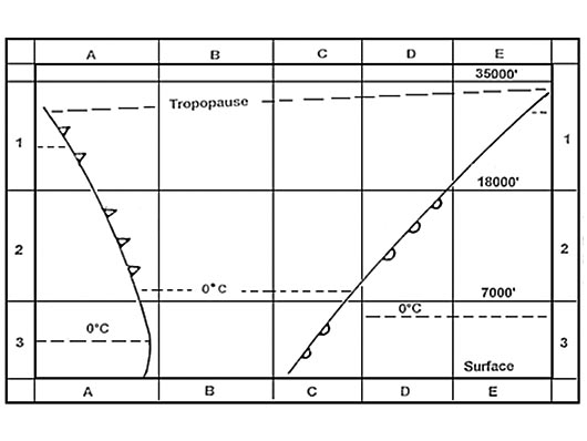
 During summer the cloud type most applicable to square 2a is . 328 ?
Question 141-26 : Cb ac st cs
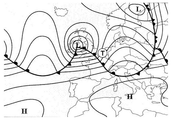 Cb
Cb The cloud type most applicable to square 2b is . 332 ?
Question 141-27 : Cb cs st sc
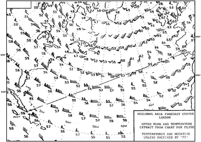 Cb.
Cb. The cloud type most applicable to square 2c is . 332 ?
Question 141-28 : As cs cb cu
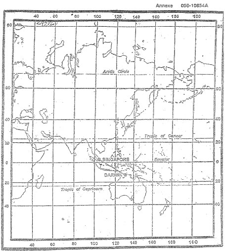 As
As The cloud type most applicable to square 1e is . 332 ?
Question 141-29 : Cs cb ns sc
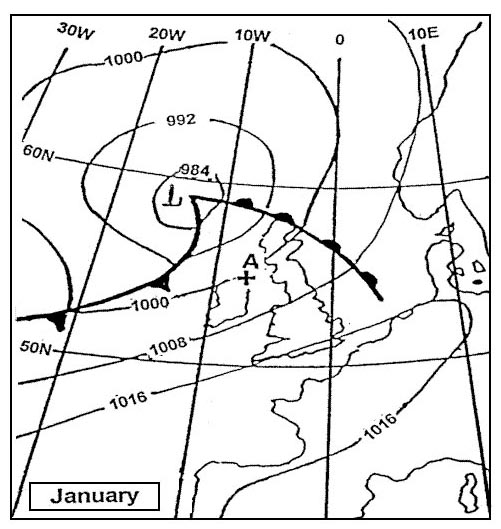 Cs.
Cs. The front at the bottom of the diagram south of position c is . 333 ?
Question 141-30 : An occlusion on the surface a warm front an occlusion above the surface a cold front
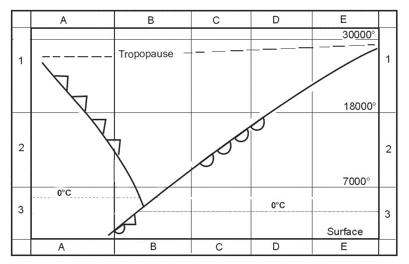 An occlusion on the surface.
 The weather most likely to be experienced at position 'b' is . 334 ?
Question 141-31 : Frequent showers of rain or snow good visibility outside showers scattered stratocumulus with good visibility mainly overcast with stratus or stratocumulus drizzle clear skies moderate wind good visibility
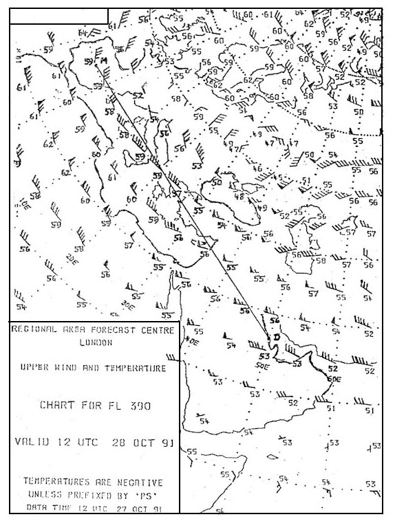 Frequent showers of rain or snow, good visibility outside showers
 The air mass at position 'x' is most likely to be . 335 ?
Question 141-32 : Maritime tropical maritime polar continental polar continental tropical
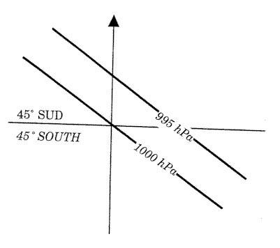 Maritime tropical.
 The weather most likely to be experienced near to position 'a' is . 336 ?
Question 141-33 : Frequent showers of rain and snow good visibility outside precipitation advection fog and drizzle overcast layer cloud rain later clear skies radiation fog at night
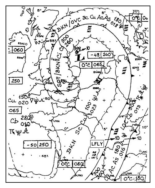 Frequent showers of rain and snow, good visibility outside precipitation.
 For an aircraft making an approach to an airfield located in square 3b away ?
Question 141-34 : Poor visibility in mist and drizzle scattered sc and cu good visibility generally overcast moderate continuous rain and risk of low level wind shear prolonged periods of heavy rain and hail
 Poor visibility in mist and drizzle.
 For an aircraft making an approach to an airfield located in square 3b the most ?
Question 141-35 : Low cloud mist moderate continuous rain showers of rain and hail scattered ac base 2000 ft good visibility
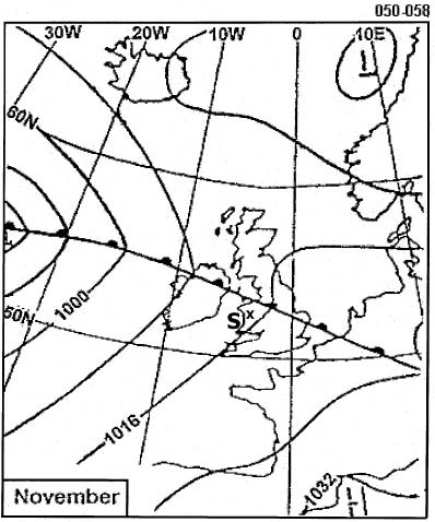 Low cloud, mist.
 What flight conditions are most likely to be experienced in square 2b by an ?
Question 141-36 : Vmc above layers of st and sc generally stable conditions vmc below an overcast of as and cs generally smooth air imc in layers of as and isolated cb risk of severe turbulence and icing imc in ns with risk of light icing
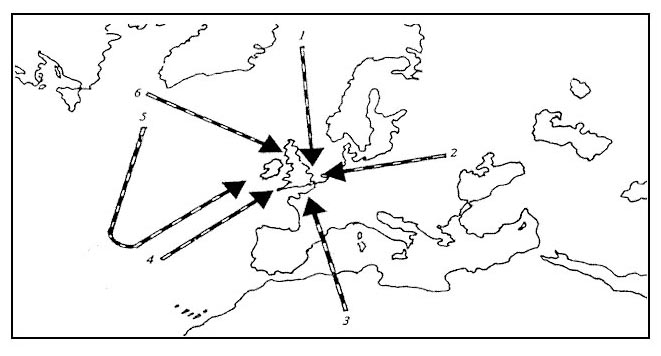 Vmc above layers of st and sc, generally stable conditions.
 The cloud type most applicable to most of square 3b is . 337 ?
Question 141-37 : Sc cs as ns
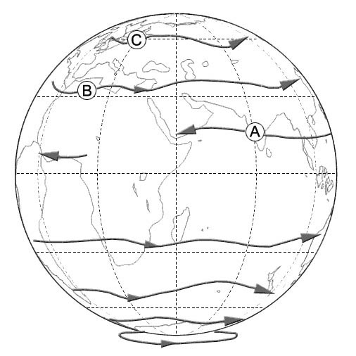 Sc.
Sc. For 1300 utc select a metar which you consider to be most appropriate to ?
Question 141-38 : 19010kt 6000 ra bkn016 ovc090 08/06 q1004= 24020kt 5000 ra bkn100 11/10 q1002= 18015kt 9999 sct020 03/01 q1000= 27030kt 8000 sct020 07/03 q1004=
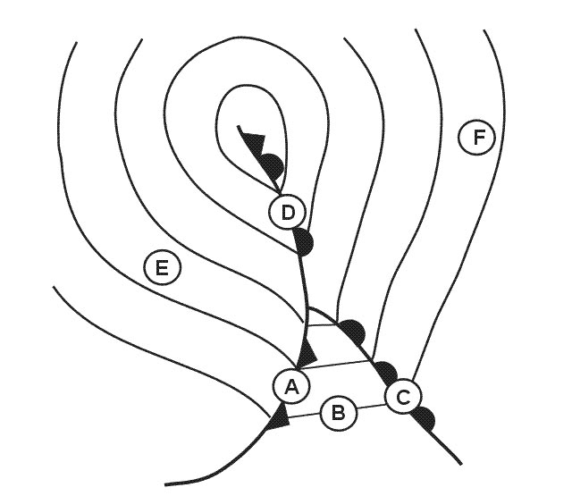 19010kt 6000 ra bkn016 ovc090 08/06 q1004=
 The front labelled 'e' is a . 343 ?
Question 141-39 : Cold front warm front warm occlusion cold occlusion
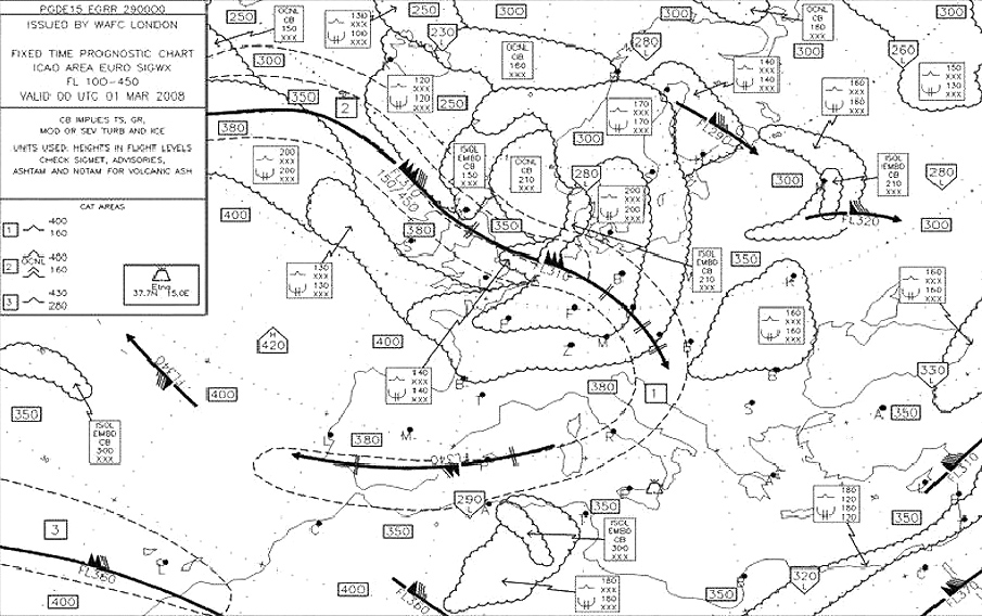 Cold front.
 The front located from 10°w to 10°e is most likely to be . 344 ?
Question 141-40 : A quasi stationary front an active warm front moving north an active occlusion moving south a cold front moving south
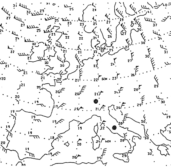 A quasi-stationary front.
 ~
Exclusive rights reserved. Reproduction prohibited under penalty of prosecution.
5599 Free Training Exam
