What type of front / occlusion usually moves the fastest ? [ Certification weather ]
Question 140-1 : Cold front warm front cold occlusion warm occlusion
 Cold front.
 What weather conditions are prevalent during the summer over the north sea ?
Question 140-2 : Cloud cover mostly scattered isolated showers advection fog rain covering a large area 8 octas ns 8 octas cs as without precipitation
 Cloud cover mostly scattered, isolated showers.
 What is the surface visibility most likely to be in a warm sector of maritime ?
Question 140-3 : Moderate several km very poor less than 1 km good greater than 10 km very good greater than 50 km
 Moderate (several km).
 After passing at right angles through a very active cold front in the direction ?
Question 140-4 : A veering in the wind direction a backing in the wind direction an increase in tailwind a decrease in tailwind
 A veering in the wind direction.
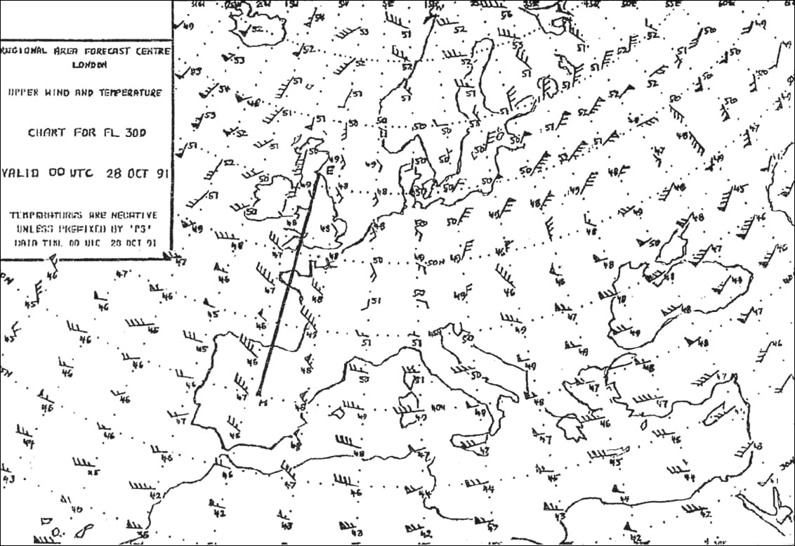
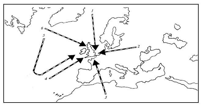
 Which one of the tracks dashed lines is represented by the cross section shown ?
Question 140-5 : Track d a track c a track b a track b c
 Track d-a
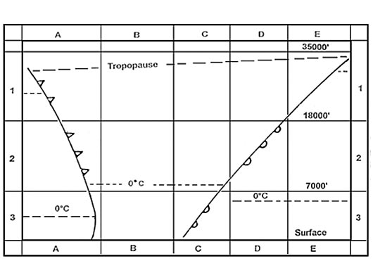
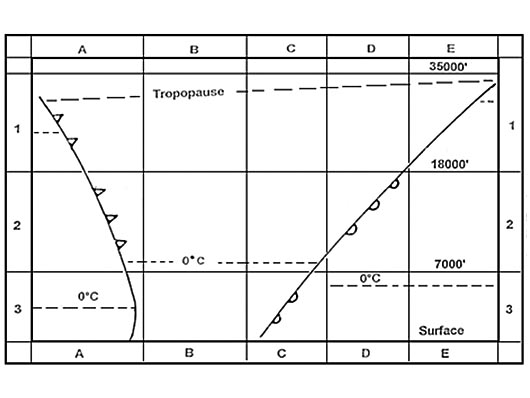
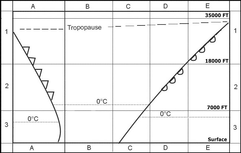
 Which cross section of air mass and cloud presentation is applicable to the ?
Question 140-6 : N°3 n°1 n°2 n°4
 N°3
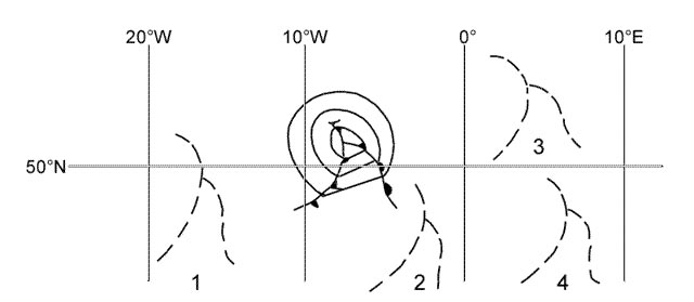
N°3 Refer to the diagram assuming the usual direction of movement where will this ?
Question 140-7 : Position 3 position 2 position 1 position 4
 Position 3.
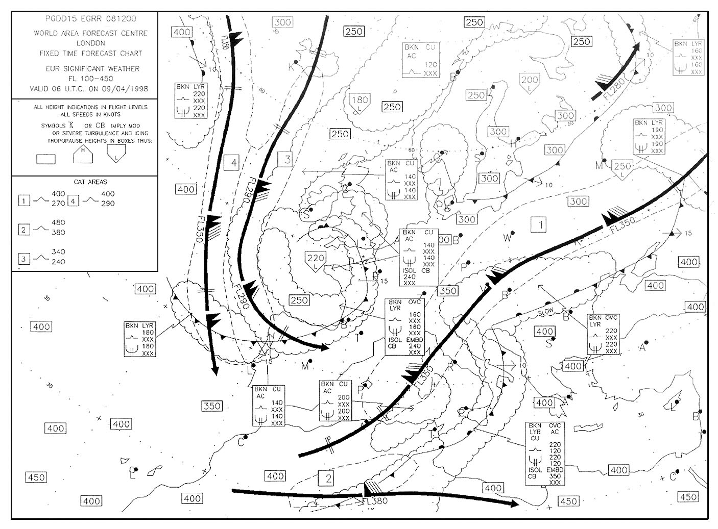
 What is the classification of the airmass affecting position 'q' at 0600 utc . ?
Question 140-8 : Tropical maritime polar continental polar maritime tropical continental
 Tropical maritime.
 In which of the following regions does maritime polar air originate ?
Question 140-9 : East of greenland region of british isles baltic sea black sea
 East of greenland.
 In which of the following situations can freezing rain be encountered ?
Question 140-10 : Ahead of a warm front in the winter ahead of a cold front in the winter behind a warm front in the summer ahead of a cold front in the summer
 Ahead of a warm front in the winter.
 How do air masses move at a warm front ?
Question 140-11 : Warm air overrides a cold air mass cold air overrides a warm air mass cold air undercuts a warm air mass warm air undercuts a cold air mass
 Warm air overrides a cold air mass.
 What type of precipitation would you expect at an active unstable cold front ?
Question 140-12 : Showers associated with thunderstorms freezing rain light to moderate continuous rain drizzle
 Showers associated with thunderstorms.
 What is the relative movement of the two air masses along a cold front ?
Question 140-13 : Cold air pushes under a warm air mass warm air pushes over a cold air mass cold air slides over a warm air mass warm air pushes under a cold air mass
 Cold air pushes under a warm air mass.
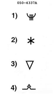
 What cloud cover is typical for a wide warm sector of a polar front depression ?
Question 140-14 : Fair weather cu bkn cu and cb sky clear st with drizzle
 Fair weather cu.
 Which of the following describes a warm occlusion ?
Question 140-15 : The coldest air mass is ahead of the original warm front the air mass behind the front is more unstable than the air mass ahead of the front the air mass ahead of the front is drier than the air mass behind the front the warmer air mass is ahead of the original warm front
 The coldest air mass is ahead of the original warm front.
 When do cold occlusions occur most frequently in europe ?
Question 140-16 : Summer winter autumn and winter winter and spring
 Summer.
 In which main direction does a polar front depression move ?
Question 140-17 : Along the front towards the east along the front towards the west across the front towards the north across the front towards the south
 Along the front towards the east.
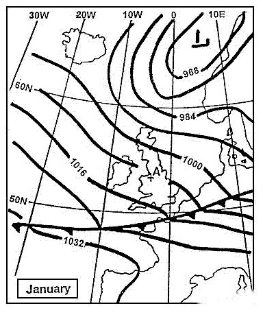
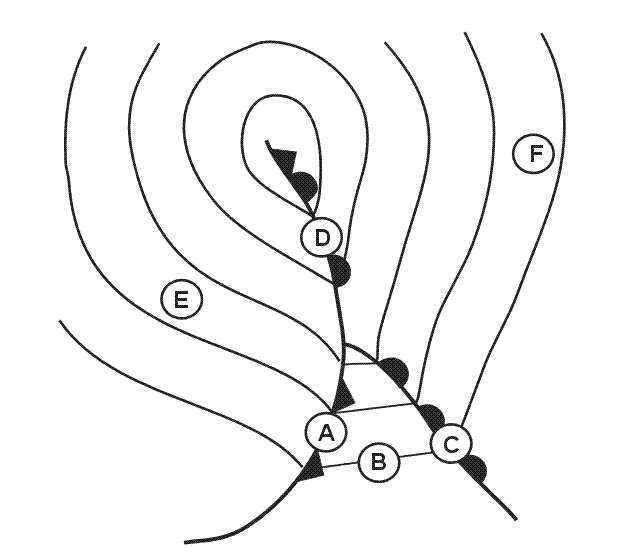
 What change in pressure will occur at point a during the next hour . 263 ?
Question 140-18 : A rise in pressure a drop in pressure irregular fluctuations approximately constant pressure
 A rise in pressure.
 What is the most likely cause of a lack of clouds at higher levels in a ?
Question 140-19 : Sinking air rising air instability divergence at higher levels
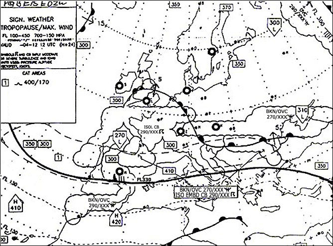 Sinking air.
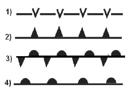
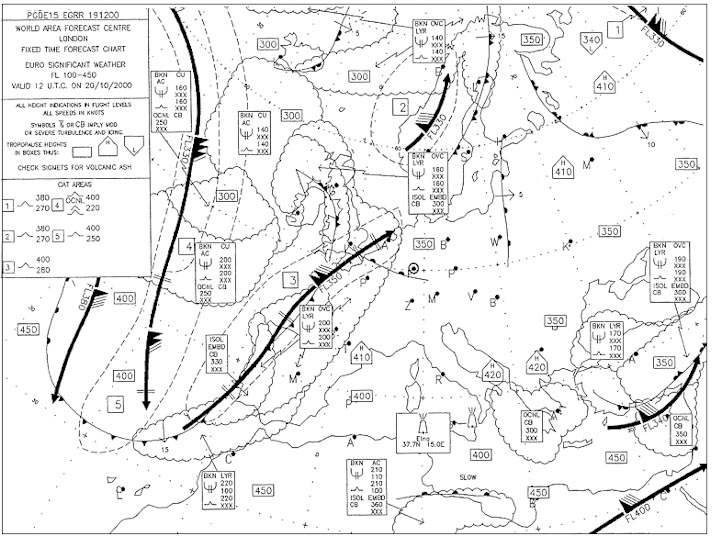
 The front labelled 'z' is a . 279 ?
Question 140-20 : Warm front cold front cold occlusion warm occlusion
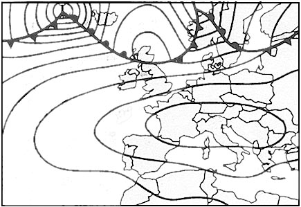 Warm front.
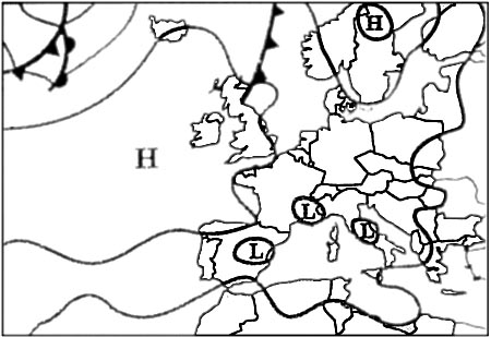
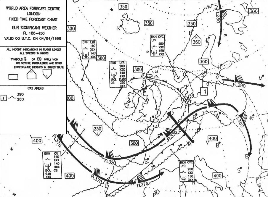
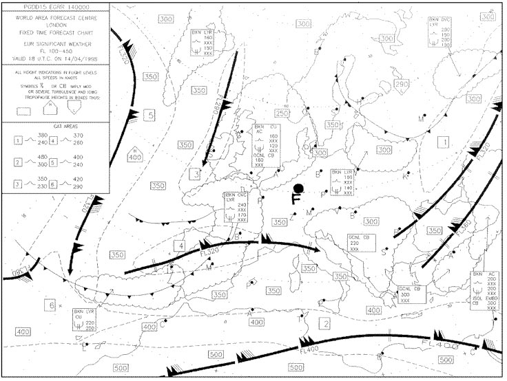
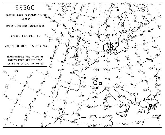
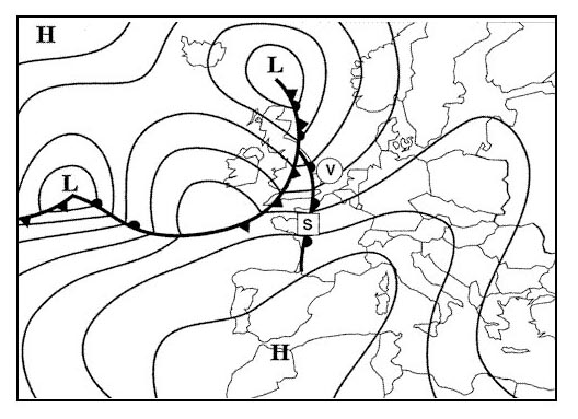
 What is the speed of the front located over france . 284 ?
Question 140-21 : 15 kt 25 kt 10 kt 30 kt
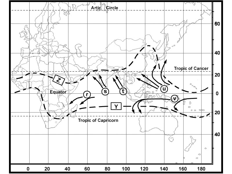 15 kt
15 kt How are the air masses distributed in a cold occlusion ?
Question 140-22 : The coldest air mass behind and the less cold air in front of the occlusion the warm air mass is above ground level the coldest air in front of and the less cold air is behind the occlusion the warm air mass is above ground level the coldest air in front of and the warm air behind the occlusion the less cold air is above ground level the coldest air behind and the warm air in front of the occlusion the less cold air mass is above ground level
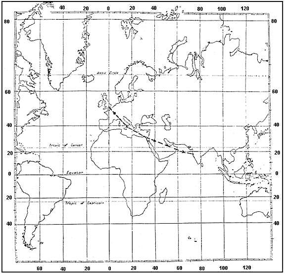 The coldest air mass behind and the less cold air in front of the occlusion, the warm air mass is above ground level.
 What characterizes a stationary front ?
Question 140-23 : The surface wind usually has its direction parallel to the front the surface wind usually has its direction perpendicular to the front the warm air moves at approximately half the speed of the cold air the weather conditions that it originates is a combination between those of an intense cold front and those of a warm and very active front
 The surface wind usually has its direction parallel to the front.
 In an intense trough of low pressure over iceland during wintertime the weather ?
Question 140-24 : Strong wind shear convection and snow showers strong wind associated with an almost clear sky strong wind with subsidence at low levels light wind good visibility and a high cloud ceiling
 Strong wind shear, convection and snow showers.
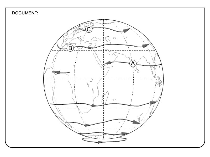
 Where are you likely to find the strongest winds close to the ground ?
Question 140-25 : In the transition zone between two air masses at the centre of a low pressure system at the centre of a high pressure system where there is little variation in pressure over a large area during the winter months
 In the transition zone between two air masses.
 An aircraft flying in the southern hemisphere at 2000 feet has to turn to the ?
Question 140-26 : In front behind to the left to the right
 In front.
 Between which latitudes are you most likely to find the subtropical high ?
Question 140-27 : 25° 35° 10° 15° 35° 55° 55° 75°
 25° - 35°.
 'after such a fine day the ring around the moon was a bad sign terday evening ?
Question 140-28 : A warm front a blizzard weather at the back of a cold front a cold front
 A warm front.
 What will be the effect on the reading of an altimeter of an aircraft parked on ?
Question 140-29 : It will have decreased it will remain unchanged it will have increased it will show a small increase or decrease
 It will have decreased.
 What will be the effect on the reading of an altimeter of an aircraft parked on ?
Question 140-30 : It will be increasing it will remain unchanged it will be decreasing it will fluctuate up and down by about +/ 50 feet
 It will be increasing.
 What will be the effect on the reading of an altimeter of an aircraft parked on ?
Question 140-31 : It will first increase then decrease it will remain unchanged it will first decrease then increase it will fluctuate up and down by about +/ 50 feet
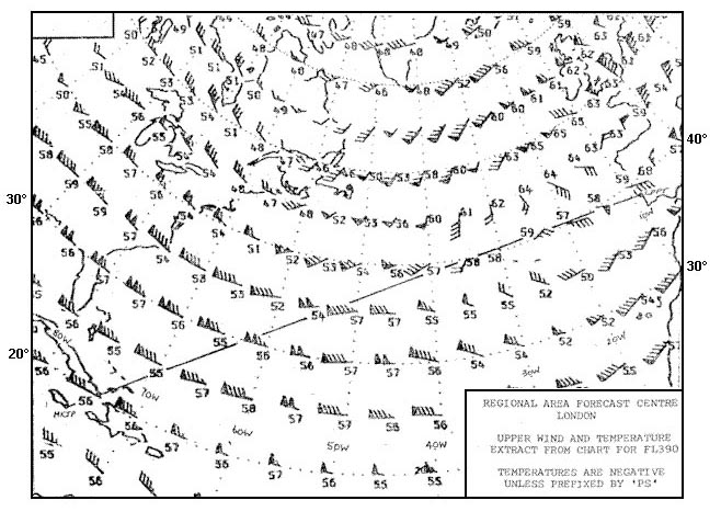 It will first increase then decrease.
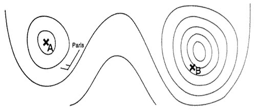
 Which of the following best describes zone a . 299 ?
Question 140-32 : Trough of low pressure col ridge of high pressure depression
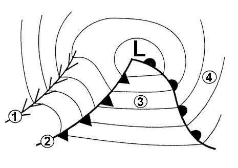 Trough of low pressure.
 Which of the following best describes zone b . 299 ?
Question 140-33 : Col ridge of high pressure depression trough of low pressure
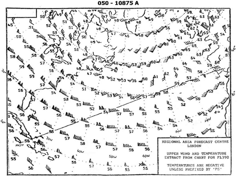 Col.
Col. Which of the following best describes zone c . 299 ?
Question 140-34 : Ridge of high pressure col trough of low pressure depression
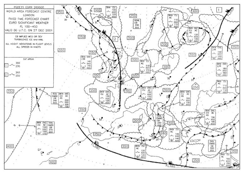 Ridge of high pressure.
 Which of the following best describes zone d . 299 ?
Question 140-35 : Depression ridge of high pressure anticyclone trough of low pressure
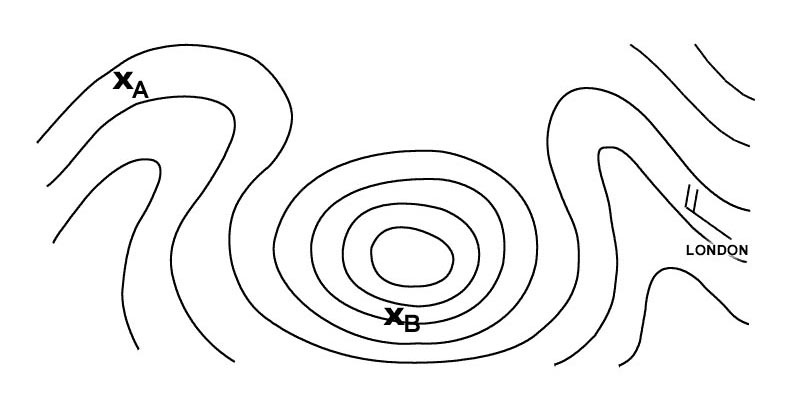 Depression.
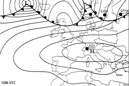
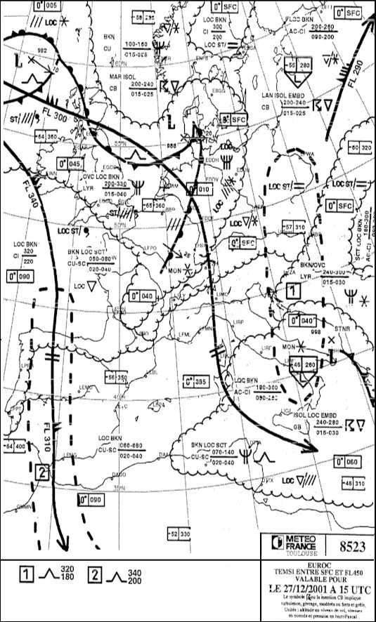
 At which airport is the following weather development taking place .taf 231200z ?
Question 140-36 : Einn essa lszh ekch
 Einn
Einn Which of the following weather conditions would be expected at athens airport ?
Question 140-37 : 21002kt 6000 br sct040 29/16 q1026 nosig = 26014kt 8000 bkn090 17/12 q1009 becmg 4000 = 23018g35kt 9999 sct035 10/04 q0988 nosig = 16002kt 0200 r33l/0600n fg vv001 12/12 q1031 becmg 0800 =
 21002kt 6000 br sct040 29/16 q1026 nosig =
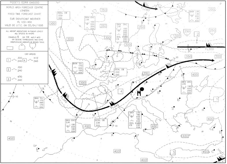
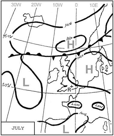
 This chart shows the weather conditions on the ground at 0600 utc on may 4 ?
Question 140-38 : Taf lsgg 040716 23016kt 8000 ra bkn030 ovc070 becmg 0810 5000 ra bkn020 ovc050 tempo 3000 +ra bkn010 ovc030 becmg 1215 25014kt 8000 sct030 bkn090 = taf lsgg 040716 vrb03kt 6000 br sct020 becmg 0811 23005kt 9999 sct025tcu prob 40 tempo 1216 34012g30kt 3000 tsra bkn020cb = taf lsgg 040716 05014kt 5000 ovc015 becmg 0810 8000 bkn018 becmg 1013 05015g30kt 9999 sct025 = taf lsgg 040716 26012kt 9999 sct030 bkn080 tempo 1013 25020g35kt 3000 tsra or +shra bkn030cb becmg 1316 vrb02kt 3000 bcfg sct100 =
 Taf lsgg 040716 23016kt 8000 -ra bkn030 ovc070 becmg 0810 5000 ra bkn020 ovc050 tempo 3000 +ra bkn010 ovc030 becmg 1215 25014kt 8000 sct030 bkn090 =
 In zurich during a summer day the following weather observations were taken ?
Question 140-39 : A warm front passed the station early in the morning and a cold front during late afternoon a cold front passed the station early in the morning and a warm front during late afternoon a trough line passed the station early in the morning and a warm front during late afternoon storm clouds due to warm air came close to and grazed the station
 A warm front passed the station early in the morning and a cold front during late afternoon
 On an aerodrome when a warm front is approaching ?
Question 140-40 : Qfe and qnh decrease qfe and qnh increase qfe increases and qnh decreases qfe decreases and qnh increases
 Qfe and qnh decrease.
 ~
Exclusive rights reserved. Reproduction prohibited under penalty of prosecution.
5559 Free Training Exam
