When will the surface wind in a metar record a gust factor ? [ Revision flight ]
Question 130-1 : When gusts are at least 10 knots above the mean wind speed when gusts are at least 15 knots above the mean wind speed with gusts of at least 25 knots with gusts of at least 35 knots
 When gusts are at least 10 knots above the mean wind speed.
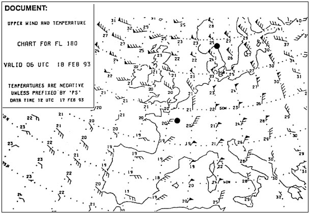
 Select from the map the average wind for the route zurich rome at fl110 . 303 ?
Question 130-2 : 230/10 200/30 040/10 250/20
 230/10.
 Select from the map the average wind for the route athens geneva at fl 160 . ?
Question 130-3 : 240/40 210/25 260/40 050/35
 240/40.
 Select from the map the average wind for the route zurich hamburg at fl 240 . ?
Question 130-4 : 230/20 020/20 200/15 260/25
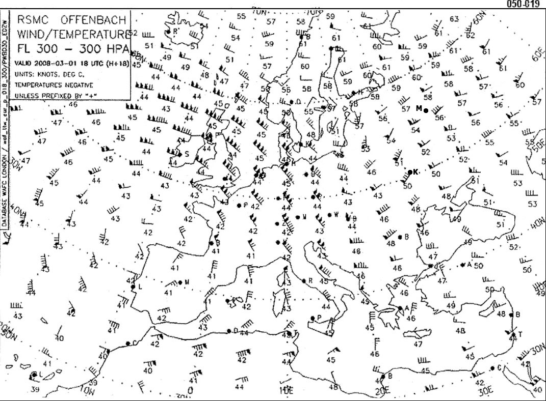
Select from the map the average wind for the route shannon lisboa at fl 290 . ?
Question 130-5 : 360/80 030/70 190/75 340/90
 360/80.
 When otherwise calm and clear conditions exist a station on the shore of a ?
Question 130-6 : From the water in daytime and from the land at night continually from land to water continually from water to the land from the land in daytime and from the water at night
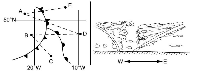 From the water in daytime and from the land at night.
 The greater the pressure gradient the ?
Question 130-7 : Closer the isobars and the stronger the wind further the isobars will be apart and the weaker the wind closer the isobars and the lower the temperatures further the isobars will be apart and the higher the temperature
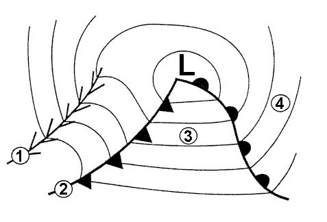 Closer the isobars and the stronger the wind.
 When isobars for an area in the mid latitudes on a weather map are close ?
Question 130-8 : Strong changing direction rapidly blowing perpendicular to the isobars light
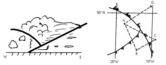 Strong.
 In the northern hemisphere a pilot flying at 1000 ft above ground level ?
Question 130-9 : Left and behind right and behind about 45 degrees to the right of directly ahead directly ahead
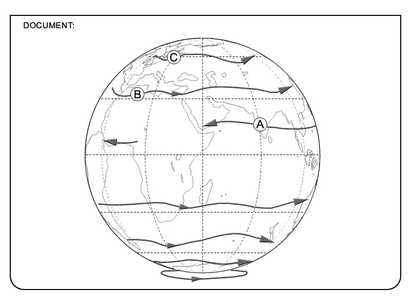 Left and behind.
 In the northern hemisphere the wind at the surface blows ?
Question 130-10 : Counter clockwise around and toward the centre of a low pressure area from a low pressure area to a high pressure area clockwise around and away from the centre of a low pressure area counter clockwise around and away from the centre of a high pressure area
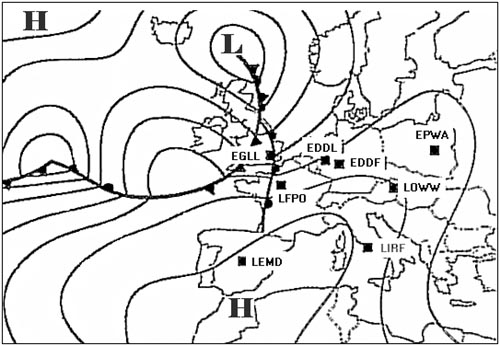 Counter-clockwise around, and toward the centre of, a low pressure area
 Wind is caused by ?
Question 130-11 : Horizontal pressure differences the rotation of the earth friction between the air and the ground the movements of fronts
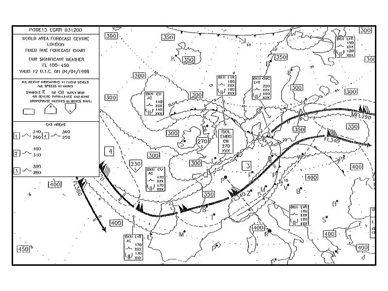 Horizontal pressure differences
 During a descent from 2000 ft above the surface to the surface no frontal ?
Question 130-12 : Backs and decreases veers and increases backs and increases veers and decreases
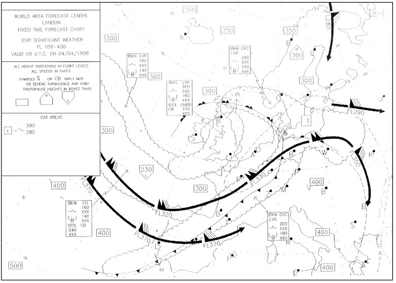 Backs and decreases.
 The foehn wind is a ?
Question 130-13 : Warm katabatic wind cold katabatic wind warm anabatic wind cold anabatic wind
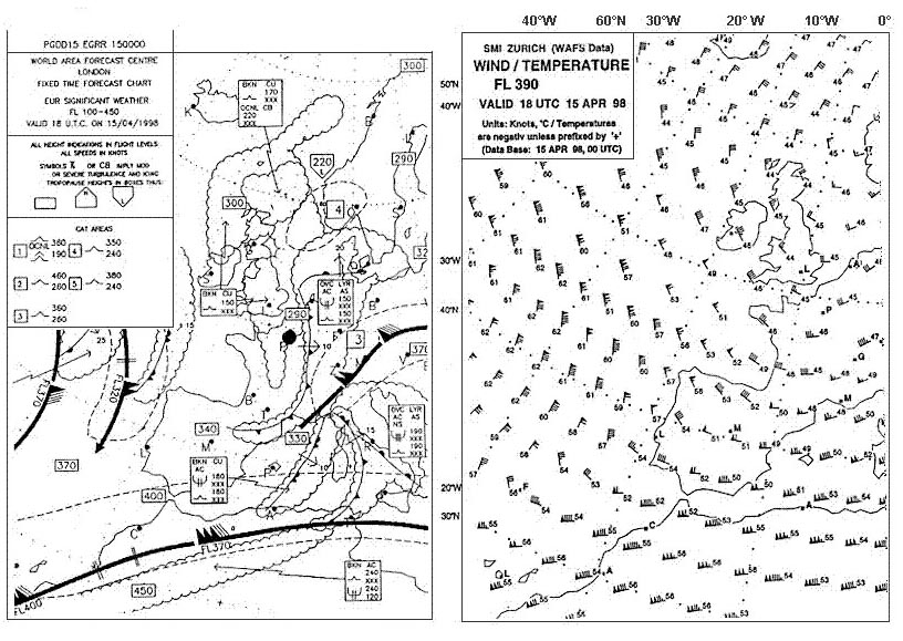 Warm katabatic wind.
 The sea breeze is a wind from the sea ?
Question 130-14 : Occurring only in the lower layers of the atmosphere in daytime that reaches up to the tropopause in daytime blowing at night in mid latitudes occurring only in mid latitudes and in daytime
 Occurring only in the lower layers of the atmosphere in daytime
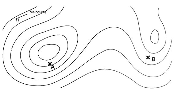
 Geostrophic wind is the wind when isobars are ?
Question 130-15 : Straight lines and no friction is involved curved lines and no friction is involved straight lines and friction is involved curved lines and friction is involved
 Straight lines and no friction is involved.
 What relationship exists between the wind at 3000 feet and the surface wind ?
Question 130-16 : The wind at 3000 feet is parallel to the isohypses and the surface wind direction is across the isobars toward the low pressure and the surface wind is weaker they have the same direction but the surface wind is weaker caused by friction they are practically the same except when eddies exist caused by obstacles the surface wind is veered compared to the wind at 3000 feet and is usually weaker
 The wind at 3000 feet is parallel to the isohypses and the surface wind direction is across the isobars toward the low pressure and the surface wind is weaker.
 The wind tends to follow the contour lines isohypses above the friction layer ?
Question 130-17 : The coriolis force tends to balance with the horizontal pressure gradient force contour lines are lines that connect points with the same wind speed in the upper air the coriolis force acts perpendicular on a line that connects high and low pressure system the friction of the air with the earth's surface gives the airflow a diversion perpendicular to the gradient force
 The coriolis force tends to balance with the horizontal pressure gradient force.
 The wind speed in a system with curved isobars compared to a system with ?
Question 130-18 : Higher if curvature is anticyclonic always higher always lower higher if curvature is cyclonic
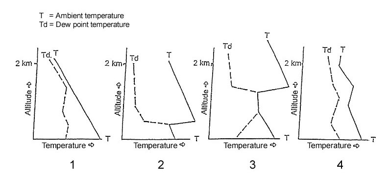 Higher if curvature is anticyclonic.
 The geostrophic wind depends on ?
Question 130-19 : Density earth's rotation geographic latitude earth's rotation geographic latitude centripetal force geographic latitude centripetal force height centripetal force height pressure gradient
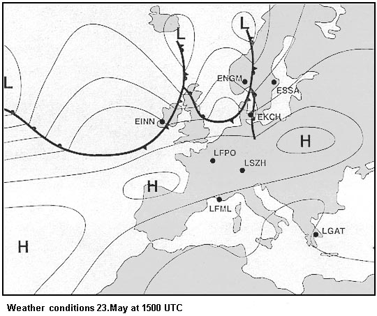 Density, earth's rotation, geographic latitude.
 In a mountain valley wind circulation the mountain wind blows ?
Question 130-20 : At night down from the mountains at night up from the valley during the day down from the mountains during the day up from the valley
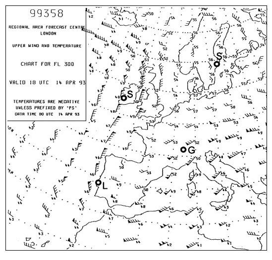 At night down from the mountains.
 Ahead of a warm front in northern hemisphere the wind direction changes from ?
Question 130-21 : Veers in the friction layer and veers above the friction layer backs in the friction layer and veers above the friction layer veers in the friction layer and backs above the friction layer backs in the friction layer and backs above the friction layer
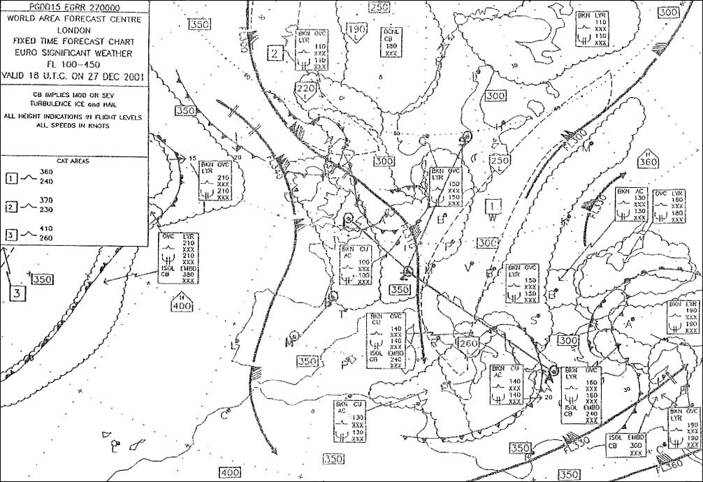 Veers in the friction layer and veers above the friction layer.
 The difference between geostrophic wind and gradient wind is caused by ?
Question 130-22 : Curvature of isobars friction horizontal temperature gradients slope of pressure surfaces
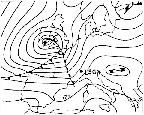 Curvature of isobars.
 During periods of prolonged clear skies associated with anticyclonic conditions ?
Question 130-23 : Surface wind speed tends to be highest during the early afternoon surface wind speed tends to be highest at night angle between isobars and surface wind direction tends to be greatest in the early afternoon wind tends to back from early morning until early afternoon
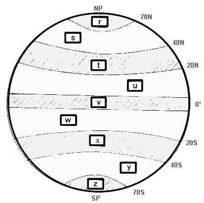 Surface wind speed tends to be highest during the early afternoon.
 The geostrophic wind speed is directly proportional to the ?
Question 130-24 : Horizontal pressure gradient curvature of isobars sine of latitude density of the air
 Horizontal pressure gradient.
 A strong dry and warm downslope wind produced by prior enforced ascent of air ?
Question 130-25 : Foehn scirocco mistral bora
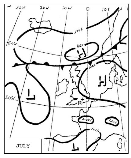 Foehn.
 Geostrophic wind ?
Question 130-26 : Is perpendicular to the horizontal pressure gradient force is directly proportional to the density of the air always increases with increasing height veers with height if cold air is advected in the northern hemisphere
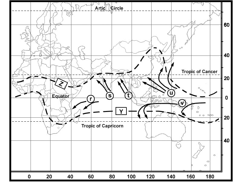 Is perpendicular to the horizontal pressure gradient force.
 Which of the following statements concerning jet streams is correct ?
Question 130-27 : In the northern hemisphere both westerly and easterly jet streams occur in the northern hemisphere only westerly jet streams occur in the southern hemisphere no jet streams occur in the southern hemisphere only easterly jet streams occur
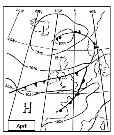 In the northern hemisphere both westerly and easterly jet streams occur.
 Under which of the following conditions is the most severe cat likely to be ?
Question 130-28 : A curved jet stream near a deep trough a jet stream with great spacing between the isotherms a westerly jet stream at low latitudes in the summer a straight jet stream near a low pressure area
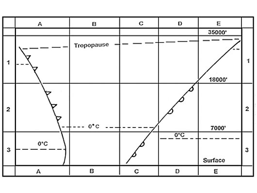 A curved jet stream near a deep trough.
 Above and below a low level inversion the wind is likely to ?
Question 130-29 : Change significantly in speed and direction change in speed but not in direction change in direction but not in speed experience little or no change in speed and direction
 Change significantly in speed and direction.
 Which of the following statements concerning the core of a polar front jet ?
Question 130-30 : It lies at a height where there is no horizontal temperature gradient the slope of the pressure surfaces at the height of the core is at its maximum it and its surface projection lie in the warm air it lies in the warm air its pressure surfaces are horizontal at the height of the core it lies in the cold air the wind reverses direction at the height of the core
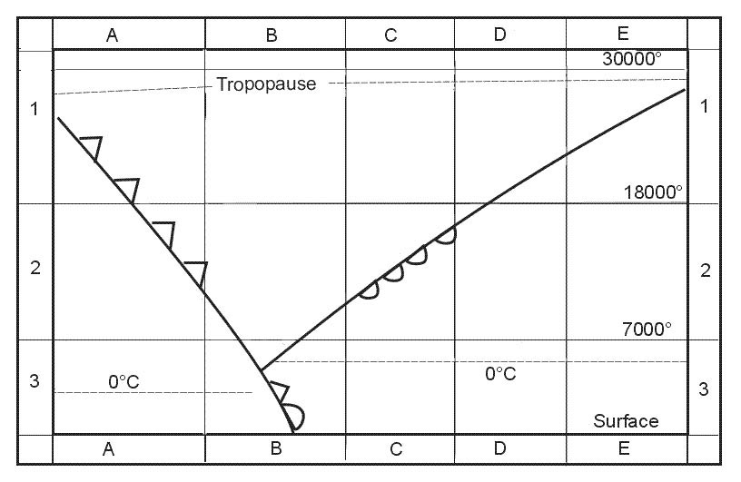 It lies at a height where there is no horizontal temperature gradient, the slope of the pressure surfaces at the height of the core is at its maximum.
 On a particular day part of a polar front jet stream runs from north to south ?
Question 130-31 : The polar air is below and to the east of the core of the jet the polar air is on the eastern side and above the core of the jet below the core of the jet the horizontal temperature gradient runs from north to south above the core of the jet the horizontal temperature gradient runs from north to south
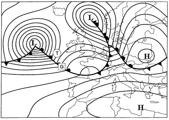 The polar air is below and to the east of the core of the jet.
 For a similar pressure gradient the geostrophic wind speed will be ?
Question 130-32 : Greater at 30°n than at 60°n greater at 60°n than at 30°n the same at all latitudes north or south of 15° equivalent to gradient wind ± thermal component
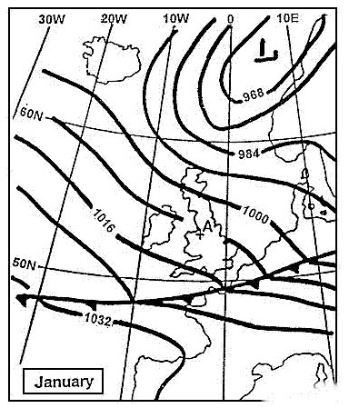 Greater at 30°n than at 60°n.
 For the same pressure gradient at 60°n 50°n and 40°n the speed of the ?
Question 130-33 : Greatest at 40°n the same at all latitudes greatest at 60°n least at 50°n
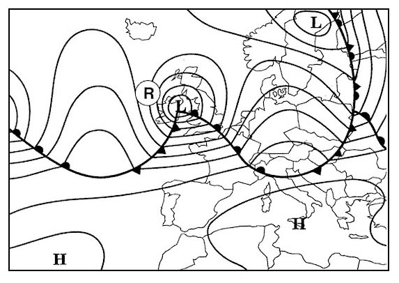 Greatest at 40°n.
 Under anticyclone conditions in the northern hemisphere with curved isobars the ?
Question 130-34 : Greater than the geostrophic wind less than the geostrophic wind the same as the thermal component proportional only to the coriolis force
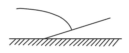 Greater than the geostrophic wind.
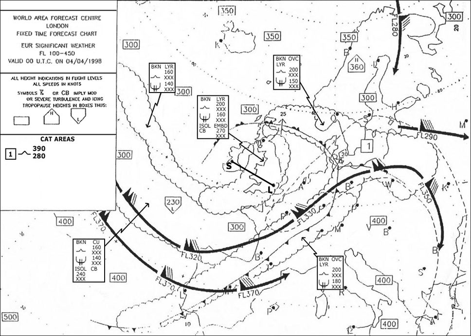
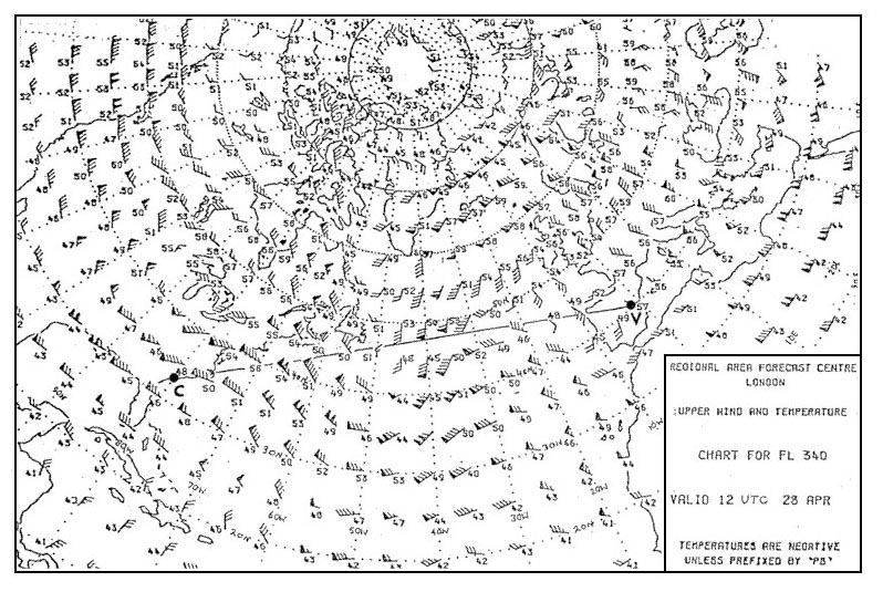
 Considering that portion of the route indicated from 30°e to 50°e the upper ?
Question 130-35 : A subtropical westerly jet stream maximum speed exceeding 90 kt a westerly polar front jet stream maximum speed exceeding 90 kt variable in direction and less than 30 kt light easterlies
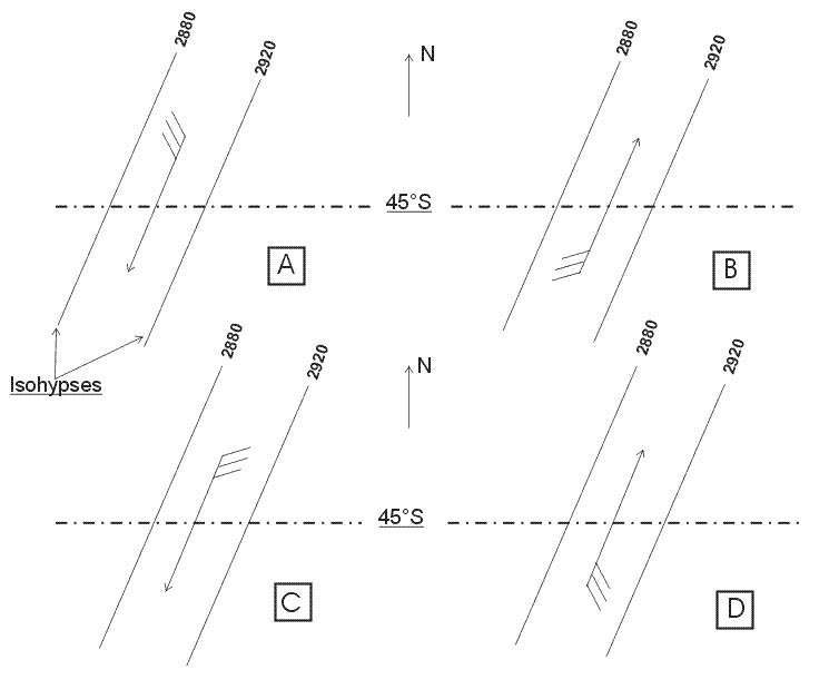 A subtropical westerly jet stream, maximum speed exceeding 90 kt.
 The core of the polar front jet stream is usually located in the ?
Question 130-36 : Tropical air below the tropopause polar air above the tropopause polar air below the tropopause tropical air above the tropical tropopause
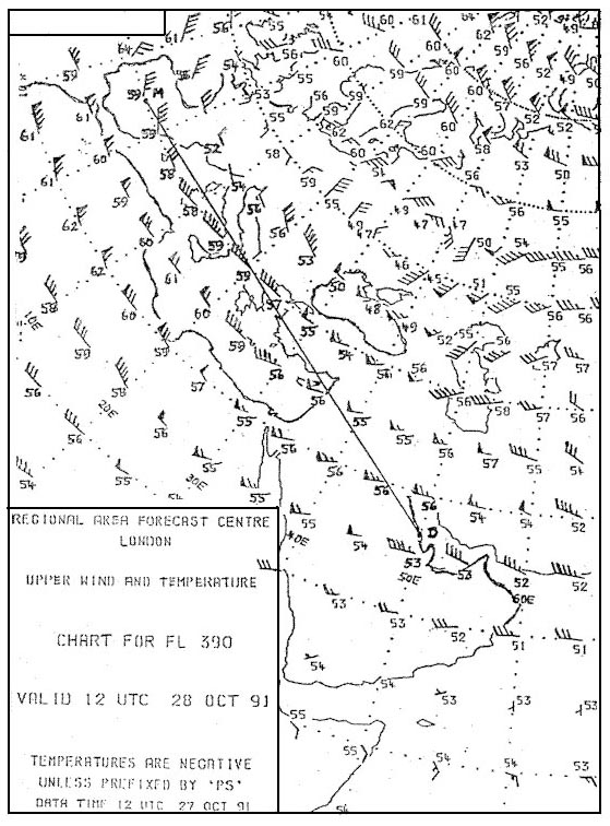 Tropical air below the tropopause.
 A wind of 20 knots corresponds to an approximate speed of ?
Question 130-37 : 10 m/s 50 km/h 40 m/s 10 km/h
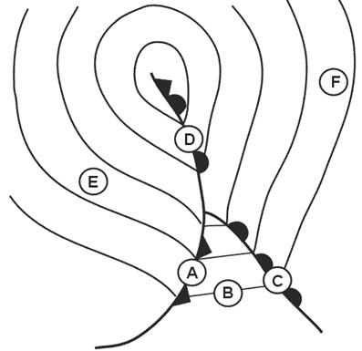 10 m/s.
 After a sunny day followed by a long clear night you take off from an airfield ?
Question 130-38 : A sudden strong increase in wind speed and strong veering of the wind a short time after take off large but gradual increase in wind speed and large but gradual veering of the wind up to a height of 5000 ft little increase in wind speed and little veering of the wind up to an height of 5000 ft a squally wind up to great heights
 A sudden strong increase in wind speed and strong veering of the wind a short time after take-off.
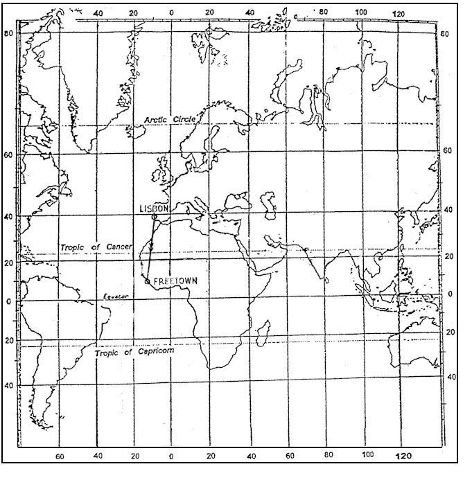
 At about what geographical latitude as average is assumed for the zone of ?
Question 130-39 : 50°n 10°n 30°n 80°n
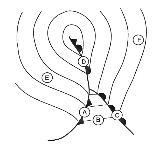 50°n.
50°n. At which time if any are polar front jet streams over the south pacific usually ?
Question 130-40 : July january there is no annual variation october
 July.
July. ~
Exclusive rights reserved. Reproduction prohibited under penalty of prosecution.
5159 Free Training Exam
